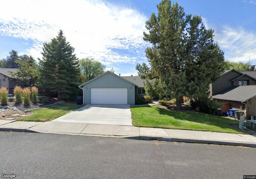
20005 Rock Bluff Cir Bend, OR 97702
Southwest Bend NeighborhoodEstimated Value: $571,230 - $609,000
3
Beds
2
Baths
1,132
Sq Ft
$523/Sq Ft
Est. Value
About This Home
This home is located at 20005 Rock Bluff Cir, Bend, OR 97702 and is currently estimated at $591,558, approximately $522 per square foot. 20005 Rock Bluff Cir is a home located in Deschutes County with nearby schools including Pine Ridge Elementary School, Cascade Middle School, and Bend Senior High School.
Ownership History
Date
Name
Owned For
Owner Type
Purchase Details
Closed on
Mar 5, 2025
Sold by
Mihelcich Sandra A
Bought by
Sandra A Mihelcich Trust and Mihelcich
Current Estimated Value
Purchase Details
Closed on
Aug 20, 2015
Sold by
Mihelcich John S and Mihelcich Sandra A
Bought by
John Steve Mihelcich Revocable Trust
Purchase Details
Closed on
Dec 9, 2010
Sold by
Mihelcich Robert R
Bought by
Mihelcich John S and Mihelcich Sandra A
Purchase Details
Closed on
Feb 12, 2010
Sold by
Mihelcich Mary
Bought by
Mihelcich John S and Mihelcich Robert R
Create a Home Valuation Report for This Property
The Home Valuation Report is an in-depth analysis detailing your home's value as well as a comparison with similar homes in the area
Home Values in the Area
Average Home Value in this Area
Purchase History
| Date | Buyer | Sale Price | Title Company |
|---|---|---|---|
| Sandra A Mihelcich Trust | -- | None Listed On Document | |
| Mihelcich Sandra A | -- | None Listed On Document | |
| John Steve Mihelcich Revocable Trust | -- | None Available | |
| Mihelcich John S | -- | None Available | |
| Mihelcich John S | -- | None Available |
Source: Public Records
Tax History
| Year | Tax Paid | Tax Assessment Tax Assessment Total Assessment is a certain percentage of the fair market value that is determined by local assessors to be the total taxable value of land and additions on the property. | Land | Improvement |
|---|---|---|---|---|
| 2025 | $3,646 | $215,780 | -- | -- |
| 2024 | $3,508 | $209,500 | -- | -- |
| 2023 | $3,252 | $203,400 | $0 | $0 |
| 2022 | $3,034 | $191,730 | $0 | $0 |
| 2021 | $3,038 | $186,150 | $0 | $0 |
| 2020 | $2,883 | $186,150 | $0 | $0 |
| 2019 | $2,802 | $180,730 | $0 | $0 |
| 2018 | $2,723 | $175,470 | $0 | $0 |
| 2017 | $2,643 | $170,360 | $0 | $0 |
| 2016 | $2,521 | $165,400 | $0 | $0 |
| 2015 | $2,451 | $160,590 | $0 | $0 |
| 2014 | $2,379 | $155,920 | $0 | $0 |
Source: Public Records
Map
Nearby Homes
- 61388 Elkhorn St
- 20029 Rock Bluff Cir
- 61336 Elkhorn St
- 20086 Porter Place
- 20080 Mount Hope Ln
- 20098 Elizabeth Ln
- 20017 Voltera Place
- 61521 Sunny Breeze Ln
- 61324 Sparrow Ct
- 61514 Tall Tree Ct
- 0 Pinebrook Blvd Unit 220199740
- 20192 Reed Ln
- 61176 Larkwood Dr
- 1216 SW Bryanwood Place
- 61280 Parrell Rd Unit 10
- 61304 SE Wizard Ln Unit 8
- 19717 Mount Bachelor Dr Unit 421
- 20221 Silver Sage St
- 19717 Mount Bachelor Dr Unit 617
- 19717 Mt Bachelor Dr Unit 330E
- 19999 Rock Bluff Cir
- 20011 Rock Bluff Cir
- 20014 Powers Rd
- 20002 Powers Rd
- 20017 Rock Bluff Cir
- 19996 Powers Rd
- 20020 Powers Rd
- 20000 Rock Bluff Cir
- 20010 Rock Bluff Cir
- 19994 Rock Bluff Cir
- 19987 Rock Bluff Cir
- 20023 Rock Bluff Cir
- 19990 Powers Rd
- 20026 Powers Rd
- 20026 SW Powers
- 19988 Rock Bluff Cir
- 19981 Rock Bluff Cir
- 20036 Rock Bluff Cir
Your Personal Tour Guide
Ask me questions while you tour the home.