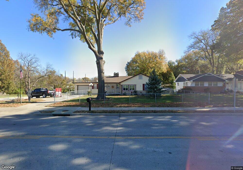
2001 10th Ave Leavenworth, KS 66048
Estimated Value: $229,032 - $260,000
3
Beds
3
Baths
1,594
Sq Ft
$152/Sq Ft
Est. Value
About This Home
This home is located at 2001 10th Ave, Leavenworth, KS 66048 and is currently estimated at $241,758, approximately $151 per square foot. 2001 10th Ave is a home located in Leavenworth County with nearby schools including Anthony Elementary School, Richard Warren Middle School, and Leavenworth Senior High School.
Ownership History
Date
Name
Owned For
Owner Type
Purchase Details
Closed on
Jul 1, 2003
Bought by
Meinert Ronald E and Meinert Linda S
Current Estimated Value
Home Financials for this Owner
Home Financials are based on the most recent Mortgage that was taken out on this home.
Original Mortgage
$10,000
Outstanding Balance
$4,245
Interest Rate
5.24%
Mortgage Type
New Conventional
Estimated Equity
$237,513
Create a Home Valuation Report for This Property
The Home Valuation Report is an in-depth analysis detailing your home's value as well as a comparison with similar homes in the area
Home Values in the Area
Average Home Value in this Area
Purchase History
| Date | Buyer | Sale Price | Title Company |
|---|---|---|---|
| Meinert Ronald E | $93,000 | -- |
Source: Public Records
Mortgage History
| Date | Status | Borrower | Loan Amount |
|---|---|---|---|
| Open | Meinert Ronald E | $10,000 | |
| Closed | Meinert Ronald E | $86,301 |
Source: Public Records
Tax History Compared to Growth
Tax History
| Year | Tax Paid | Tax Assessment Tax Assessment Total Assessment is a certain percentage of the fair market value that is determined by local assessors to be the total taxable value of land and additions on the property. | Land | Improvement |
|---|---|---|---|---|
| 2025 | $2,476 | $22,361 | $3,217 | $19,144 |
| 2024 | $2,478 | $21,296 | $3,217 | $18,079 |
| 2023 | $2,478 | $20,676 | $3,217 | $17,459 |
| 2022 | $2,169 | $17,979 | $2,717 | $15,262 |
| 2021 | $2,102 | $16,295 | $2,717 | $13,578 |
| 2020 | $2,024 | $15,564 | $2,717 | $12,847 |
| 2019 | $1,955 | $14,892 | $2,717 | $12,175 |
| 2018 | $1,837 | $13,869 | $2,717 | $11,152 |
| 2017 | $1,763 | $13,547 | $2,717 | $10,830 |
| 2016 | $1,766 | $13,547 | $2,717 | $10,830 |
| 2015 | $1,822 | $14,047 | $2,717 | $11,330 |
| 2014 | $1,814 | $14,047 | $2,717 | $11,330 |
Source: Public Records
Map
Nearby Homes
- 1700 Lawrence Ave
- 1912 Montezuma St
- 1715 Klemp St
- 1932 S Broadway St
- 1708 S Broadway St
- 1509 10th Ave
- 1913 Cleveland Terrace
- 1036 Vilas St
- 708 Thornton St
- 2017 Vilas St
- 2021 Vilas St
- 1305 Lawrence Ave
- 840 Limit St
- 1305 Klemp St
- 2825 Broadway Terrace
- 00000 Limit St
- 2104 Limit St
- 911 Limit St
- 901 Limit St
- 1316 Vilas St
- 2005 10th Ave
- 907 Halderman St
- 2009 10th Ave
- 901 Halderman St
- 2010 Lawrence Ave
- 2012 Lawrence Ave
- 1000 Halderman St
- 1907 10th Ave
- 1002 Halderman St
- 2013 10th Ave
- 2018 Lawrence Ave
- 1010 Halderman St
- 1012 Halderman St
- 1906 10th Ave
- 1020 Halderman St
- 2017 10th Ave
- 2024 Lawrence Ave
- 2003 Lawrence Ave
- 2009 Lawrence Ave
- 1022 Halderman St