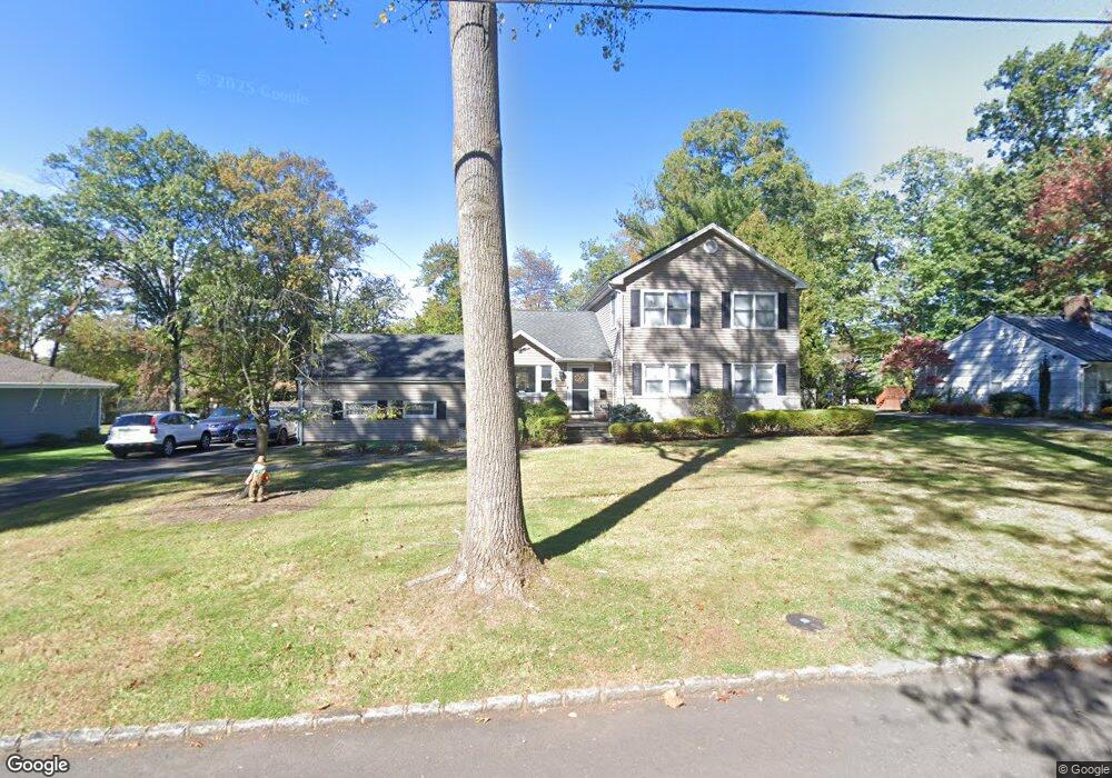
2001 Brookside Dr Scotch Plains, NJ 07076
Estimated Value: $766,500 - $1,328,000
Studio
--
Bath
2,450
Sq Ft
$425/Sq Ft
Est. Value
About This Home
This home is located at 2001 Brookside Dr, Scotch Plains, NJ 07076 and is currently estimated at $1,042,125, approximately $425 per square foot. 2001 Brookside Dr is a home located in Union County with nearby schools including William J. McGinn Elementary School, Terrill Middle School, and Scotch Plains-Fanwood High School.
Ownership History
Date
Name
Owned For
Owner Type
Purchase Details
Closed on
Jul 22, 2025
Sold by
Voeltzel Charles and Romisher Robin
Bought by
Voeltzel Rachel A
Current Estimated Value
Home Financials for this Owner
Home Financials are based on the most recent Mortgage that was taken out on this home.
Original Mortgage
$200,000
Outstanding Balance
$198,970
Interest Rate
6.84%
Mortgage Type
New Conventional
Estimated Equity
$843,155
Purchase Details
Closed on
Jun 9, 1993
Sold by
Voeltzel Diane H
Bought by
Voeltzel Chas
Create a Home Valuation Report for This Property
The Home Valuation Report is an in-depth analysis detailing your home's value as well as a comparison with similar homes in the area
Home Values in the Area
Average Home Value in this Area
Purchase History
| Date | Buyer | Sale Price | Title Company |
|---|---|---|---|
| Voeltzel Rachel A | $999,500 | Residential Commercial Title | |
| Voeltzel Chas | $46,000 | -- | |
| Voeltzel Charles | $46,000 | -- |
Source: Public Records
Mortgage History
| Date | Status | Borrower | Loan Amount |
|---|---|---|---|
| Open | Voeltzel Rachel A | $200,000 |
Source: Public Records
Tax History
| Year | Tax Paid | Tax Assessment Tax Assessment Total Assessment is a certain percentage of the fair market value that is determined by local assessors to be the total taxable value of land and additions on the property. | Land | Improvement |
|---|---|---|---|---|
| 2025 | $18,676 | $158,700 | $54,000 | $104,700 |
| 2024 | $18,125 | $158,700 | $54,000 | $104,700 |
| 2023 | $18,125 | $158,700 | $54,000 | $104,700 |
| 2022 | $17,909 | $158,700 | $54,000 | $104,700 |
| 2021 | $17,879 | $158,700 | $54,000 | $104,700 |
| 2020 | $17,793 | $158,700 | $54,000 | $104,700 |
| 2019 | $17,662 | $158,700 | $54,000 | $104,700 |
| 2018 | $17,365 | $158,700 | $54,000 | $104,700 |
| 2017 | $16,979 | $158,700 | $54,000 | $104,700 |
| 2016 | $16,652 | $158,700 | $54,000 | $104,700 |
| 2015 | $16,379 | $158,700 | $54,000 | $104,700 |
| 2014 | $15,840 | $158,700 | $54,000 | $104,700 |
Source: Public Records
Map
Nearby Homes
- 1280 White Oak Rd
- 1761 Cooper Rd
- 2087 Dogwood Dr
- 119 Lamberts Mill Rd
- 1466 Lamberts Mill Rd
- 4 Brandywine Ct
- 320 Highgate Ave
- 2 Dutch Ln
- 2116 Newark Ave
- 1568 Radley Rd
- 207 N Scotch Plains Ave
- 652 W Broad St
- 2065 Jersey Ave
- 258 Hyslip Ave
- 191 King St
- 187 King St
- 608 Hort St
- 35 Shady Ln
- 3 Herbert Rd
- 17 Shady Ln
- 2011 Brookside Dr
- 1991 Brookside Dr
- 1414 Graymill Dr
- 1406 Graymill Dr
- 2021 Brookside Dr
- 1981 Brookside Dr
- 2002 Brookside Dr
- 1430 Graymill Dr
- 2012 Brookside Dr
- 1398 Graymill Dr
- 1992 Brookside Dr
- 2022 Brookside Dr
- 1438 Graymill Dr
- 2031 Brookside Dr
- 1415 Graymill Dr
- 1 Brookside Ct
- 1423 Graymill Dr
- 1390 Graymill Dr
- 1407 Graymill Dr
- 2032 Brookside Dr
Your Personal Tour Guide
Ask me questions while you tour the home.