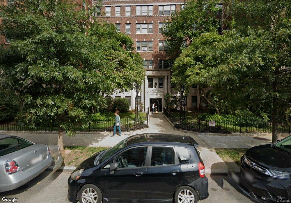
2001 Commonwealth Ave Unit 27 Brighton, MA 02135
Saint Elizabeths NeighborhoodEstimated Value: $324,058 - $463,000
1
Bed
1
Bath
390
Sq Ft
$970/Sq Ft
Est. Value
About This Home
This home is located at 2001 Commonwealth Ave Unit 27, Brighton, MA 02135 and is currently estimated at $378,265, approximately $969 per square foot. 2001 Commonwealth Ave Unit 27 is a home located in Suffolk County with nearby schools including Shaloh House Jewish Day School, St Columbkille Partnership School, and Bais Yaakov Of Boston High School.
Ownership History
Date
Name
Owned For
Owner Type
Purchase Details
Closed on
Jun 14, 1999
Sold by
Bray Susan D and Murphy Christine P
Bought by
Hildebrand Joanne G
Current Estimated Value
Home Financials for this Owner
Home Financials are based on the most recent Mortgage that was taken out on this home.
Original Mortgage
$47,500
Outstanding Balance
$12,373
Interest Rate
6.9%
Mortgage Type
Purchase Money Mortgage
Estimated Equity
$365,892
Create a Home Valuation Report for This Property
The Home Valuation Report is an in-depth analysis detailing your home's value as well as a comparison with similar homes in the area
Home Values in the Area
Average Home Value in this Area
Purchase History
| Date | Buyer | Sale Price | Title Company |
|---|---|---|---|
| Hildebrand Joanne G | $63,000 | -- |
Source: Public Records
Mortgage History
| Date | Status | Borrower | Loan Amount |
|---|---|---|---|
| Open | Hildebrand Joanne G | $47,500 |
Source: Public Records
Tax History Compared to Growth
Tax History
| Year | Tax Paid | Tax Assessment Tax Assessment Total Assessment is a certain percentage of the fair market value that is determined by local assessors to be the total taxable value of land and additions on the property. | Land | Improvement |
|---|---|---|---|---|
| 2025 | $3,213 | $277,500 | $0 | $277,500 |
| 2024 | $3,081 | $282,700 | $0 | $282,700 |
| 2023 | $3,036 | $282,700 | $0 | $282,700 |
| 2022 | $2,902 | $266,700 | $0 | $266,700 |
| 2021 | $2,846 | $266,700 | $0 | $266,700 |
| 2020 | $2,391 | $226,400 | $0 | $226,400 |
| 2019 | $2,340 | $222,000 | $0 | $222,000 |
| 2018 | $2,175 | $207,500 | $0 | $207,500 |
| 2017 | $2,035 | $192,200 | $0 | $192,200 |
| 2016 | $1,847 | $167,900 | $0 | $167,900 |
| 2015 | $2,085 | $172,200 | $0 | $172,200 |
| 2014 | $1,969 | $156,500 | $0 | $156,500 |
Source: Public Records
Map
Nearby Homes
- 39 South St Unit B
- 2021 Commonwealth Ave Unit B
- 1945 Commonwealth Ave Unit 4
- 129 Chiswick Rd Unit 6
- 24 Sidlaw Rd Unit 12
- 5 Braemore Rd Unit 10
- 114 Strathmore Rd Unit 102
- 1789 Commonwealth Ave
- 97 Strathmore Rd Unit 4
- 21 Glenmont Rd
- 51 Wallingford Rd Unit 53
- 8 Kinross Rd Unit 2
- 6 Sutherland Rd Unit 41
- 30 Kinross Rd Unit 1
- 77 Undine Rd
- 41 Orkney Rd
- 12 Mina Way
- 10 Mina Way
- 118 Foster Terrace Unit 118
- 108 Lake Shore Rd Unit 4
- 2001 Commonwealth Ave Unit 36
- 2001 Commonwealth Ave Unit 35
- 2001 Commonwealth Ave Unit 34
- 2001 Commonwealth Ave Unit 33
- 2001 Commonwealth Ave Unit 32
- 2001 Commonwealth Ave Unit 31
- 2001 Commonwealth Ave Unit 30
- 2001 Commonwealth Ave Unit 29
- 2001 Commonwealth Ave Unit 28
- 2001 Commonwealth Ave Unit 26
- 2001 Commonwealth Ave Unit 25
- 2001 Commonwealth Ave Unit 24
- 2001 Commonwealth Ave Unit 23
- 2001 Commonwealth Ave Unit 22
- 2001 Commonwealth Ave Unit 21
- 2001 Commonwealth Ave Unit 20
- 2001 Commonwealth Ave Unit 19
- 2001 Commonwealth Ave Unit 18
- 2001 Commonwealth Ave Unit 17
- 2001 Commonwealth Ave Unit 16