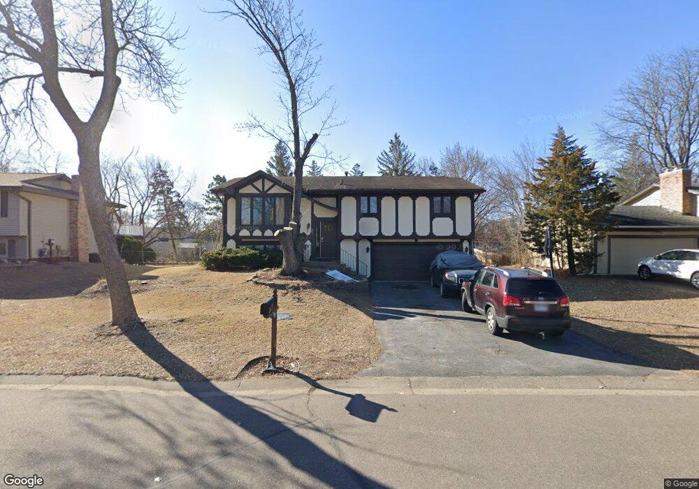
2001 Gunflint Trail Brooklyn Park, MN 55444
Norwood NeighborhoodEstimated Value: $333,000 - $352,000
4
Beds
2
Baths
1,162
Sq Ft
$296/Sq Ft
Est. Value
About This Home
This home is located at 2001 Gunflint Trail, Brooklyn Park, MN 55444 and is currently estimated at $344,288, approximately $296 per square foot. 2001 Gunflint Trail is a home located in Hennepin County with nearby schools including Palmer Lake Elementary School, Park Center Senior High, and SAGE Academy Charter School.
Ownership History
Date
Name
Owned For
Owner Type
Purchase Details
Closed on
Oct 18, 2019
Sold by
Reis Antonia Araujo
Bought by
Woahloe Maxwell Gontorwon and Sando Victoria K
Current Estimated Value
Home Financials for this Owner
Home Financials are based on the most recent Mortgage that was taken out on this home.
Original Mortgage
$232,703
Outstanding Balance
$203,440
Interest Rate
3.4%
Mortgage Type
New Conventional
Estimated Equity
$140,848
Create a Home Valuation Report for This Property
The Home Valuation Report is an in-depth analysis detailing your home's value as well as a comparison with similar homes in the area
Home Values in the Area
Average Home Value in this Area
Purchase History
| Date | Buyer | Sale Price | Title Company |
|---|---|---|---|
| Woahloe Maxwell Gontorwon | $239,900 | Executive Title |
Source: Public Records
Mortgage History
| Date | Status | Borrower | Loan Amount |
|---|---|---|---|
| Open | Woahloe Maxwell Gontorwon | $232,703 |
Source: Public Records
Tax History Compared to Growth
Tax History
| Year | Tax Paid | Tax Assessment Tax Assessment Total Assessment is a certain percentage of the fair market value that is determined by local assessors to be the total taxable value of land and additions on the property. | Land | Improvement |
|---|---|---|---|---|
| 2024 | $3,909 | $283,300 | $120,000 | $163,300 |
| 2023 | $3,863 | $287,900 | $120,000 | $167,900 |
| 2022 | $3,103 | $281,000 | $120,000 | $161,000 |
| 2021 | $2,925 | $233,800 | $58,000 | $175,800 |
| 2020 | $2,847 | $222,200 | $58,000 | $164,200 |
| 2019 | $2,864 | $207,200 | $58,000 | $149,200 |
| 2018 | $2,742 | $198,700 | $50,400 | $148,300 |
| 2017 | $2,396 | $163,200 | $50,400 | $112,800 |
| 2016 | $2,348 | $158,400 | $50,400 | $108,000 |
| 2015 | $2,308 | $152,500 | $40,300 | $112,200 |
| 2014 | -- | $139,100 | $40,300 | $98,800 |
Source: Public Records
Map
Nearby Homes
- 2300 Laramie Trail
- 7849 Sierra Pkwy
- 2016 Teton Trail
- 8205 Queen Ave N
- 2425 Gunflint Trail
- 8215 Queen Ave N
- 8232 Morgan Ave N
- 1222 81st Ct N
- 7701 Girard Ave N
- 1216 82nd Ave N
- 1308 Pearson Pkwy
- 7608 Newton Ave N
- 2708 Pearson Pkwy
- 7508 Newton Ave N
- 2531 Brookdale Ln Unit 2531
- 2729 Parkhaven Ct N
- 2208 84th Ave N
- 2537 Brookdale Ln
- 2530 Brookdale Ln
- 924 81st Ave N
- 1933 Gunflint Trail
- 2009 Gunflint Trail
- 2008 Yellowstone Trail
- 2000 Yellowstone Trail
- 1925 Gunflint Trail
- 2017 Gunflint Trail
- 2016 Yellowstone Trail
- 2000 Gunflint Trail
- 1916 Yellowstone Trail
- 2008 Gunflint Trail
- 1916 Gunflint Trail
- 2024 Yellowstone Trail
- 1917 Gunflint Trail
- 2016 Gunflint Trail
- 1908 Gunflint Trail
- 1908 Yellowstone Trail
- 2025 Gunflint Trail
- 7932 Newton Ave N
- 2024 Gunflint Trail
- 2001 Yellowstone Trail