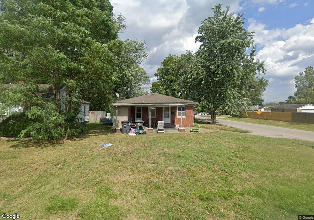
2001 Harding Ave Unit A/B Evansville, IN 47711
Estimated Value: $138,000 - $156,000
4
Beds
2
Baths
1,682
Sq Ft
$88/Sq Ft
Est. Value
About This Home
This home is located at 2001 Harding Ave Unit A/B, Evansville, IN 47711 and is currently estimated at $147,919, approximately $87 per square foot. 2001 Harding Ave Unit A/B is a home located in Vanderburgh County with nearby schools including Vogel Elementary School, North Junior High School, and North High School.
Ownership History
Date
Name
Owned For
Owner Type
Purchase Details
Closed on
Mar 17, 2022
Sold by
Weightman Robbie L and Weightman Ann
Bought by
Truth Lodging Investment Properties Llc
Current Estimated Value
Purchase Details
Closed on
Mar 16, 2022
Sold by
Weightman Robbie L and Weightman Ann
Bought by
Truth Lodging Investment Properties Llc
Purchase Details
Closed on
Jun 6, 2014
Sold by
Hennessy David R
Bought by
Weightman Robbie L and Weightman Mary Ann
Create a Home Valuation Report for This Property
The Home Valuation Report is an in-depth analysis detailing your home's value as well as a comparison with similar homes in the area
Home Values in the Area
Average Home Value in this Area
Purchase History
| Date | Buyer | Sale Price | Title Company |
|---|---|---|---|
| Truth Lodging Investment Properties Llc | $125,000 | Latham Christina | |
| Truth Lodging Investment Properties Llc | -- | Latham Christina | |
| Weightman Robbie L | -- | -- |
Source: Public Records
Tax History Compared to Growth
Tax History
| Year | Tax Paid | Tax Assessment Tax Assessment Total Assessment is a certain percentage of the fair market value that is determined by local assessors to be the total taxable value of land and additions on the property. | Land | Improvement |
|---|---|---|---|---|
| 2024 | $2,983 | $137,900 | $11,300 | $126,600 |
| 2023 | $2,844 | $130,600 | $10,700 | $119,900 |
| 2022 | $1,943 | $88,600 | $10,700 | $77,900 |
| 2021 | $1,293 | $57,900 | $10,700 | $47,200 |
| 2020 | $1,264 | $57,900 | $10,700 | $47,200 |
| 2019 | $1,256 | $57,900 | $10,700 | $47,200 |
| 2018 | $1,261 | $57,900 | $10,700 | $47,200 |
| 2017 | $1,255 | $57,300 | $10,700 | $46,600 |
| 2016 | $1,236 | $56,300 | $10,800 | $45,500 |
| 2014 | $1,247 | $56,800 | $10,800 | $46,000 |
| 2013 | -- | $72,300 | $10,800 | $61,500 |
Source: Public Records
Map
Nearby Homes
- 1908 Haven Dr
- 1821 Harding Ave
- 2120 Harding Ave
- 1699 Harding Ave
- 2108 Hercules Ave
- 1812 Hercules Ave
- 1301 E Eichel Ave
- 1207 E Eichel Ave
- 1120 Negley Ave
- 2044 Briar Meadows Dr Unit 2
- 2044 Briar Meadows Dr Unit 1
- 2027 Shiar Ct
- 837 Herndon Dr
- 928 Negley Ave
- 2936 Palomar Dr
- 1101 N Spring St
- 652 E Maryland St
- 912 N Spring St
- 721 Reis Ave
- 917 E Olmstead Ave
- 2001 Harding Ave
- 2001 Harding Ave
- 2003 Harding Ave
- 2005 Harding Ave
- 1921 Harding Ave
- 1510 Keck Ave
- 1917 Harding Ave
- 1926 Haven Dr
- 1926 Haven Dr Unit 4
- 2006 Haven Dr
- 1516 Keck Ave
- 2011 Harding Ave
- 1913 Harding Ave
- 1922 Haven Dr
- 1926 Harding Ave
- 2012 Harding Ave
- 2016 Haven Dr
- 1924 Harding Ave
- 2010 Harding Ave
- 2013 Harding Ave