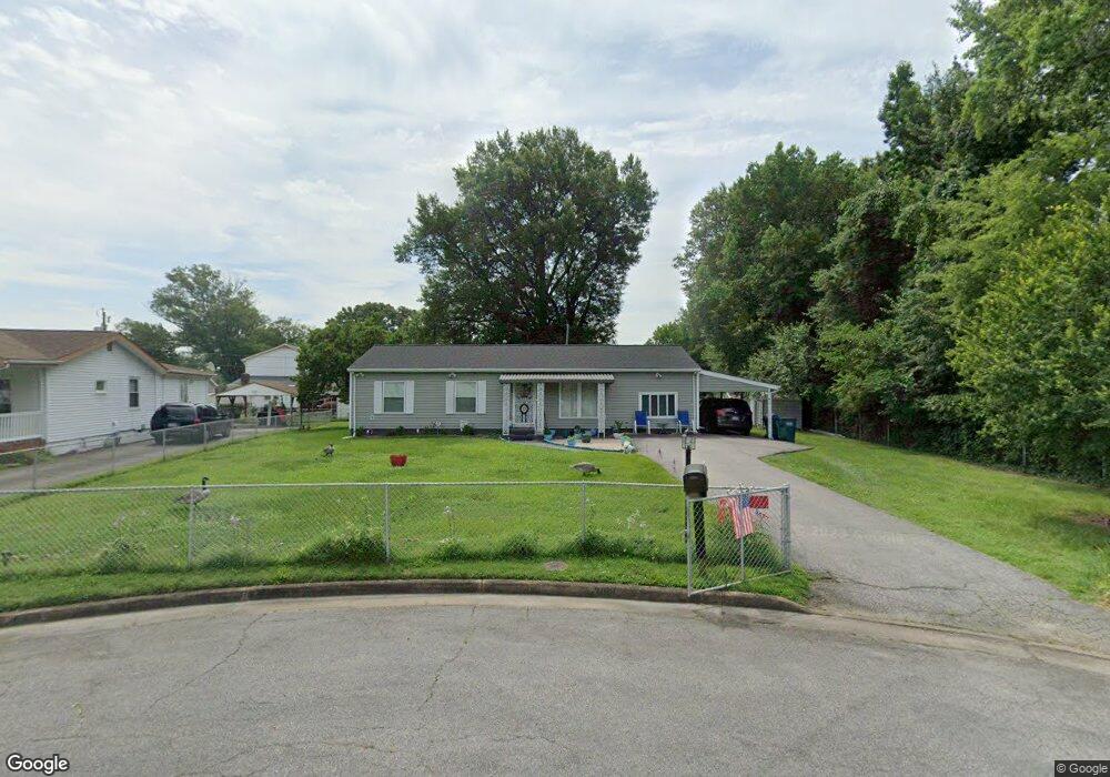
2001 Maple St Richmond, VA 23223
Fairfield NeighborhoodEstimated Value: $235,000 - $251,000
3
Beds
1
Bath
1,000
Sq Ft
$242/Sq Ft
Est. Value
About This Home
This home is located at 2001 Maple St, Richmond, VA 23223 and is currently estimated at $242,322, approximately $242 per square foot. 2001 Maple St is a home located in Henrico County with nearby schools including Ratcliffe Elementary School, Fairfield Middle School, and Highland Springs High School.
Ownership History
Date
Name
Owned For
Owner Type
Purchase Details
Closed on
Apr 6, 2001
Bought by
Dent Donald
Current Estimated Value
Home Financials for this Owner
Home Financials are based on the most recent Mortgage that was taken out on this home.
Original Mortgage
$25,000
Outstanding Balance
$9,237
Interest Rate
7.05%
Mortgage Type
New Conventional
Estimated Equity
$233,085
Create a Home Valuation Report for This Property
The Home Valuation Report is an in-depth analysis detailing your home's value as well as a comparison with similar homes in the area
Home Values in the Area
Average Home Value in this Area
Purchase History
| Date | Buyer | Sale Price | Title Company |
|---|---|---|---|
| Dent Donald | -- | -- |
Source: Public Records
Mortgage History
| Date | Status | Borrower | Loan Amount |
|---|---|---|---|
| Open | Dent Donald | $25,000 |
Source: Public Records
Tax History
| Year | Tax Paid | Tax Assessment Tax Assessment Total Assessment is a certain percentage of the fair market value that is determined by local assessors to be the total taxable value of land and additions on the property. | Land | Improvement |
|---|---|---|---|---|
| 2025 | -- | $177,800 | $34,600 | $143,200 |
| 2024 | -- | $168,900 | $30,200 | $138,700 |
| 2023 | -- | $168,900 | $30,200 | $138,700 |
| 2022 | $0 | $148,800 | $28,100 | $120,700 |
| 2021 | $0 | $102,300 | $21,600 | $80,700 |
| 2020 | $0 | $102,300 | $21,600 | $80,700 |
| 2019 | $0 | $100,200 | $21,600 | $78,600 |
| 2018 | $0 | $98,100 | $21,600 | $76,500 |
| 2017 | $0 | $95,900 | $19,400 | $76,500 |
| 2016 | $0 | $92,800 | $19,400 | $73,400 |
| 2015 | -- | $92,800 | $19,400 | $73,400 |
| 2014 | -- | $102,300 | $19,400 | $82,900 |
Source: Public Records
Map
Nearby Homes
- 2306 Brockway Ln
- 405 Hollybrook Ridge Ln
- 2800 Fairfield Ave
- 451 Hollybrook Ridge Ln
- 2214 Beau Ln
- 2211 Apollo Rd
- 2117 Selden St
- 2000 Selden St
- 2151 Binford Ln
- 2855 Hartman St
- 1820 N 28th St
- 1804 N 25th St
- 1711 Rogers St
- 1721 Mechanicsville Turnpike
- 2820 Mauldin St
- 4 Driver Ln
- 1 Driver Ln
- 2 Driver Ln
- 3173 Driver Ln
- 5 Driver Ln
- 2003 Maple St
- 2006 Poplar St
- 2005 Maple St
- 2008 Poplar St
- 2209 Carneal St
- 2010 Poplar St
- 2207 Carneal St
- 2012 Poplar St
- 2205 Carneal St
- 2005 Poplar St
- 2400 Carneal St
- 2007 Poplar St
- 2402 Carneal St
- 2203 Carneal St
- 2009 Poplar St
- 2214 Carneal St
- 2404 Carneal St
- 2011 Poplar St
- 2212 Carneal St
- 2406 Carneal St
Your Personal Tour Guide
Ask me questions while you tour the home.