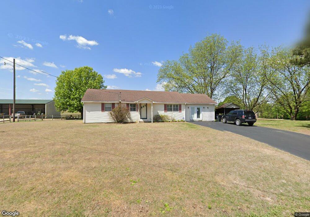
2001 Mt Lebanon Rd Covington, TN 38019
Estimated Value: $167,121 - $238,000
--
Bed
1
Bath
1,410
Sq Ft
$144/Sq Ft
Est. Value
About This Home
This home is located at 2001 Mt Lebanon Rd, Covington, TN 38019 and is currently estimated at $203,707, approximately $144 per square foot. 2001 Mt Lebanon Rd is a home located in Tipton County with nearby schools including Crestview Elementary School, Crestview Middle School, and Covington High School.
Ownership History
Date
Name
Owned For
Owner Type
Purchase Details
Closed on
Jan 27, 2025
Sold by
Hopkins William Cary and Click Margaret Diane
Bought by
Hopkins William Carey and Hopkins Angelia L
Current Estimated Value
Purchase Details
Closed on
Feb 12, 2001
Sold by
Troy Hopkins
Bought by
Hopkins Roy H
Purchase Details
Closed on
Feb 14, 2000
Sold by
Hopkins Roy H
Bought by
Carey Hopkins William
Purchase Details
Closed on
Nov 11, 1961
Bought by
Hopkins Roy H and Hopkins Margaret
Create a Home Valuation Report for This Property
The Home Valuation Report is an in-depth analysis detailing your home's value as well as a comparison with similar homes in the area
Home Values in the Area
Average Home Value in this Area
Purchase History
| Date | Buyer | Sale Price | Title Company |
|---|---|---|---|
| Hopkins William Carey | -- | None Listed On Document | |
| Hopkins Roy H | -- | -- | |
| Hopkins Roy H | -- | -- | |
| Carey Hopkins William | $5,000 | -- | |
| Hopkins Roy H | -- | -- |
Source: Public Records
Tax History Compared to Growth
Tax History
| Year | Tax Paid | Tax Assessment Tax Assessment Total Assessment is a certain percentage of the fair market value that is determined by local assessors to be the total taxable value of land and additions on the property. | Land | Improvement |
|---|---|---|---|---|
| 2024 | $598 | $39,275 | $19,350 | $19,925 |
| 2023 | $598 | $39,275 | $19,350 | $19,925 |
| 2022 | $580 | $28,450 | $14,225 | $14,225 |
| 2021 | $580 | $28,450 | $14,225 | $14,225 |
| 2020 | $580 | $28,450 | $14,225 | $14,225 |
| 2019 | $649 | $26,800 | $12,200 | $14,600 |
| 2018 | $649 | $26,800 | $12,200 | $14,600 |
| 2017 | $649 | $26,800 | $12,200 | $14,600 |
| 2016 | $649 | $26,800 | $12,200 | $14,600 |
| 2015 | $659 | $27,275 | $12,675 | $14,600 |
| 2014 | $659 | $27,274 | $0 | $0 |
Source: Public Records
Map
Nearby Homes
- 1202 Bucksnort Rd
- 0 Millstone Mountain Rd
- 101 Sivil Cir
- 1524 Garland Dr
- 65 Paulette Cir
- 73 Mcwilliams Rd
- LOT 5 Wortham Dr
- LOT 4 Wortham Dr
- 902 Hatchie Ave
- 900 Peete St
- 924 W Liberty Ave
- 000 Davis St
- 1517 Michael St
- 1186 U S 51
- 0 U S 51 S
- 0 Hwy 51
- 117 E Ripley Ave
- 273 Daniel Dr
- 272 Stephens Rd
- 0 N Munford St Unit 10156264
- 0 Bride Ln
- 00 Bride Ln
- 2037 Mt Lebanon Rd
- 2061 Mt Lebanon Rd
- 80 Bride Ln
- 97 Bride Ln
- 1872 Mount Lebanon Rd
- 157 Bride Ln
- 186 Bride Ln
- 2187 Mount Lebanon Rd
- 219 Bride Ln
- 1774 Mt Lebanon Rd
- 199 Campbell Dr
- 1759 Mt Lebanon Rd
- 1756 Mt Lebanon Rd
- 2255 Mt Lebanon Rd
- 2256 Mt Lebanon Rd
- 2273 Mt Lebanon Rd
- 310 Bride Ln
- 1707 Mt Lebanon Rd