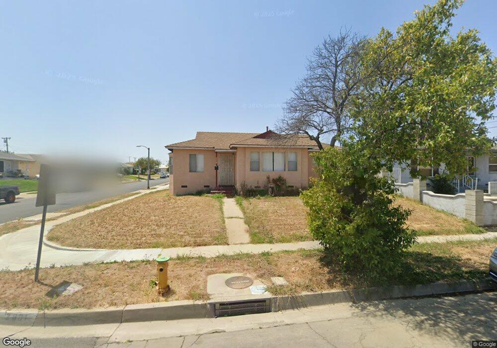
2001 N Kalsman Ave Compton, CA 90222
Estimated Value: $561,653 - $596,000
3
Beds
1
Bath
1,082
Sq Ft
$530/Sq Ft
Est. Value
About This Home
This home is located at 2001 N Kalsman Ave, Compton, CA 90222 and is currently estimated at $573,913, approximately $530 per square foot. 2001 N Kalsman Ave is a home located in Los Angeles County with nearby schools including Ronald E. McNair Elementary School, Enterprise Middle School, and Centennial High School.
Ownership History
Date
Name
Owned For
Owner Type
Purchase Details
Closed on
Oct 13, 2016
Sold by
Henderson Tabitha A and The Finis K Britton Family Tru
Bought by
Henderson Tabitha A
Current Estimated Value
Purchase Details
Closed on
Sep 11, 2013
Sold by
Britton Finis
Bought by
Britton Finis K and The Finis K Britton Family Tru
Purchase Details
Closed on
Aug 7, 2013
Sold by
Britton Finis
Bought by
Britton Finis
Create a Home Valuation Report for This Property
The Home Valuation Report is an in-depth analysis detailing your home's value as well as a comparison with similar homes in the area
Home Values in the Area
Average Home Value in this Area
Purchase History
| Date | Buyer | Sale Price | Title Company |
|---|---|---|---|
| Henderson Tabitha A | -- | None Available | |
| Henderson Tabitha A | -- | None Available | |
| Britton Finis K | -- | None Available | |
| Britton Finis | -- | None Available |
Source: Public Records
Tax History
| Year | Tax Paid | Tax Assessment Tax Assessment Total Assessment is a certain percentage of the fair market value that is determined by local assessors to be the total taxable value of land and additions on the property. | Land | Improvement |
|---|---|---|---|---|
| 2025 | $2,774 | $122,187 | $41,409 | $80,778 |
| 2024 | $2,774 | $119,793 | $40,598 | $79,195 |
| 2023 | $2,730 | $117,445 | $39,802 | $77,643 |
| 2022 | $2,280 | $115,143 | $39,022 | $76,121 |
| 2021 | $2,292 | $112,886 | $38,257 | $74,629 |
| 2019 | $2,230 | $109,539 | $37,123 | $72,416 |
| 2018 | $2,135 | $107,393 | $36,396 | $70,997 |
| 2016 | $2,030 | $103,225 | $34,984 | $68,241 |
| 2015 | $1,950 | $101,675 | $34,459 | $67,216 |
| 2014 | $1,922 | $99,684 | $33,784 | $65,900 |
Source: Public Records
Map
Nearby Homes
- 1209 W 136th St
- 1619 W 136th St
- 1701 W 136th St
- 810 W 133rd St
- 1706 W 137th St
- 1201 W 138th St
- 1036 W Stockwell St
- 9607 S Evers Ave
- 1301 W 132nd St
- 1805 N Central Ave
- 14003 S Nestor Ave
- 2114 N Bahama Ave
- 14016 S Albertson Ave
- 13918 S Hillford Ave
- 2109 N Bahama Ave
- 1716 N Grandee Ave
- 850 W 132nd St
- 910 W 138th St
- 917 W 130th St
- 800 N Kalsman Ave
- 2007 N Kalsman Ave
- 2000 N Nestor Ave
- 2009 N Kalsman Ave
- 2004 N Nestor Ave
- 1406 W 134th St
- 1317 W 134th St
- 1402 W 134th St
- 1410 W 134th St
- 2008 N Nestor Ave
- 2015 N Kalsman Ave
- 1316 W 134th St
- 1412 W 134th St
- 1318 W Sprague St
- 2012 N Nestor Ave
- 1313 W 134th St
- 1312 W 134th St
- 1314 W Sprague St
- 2016 N Nestor Ave
- 1310 W 134th St
- 1502 W 134th St
Your Personal Tour Guide
Ask me questions while you tour the home.