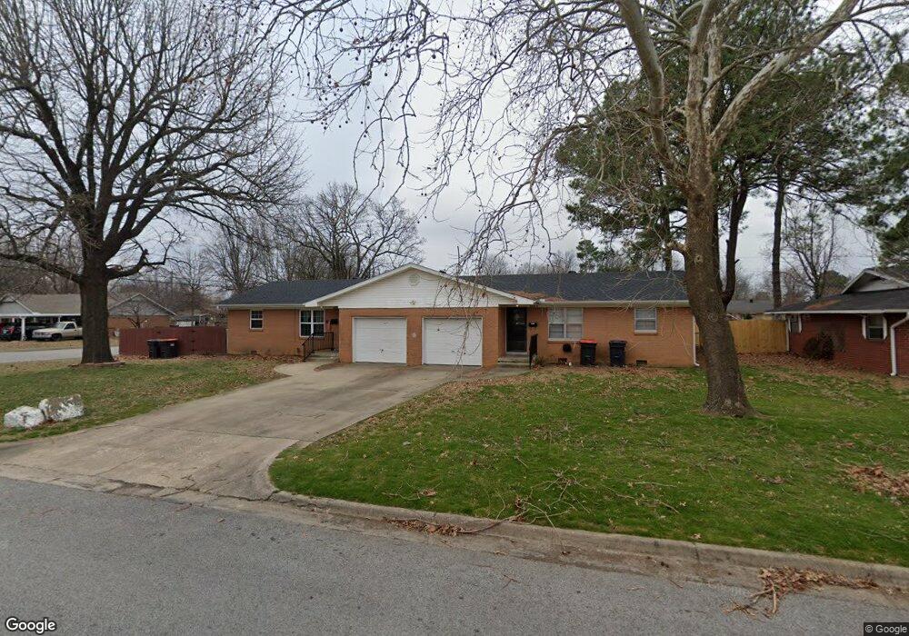
2001 Patti Ave Springdale, AR 72762
Estimated Value: $242,000 - $299,000
--
Bed
2
Baths
1,846
Sq Ft
$148/Sq Ft
Est. Value
About This Home
This home is located at 2001 Patti Ave, Springdale, AR 72762 and is currently estimated at $272,614, approximately $147 per square foot. 2001 Patti Ave is a home located in Washington County with nearby schools including Westwood Elementary School, Southwest Junior High School, and Helen Tyson Middle School.
Ownership History
Date
Name
Owned For
Owner Type
Purchase Details
Closed on
Sep 28, 2020
Sold by
Escobar Marie and Escobar Esperanza
Bought by
Rojo Lucero Verde
Current Estimated Value
Home Financials for this Owner
Home Financials are based on the most recent Mortgage that was taken out on this home.
Original Mortgage
$93,000
Outstanding Balance
$82,531
Interest Rate
2.9%
Mortgage Type
New Conventional
Estimated Equity
$190,083
Purchase Details
Closed on
Jan 31, 2007
Sold by
Swafford Sherm E and Swafford Artie B
Bought by
Escobar Mario
Home Financials for this Owner
Home Financials are based on the most recent Mortgage that was taken out on this home.
Original Mortgage
$108,000
Interest Rate
6.11%
Mortgage Type
Purchase Money Mortgage
Purchase Details
Closed on
Nov 4, 1987
Bought by
Swafford Sherm E
Purchase Details
Closed on
Jan 1, 1985
Bought by
Arhtur Orville W
Create a Home Valuation Report for This Property
The Home Valuation Report is an in-depth analysis detailing your home's value as well as a comparison with similar homes in the area
Home Values in the Area
Average Home Value in this Area
Purchase History
| Date | Buyer | Sale Price | Title Company |
|---|---|---|---|
| Rojo Lucero Verde | $116,800 | Natural State Title | |
| Escobar Mario | $120,000 | Waco Title Company | |
| Swafford Sherm E | $55,000 | -- | |
| Arhtur Orville W | -- | -- |
Source: Public Records
Mortgage History
| Date | Status | Borrower | Loan Amount |
|---|---|---|---|
| Open | Rojo Lucero Verde | $93,000 | |
| Previous Owner | Escobar Mario | $108,000 |
Source: Public Records
Tax History Compared to Growth
Tax History
| Year | Tax Paid | Tax Assessment Tax Assessment Total Assessment is a certain percentage of the fair market value that is determined by local assessors to be the total taxable value of land and additions on the property. | Land | Improvement |
|---|---|---|---|---|
| 2025 | $1,797 | $42,910 | $14,000 | $28,910 |
| 2024 | $1,659 | $42,910 | $14,000 | $28,910 |
| 2023 | $1,550 | $42,910 | $14,000 | $28,910 |
| 2022 | $1,409 | $26,740 | $6,500 | $20,240 |
| 2021 | $1,409 | $26,740 | $6,500 | $20,240 |
| 2020 | $660 | $26,740 | $6,500 | $20,240 |
| 2019 | $941 | $17,860 | $6,300 | $11,560 |
| 2018 | $941 | $17,860 | $6,300 | $11,560 |
| 2017 | $932 | $17,860 | $6,300 | $11,560 |
| 2016 | $932 | $17,860 | $6,300 | $11,560 |
| 2015 | $932 | $17,860 | $6,300 | $11,560 |
| 2014 | $1,097 | $21,010 | $6,300 | $14,710 |
Source: Public Records
Map
Nearby Homes
- 2003 Dee Ave
- 1807 Westwood Ave
- 510 Maria St
- 404 Henryetta St
- 302 S Gutensohn Rd
- 604 Maria St
- 10 Acres McRay Ave
- 506 Dyer St
- 2105 Oak Hill Dr
- 2001 Pin Oak Dr
- 508 Geneva St
- 2306 Ina Ave
- 706 Maria St
- 504 Zachary St
- 1708 Theodore Dr
- 603 Thomas Blvd
- 614 Zachary St
- 712 Carlton St
- 713 Carlton St
- 1611 Theodore Dr
- 2003 Patti Ave
- 2000 Dee Ave
- 1915 Patti Ave
- 2000 A & B Dee Ave
- 2005 Patti Ave
- 2002 Dee Ave
- 2000 Patti Ave
- 1914 Patti Ave
- 2002 Patti Ave
- 2004 Dee Ave
- 1913 Patti Ave
- 243 S Campbell Dr
- 2007 Patti Ave
- 233 S Campbell Dr
- 2004 Patti Ave
- 1912 Patti Ave
- 1912 Dee Ave
- 2006 Dee Ave
- 1913 Westwood Ave
- 1911 Patti Ave