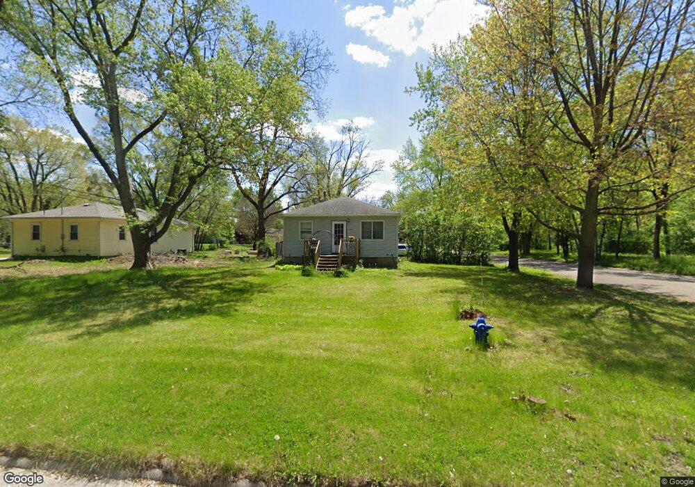
2001 Robin Rd Waterloo, IA 50701
Estimated Value: $128,029 - $136,000
2
Beds
1
Bath
720
Sq Ft
$183/Sq Ft
Est. Value
About This Home
This home is located at 2001 Robin Rd, Waterloo, IA 50701 and is currently estimated at $132,007, approximately $183 per square foot. 2001 Robin Rd is a home located in Black Hawk County with nearby schools including Becker Elementary School, Central Middle School, and West High School.
Ownership History
Date
Name
Owned For
Owner Type
Purchase Details
Closed on
Feb 8, 2013
Sold by
Maxwell Laurie R
Bought by
Wion Trenton E
Current Estimated Value
Home Financials for this Owner
Home Financials are based on the most recent Mortgage that was taken out on this home.
Original Mortgage
$79,800
Outstanding Balance
$55,303
Interest Rate
3.3%
Mortgage Type
New Conventional
Estimated Equity
$76,704
Purchase Details
Closed on
Jul 31, 2007
Sold by
Andre Doris O
Bought by
Maxwell Laurie R
Create a Home Valuation Report for This Property
The Home Valuation Report is an in-depth analysis detailing your home's value as well as a comparison with similar homes in the area
Purchase History
| Date | Buyer | Sale Price | Title Company |
|---|---|---|---|
| Wion Trenton E | $84,000 | Black Hawk County Abstract & | |
| Maxwell Laurie R | $80,000 | None Available |
Source: Public Records
Mortgage History
| Date | Status | Borrower | Loan Amount |
|---|---|---|---|
| Open | Wion Trenton E | $79,800 |
Source: Public Records
Tax History
| Year | Tax Paid | Tax Assessment Tax Assessment Total Assessment is a certain percentage of the fair market value that is determined by local assessors to be the total taxable value of land and additions on the property. | Land | Improvement |
|---|---|---|---|---|
| 2025 | $2,084 | $117,230 | $24,510 | $92,720 |
| 2024 | $2,084 | $106,250 | $24,510 | $81,740 |
| 2023 | $1,776 | $106,250 | $24,510 | $81,740 |
| 2022 | $1,726 | $89,730 | $24,510 | $65,220 |
| 2021 | $1,742 | $89,730 | $24,510 | $65,220 |
| 2020 | $1,708 | $85,480 | $20,740 | $64,740 |
| 2019 | $1,708 | $85,480 | $20,740 | $64,740 |
| 2018 | $1,712 | $85,480 | $20,740 | $64,740 |
| 2017 | $1,712 | $85,480 | $20,740 | $64,740 |
| 2016 | $1,668 | $82,240 | $20,740 | $61,500 |
| 2015 | $1,668 | $82,240 | $20,740 | $61,500 |
| 2014 | $1,700 | $82,240 | $20,740 | $61,500 |
Source: Public Records
Map
Nearby Homes
- 1839 Rush St
- 1290 Scott Ave
- 1286 Scott Ave
- 1266 Doreen Ave
- 1811 Sager Ave
- 1221 Julian Ave
- 1114 Eleanor Dr
- 1221 Downing Ave
- Lot 41 Luke St
- Lot 10 Luke St
- Lot 11 Luke St
- Lot 29 Luke St
- Lot 43 Luke St
- Lot 34 Luke St
- Lot 30 Luke St
- Lot 42 Luke St
- Lot 12 Luke St
- Lot 40 Luke St
- Lot 13 Luke St
- Lot 2 Matthew Dr
Your Personal Tour Guide
Ask me questions while you tour the home.