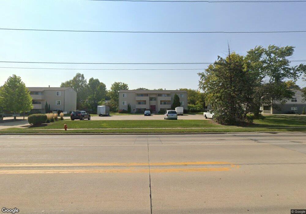
2001 S Mattis Ave Unit B Champaign, IL 61821
West Haven NeighborhoodEstimated Value: $96,000 - $105,526
--
Bed
--
Bath
--
Sq Ft
784
Sq Ft Lot
About This Home
This home is located at 2001 S Mattis Ave Unit B, Champaign, IL 61821 and is currently estimated at $101,632. 2001 S Mattis Ave Unit B is a home located in Champaign County with nearby schools including Centennial High School, Next Generation School, and St. Matthew School.
Ownership History
Date
Name
Owned For
Owner Type
Purchase Details
Closed on
Nov 14, 2006
Sold by
Coats Bradley J
Bought by
Desantis Richard
Current Estimated Value
Home Financials for this Owner
Home Financials are based on the most recent Mortgage that was taken out on this home.
Original Mortgage
$56,800
Outstanding Balance
$33,880
Interest Rate
6.36%
Mortgage Type
Purchase Money Mortgage
Estimated Equity
$67,752
Purchase Details
Closed on
Jun 2, 2003
Sold by
Armstrong Sidney L
Bought by
Coats Bradley J
Home Financials for this Owner
Home Financials are based on the most recent Mortgage that was taken out on this home.
Original Mortgage
$41,600
Interest Rate
5.9%
Mortgage Type
Purchase Money Mortgage
Purchase Details
Closed on
Aug 2, 1993
Sold by
Wiese Billy B and Will Of Helen Kuhn Wiese
Bought by
Armstrong Sidney L
Create a Home Valuation Report for This Property
The Home Valuation Report is an in-depth analysis detailing your home's value as well as a comparison with similar homes in the area
Home Values in the Area
Average Home Value in this Area
Purchase History
| Date | Buyer | Sale Price | Title Company |
|---|---|---|---|
| Desantis Richard | $53,000 | None Available | |
| Coats Bradley J | $49,500 | Allied Title Services | |
| Armstrong Sidney L | $35,500 | -- |
Source: Public Records
Mortgage History
| Date | Status | Borrower | Loan Amount |
|---|---|---|---|
| Open | Desantis Richard | $56,800 | |
| Previous Owner | Coats Bradley J | $41,600 |
Source: Public Records
Tax History Compared to Growth
Tax History
| Year | Tax Paid | Tax Assessment Tax Assessment Total Assessment is a certain percentage of the fair market value that is determined by local assessors to be the total taxable value of land and additions on the property. | Land | Improvement |
|---|---|---|---|---|
| 2024 | $1,437 | $24,090 | $2,240 | $21,850 |
| 2023 | $1,437 | $21,940 | $2,040 | $19,900 |
| 2022 | $1,309 | $20,240 | $1,880 | $18,360 |
| 2021 | $1,267 | $19,840 | $1,840 | $18,000 |
| 2020 | $1,199 | $19,080 | $1,770 | $17,310 |
| 2019 | $1,149 | $18,680 | $1,730 | $16,950 |
| 2018 | $1,114 | $18,380 | $1,700 | $16,680 |
| 2017 | $1,119 | $18,380 | $1,700 | $16,680 |
| 2016 | $993 | $18,000 | $1,660 | $16,340 |
| 2015 | $991 | $17,680 | $1,630 | $16,050 |
| 2014 | $983 | $17,680 | $1,630 | $16,050 |
| 2013 | $974 | $17,680 | $1,630 | $16,050 |
Source: Public Records
Map
Nearby Homes
- 2001 S Mattis Ave Unit E
- 1908 Barberry Cir
- 2113 Sunview Dr
- 1928 Blackthorn Dr Unit 1
- 1901 Lakeside Dr Unit B
- 2144 Harbortown Cir Unit 2144
- 1901 Branch Rd
- 2302 Blackthorn Dr
- 2306 Winchester Dr
- 2313 Glenoak Dr
- 2009 Southwood Dr
- 1801 Crescent Dr
- 2002 O Donnell Dr
- 1318 Broadmoor Dr
- 2003 W Kirby Ave
- 1612 W Kirby Ave
- 1420 S Western Ave
- 2203 W Kirby Ave
- 2404 Windward Blvd Unit 202
- 1410 S Mattis Ave
- 2001 S Mattis Ave Unit C
- 2001 S Mattis Ave Unit A
- 2001 S Mattis Ave Unit B
- 2003 S Mattis Ave Unit C
- 2003 S Mattis Ave Unit D
- 2003 S Mattis Ave Unit A
- 2003 S Mattis Ave Unit F
- 1920 Barberry Cir
- 1918 Barberry Cir
- 1922 Barberry Cir
- 1916 Barberry Cir
- 1924 Barberry Cir
- 1915 S Mattis Ave
- 2005 S Mattis Ave Unit C
- 2005 S Mattis Ave Unit B
- 2005 S Mattis Ave Unit F
- 2005 S Mattis Ave Unit D
- 2005 S Mattis Ave Unit A
- 2005 S Mattis Ave
- 1915 Barberry Cir