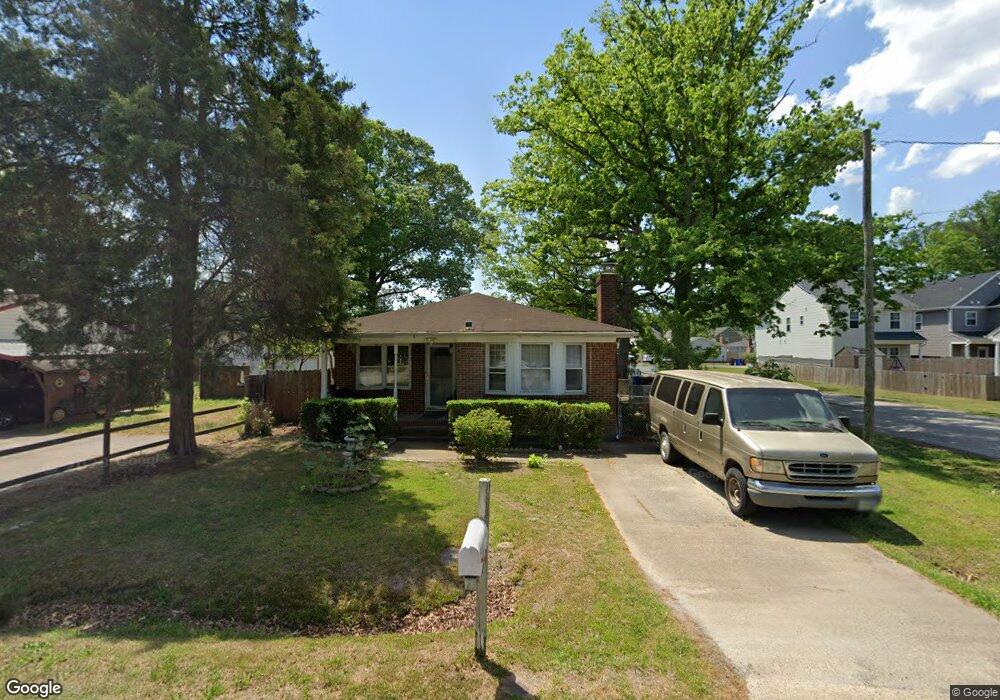
2001 Sparrow Rd Chesapeake, VA 23320
Indian River NeighborhoodEstimated Value: $298,031 - $319,000
3
Beds
2
Baths
1,356
Sq Ft
$226/Sq Ft
Est. Value
About This Home
This home is located at 2001 Sparrow Rd, Chesapeake, VA 23320 and is currently estimated at $306,758, approximately $226 per square foot. 2001 Sparrow Rd is a home located in Chesapeake City with nearby schools including Georgetown Primary School, Sparrow Road Intermediate School, and Indian River Middle.
Ownership History
Date
Name
Owned For
Owner Type
Purchase Details
Closed on
Oct 27, 2006
Sold by
Hawthorne Frank B
Bought by
Ramos Jose F
Current Estimated Value
Home Financials for this Owner
Home Financials are based on the most recent Mortgage that was taken out on this home.
Original Mortgage
$206,650
Outstanding Balance
$123,058
Interest Rate
6.33%
Mortgage Type
FHA
Estimated Equity
$183,700
Purchase Details
Closed on
Sep 25, 2000
Sold by
Pladsen Kenneth N
Bought by
Hawthorne Frank B
Home Financials for this Owner
Home Financials are based on the most recent Mortgage that was taken out on this home.
Original Mortgage
$73,500
Interest Rate
8%
Purchase Details
Closed on
Oct 20, 1999
Sold by
Samuel I White P C
Bought by
Sec Of V A
Create a Home Valuation Report for This Property
The Home Valuation Report is an in-depth analysis detailing your home's value as well as a comparison with similar homes in the area
Home Values in the Area
Average Home Value in this Area
Purchase History
| Date | Buyer | Sale Price | Title Company |
|---|---|---|---|
| Ramos Jose F | $209,000 | -- | |
| Hawthorne Frank B | $92,000 | -- | |
| Sec Of V A | $79,000 | -- |
Source: Public Records
Mortgage History
| Date | Status | Borrower | Loan Amount |
|---|---|---|---|
| Open | Ramos Jose F | $206,650 | |
| Previous Owner | Hawthorne Frank B | $73,500 |
Source: Public Records
Tax History
| Year | Tax Paid | Tax Assessment Tax Assessment Total Assessment is a certain percentage of the fair market value that is determined by local assessors to be the total taxable value of land and additions on the property. | Land | Improvement |
|---|---|---|---|---|
| 2025 | $2,585 | $274,000 | $115,000 | $159,000 |
| 2024 | $2,585 | $255,900 | $105,000 | $150,900 |
| 2023 | $2,282 | $240,700 | $100,000 | $140,700 |
| 2022 | $2,284 | $226,100 | $95,000 | $131,100 |
| 2021 | $2,128 | $202,700 | $85,000 | $117,700 |
| 2020 | $1,977 | $188,300 | $75,000 | $113,300 |
| 2019 | $1,904 | $181,300 | $75,000 | $106,300 |
| 2018 | $1,911 | $176,700 | $70,000 | $106,700 |
| 2017 | $1,911 | $182,000 | $70,000 | $112,000 |
| 2016 | $1,855 | $176,700 | $70,000 | $106,700 |
| 2015 | $1,833 | $174,600 | $70,000 | $104,600 |
| 2014 | $1,855 | $176,700 | $70,000 | $106,700 |
Source: Public Records
Map
Nearby Homes
- 2005 Lockard Ave
- 2041 Lockard Ave
- 2108 Lockard Ave
- 2044 Miller Ave
- 2123 Engle Ave
- 4501 Clipperton St
- 6464 Duquesne Place
- 2209 Sparrow Rd
- 6409 Duquesne Place
- 1728 Speedy Ave
- 6492 Duquesne Place
- 6407 Duquesne Place
- 6403 Duquesne Place
- 837 Providence Rd
- 1233 Parkley Dr
- 2418 Fieldsway Dr
- 1620 Elm Ave
- 1601 Wood Ave
- 2435 Fieldsway Dr
- 1701 Willow Ave
- 2000 Lockard Ave
- 2005 Sparrow Rd
- 2004 Lockard Ave
- 2007 Sparrow Rd
- 1925 Sparrow Rd
- 1923 Sparrow Rd
- 2000 Sparrow Rd
- 2002 Sparrow Rd
- 1938 Lockard Ave
- 2009 Sparrow Rd
- 2008 Lockard Ave
- 2004 Sparrow Rd
- 1921 Sparrow Rd
- 1922 Sparrow Rd
- 1936 Lockard Ave
- 2012 Lockard Ave
- 2008 Sparrow Rd
- 2011 Sparrow Rd
- 1919 Sparrow Rd
- 1920 Sparrow Rd
Your Personal Tour Guide
Ask me questions while you tour the home.