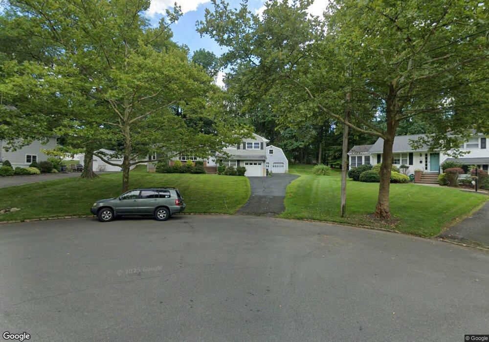
2002 Hill Top Rd Scotch Plains, NJ 07076
Estimated Value: $592,113 - $904,000
--
Bed
--
Bath
1,674
Sq Ft
$452/Sq Ft
Est. Value
About This Home
This home is located at 2002 Hill Top Rd, Scotch Plains, NJ 07076 and is currently estimated at $757,278, approximately $452 per square foot. 2002 Hill Top Rd is a home located in Union County with nearby schools including William J. McGinn Elementary School, Terrill Middle School, and Scotch Plains-Fanwood High School.
Ownership History
Date
Name
Owned For
Owner Type
Purchase Details
Closed on
Oct 17, 2018
Sold by
Benedict Lawrence R
Bought by
Xu Benedict Lawrence R and Xu Du
Current Estimated Value
Purchase Details
Closed on
Oct 4, 2010
Sold by
Benedict George R
Bought by
Benedict Lawrence R
Purchase Details
Closed on
Sep 29, 2010
Sold by
Benedict Russell B
Bought by
Benedict Lawrence R
Purchase Details
Closed on
Sep 17, 2010
Sold by
Benedict George T
Bought by
Benedict Lawrence R
Create a Home Valuation Report for This Property
The Home Valuation Report is an in-depth analysis detailing your home's value as well as a comparison with similar homes in the area
Home Values in the Area
Average Home Value in this Area
Purchase History
| Date | Buyer | Sale Price | Title Company |
|---|---|---|---|
| Xu Benedict Lawrence R | -- | None Available | |
| Benedict Lawrence R | -- | None Available | |
| Benedict Lawrence R | $120,000 | None Available | |
| Benedict Lawrence R | $120,000 | None Available |
Source: Public Records
Tax History Compared to Growth
Tax History
| Year | Tax Paid | Tax Assessment Tax Assessment Total Assessment is a certain percentage of the fair market value that is determined by local assessors to be the total taxable value of land and additions on the property. | Land | Improvement |
|---|---|---|---|---|
| 2025 | $13,886 | $118,000 | $44,500 | $73,500 |
| 2024 | $13,477 | $118,000 | $44,500 | $73,500 |
| 2023 | $13,477 | $118,000 | $44,500 | $73,500 |
| 2022 | $13,316 | $118,000 | $44,500 | $73,500 |
| 2021 | $13,294 | $118,000 | $44,500 | $73,500 |
| 2020 | $13,230 | $118,000 | $44,500 | $73,500 |
| 2019 | $13,132 | $118,000 | $44,500 | $73,500 |
| 2018 | $12,912 | $118,000 | $44,500 | $73,500 |
| 2017 | $12,625 | $118,000 | $44,500 | $73,500 |
| 2016 | $12,382 | $118,000 | $44,500 | $73,500 |
| 2015 | $12,179 | $118,000 | $44,500 | $73,500 |
| 2014 | $11,778 | $118,000 | $44,500 | $73,500 |
Source: Public Records
Map
Nearby Homes
- 1933 Mary Ellen Ln
- 1933 W Broad St
- 2116 Newark Ave
- 187 King St
- 2 Brookside Ct
- 5 Robin Rd
- 2154 W Broad St
- 120 S Martine Ave
- 119 Lamberts Mill Rd
- 345 La Grande Ave
- 2212 Shady Ln
- 40 1st St
- 21 Old South Ave
- 2219 North Ave Unit 6
- 57 Rambling Dr
- 32 Gere Place
- 1466 Lamberts Mill Rd
- 2314 Longfellow Ave
- 36 2nd St
- 314 Highgate Ave
- 2000 Hill Top Rd
- 2004 Hill Top Rd
- 1230 Christine Cir
- 1224 Christine Cir
- 2006 Hill Top Rd
- 1236 Christine Cir
- 1218 Christine Cir
- 2001 Hill Top Rd
- 2003 Hill Top Rd
- 2007 Hill Top Rd
- 2008 Hill Top Rd
- 1242 Christine Cir
- 1240 White Oak Rd
- 2009 Hill Top Rd
- 2005 Hill Top Rd
- 1221 Christine Cir
- 1241 Christine Cir
- 1212 Christine Cir
- 1246 White Oak Rd
- 2010 Hill Top Rd