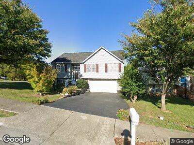
2002 Kay St NW Roanoke, VA 24017
Westview Terrace NeighborhoodEstimated Value: $263,000 - $284,000
3
Beds
3
Baths
1,221
Sq Ft
$226/Sq Ft
Est. Value
About This Home
This home is located at 2002 Kay St NW, Roanoke, VA 24017 and is currently estimated at $275,654, approximately $225 per square foot. 2002 Kay St NW is a home located in Roanoke City with nearby schools including Westside Elementary School, Breckinridge Middle School, and William Fleming High School.
Ownership History
Date
Name
Owned For
Owner Type
Purchase Details
Closed on
Mar 29, 2007
Sold by
D & S Development Group Llc
Bought by
Rackley Jeffrey Glenn
Current Estimated Value
Home Financials for this Owner
Home Financials are based on the most recent Mortgage that was taken out on this home.
Original Mortgage
$27,655
Interest Rate
6.21%
Mortgage Type
Credit Line Revolving
Create a Home Valuation Report for This Property
The Home Valuation Report is an in-depth analysis detailing your home's value as well as a comparison with similar homes in the area
Home Values in the Area
Average Home Value in this Area
Purchase History
| Date | Buyer | Sale Price | Title Company |
|---|---|---|---|
| Rackley Jeffrey Glenn | -- | None Available |
Source: Public Records
Mortgage History
| Date | Status | Borrower | Loan Amount |
|---|---|---|---|
| Open | Rackley Jeffrey Glenn | $128,453 | |
| Closed | Rackley Jeffrey G | $27,655 | |
| Closed | Rackley Jeffrey Glenn | $132,500 |
Source: Public Records
Tax History Compared to Growth
Tax History
| Year | Tax Paid | Tax Assessment Tax Assessment Total Assessment is a certain percentage of the fair market value that is determined by local assessors to be the total taxable value of land and additions on the property. | Land | Improvement |
|---|---|---|---|---|
| 2024 | $3,350 | $259,000 | $31,900 | $227,100 |
| 2023 | $3,350 | $236,700 | $27,000 | $209,700 |
| 2022 | $2,668 | $204,600 | $27,000 | $177,600 |
| 2021 | $2,502 | $191,700 | $21,100 | $170,600 |
| 2020 | $2,380 | $182,800 | $19,000 | $163,800 |
| 2019 | $2,317 | $177,600 | $19,000 | $158,600 |
| 2018 | $2,231 | $170,600 | $19,000 | $151,600 |
| 2017 | $2,012 | $160,500 | $19,000 | $141,500 |
| 2016 | $1,950 | $155,400 | $19,000 | $136,400 |
| 2015 | $1,953 | $162,600 | $19,000 | $143,600 |
| 2014 | $1,953 | $164,100 | $19,000 | $145,100 |
Source: Public Records
Map
Nearby Homes
- 4323 Quail Dr NW
- 2048 Laura Rd NW
- 4731 Peach Tree Dr NW
- 4770 Northwood Dr NW
- 0 Mountain View Rd NW
- 4774 Northwood Dr NW
- 0 Garstland Dr NW
- 4302 Kaiden Ct NW
- 1634 Sigmon Rd NW
- 0 Harvest Ln NW
- 2256 Mattaponi Dr NW
- 4414 Surrey Ave NW
- 0 Surrey Ave NW
- 0 Surrey Ave NW Unit 914794
- 4433 Lewiston St NW
- 1401 Gilbert Rd NW
- 4705 Surrey Ave NW
- 1414 Westside Blvd NW
- 0 Barnett Cir NW
- 4711 Surrey Ave NW
- 2002 Kay St NW
- 2010 Kay St NW
- 4402 Woodbridge Ave NW
- 4403 Woodbridge Ave NW
- 2016 Kay St NW
- 4363 Woodbridge Ave NW
- 1917 Kay St NW
- 4358 Quail Dr NW
- 4357 Woodbridge Ave NW
- 1911 Kay St NW
- 4354 Woodbridge Ave NW
- 4352 Quail Dr NW
- 1905 Kay St NW
- 2028 Kay St NW
- 4351 Woodbridge Ave NW
- 2203 Peters Creek Rd NW
- 4346 Quail Dr NW
- 2115 Peters Creek Rd NW
- 4348 Woodbridge Ave NW
- 2207 Peters Creek Rd NW