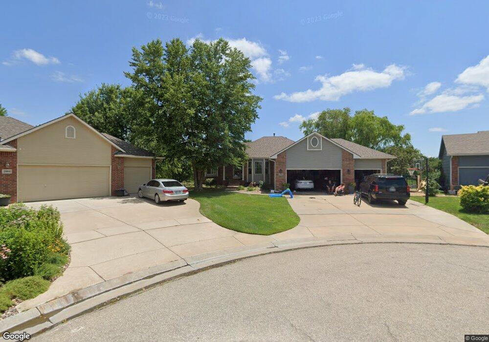
2002 N Colt Ct Andover, KS 67002
Estimated Value: $336,319 - $363,000
5
Beds
3
Baths
2,650
Sq Ft
$132/Sq Ft
Est. Value
About This Home
This home is located at 2002 N Colt Ct, Andover, KS 67002 and is currently estimated at $348,830, approximately $131 per square foot. 2002 N Colt Ct is a home located in Butler County with nearby schools including Robert M. Martin Elementary School, Andover Middle School, and Andover High School.
Ownership History
Date
Name
Owned For
Owner Type
Purchase Details
Closed on
Jun 17, 2025
Sold by
Chism Donald D
Bought by
Jensen Jennifer L and Chism Jennifer L
Current Estimated Value
Purchase Details
Closed on
Aug 23, 2019
Sold by
Slape Phillip B and Slape Lisa M
Bought by
Chism Jennifer L and Chism Donald D
Home Financials for this Owner
Home Financials are based on the most recent Mortgage that was taken out on this home.
Original Mortgage
$237,500
Interest Rate
3.7%
Mortgage Type
New Conventional
Create a Home Valuation Report for This Property
The Home Valuation Report is an in-depth analysis detailing your home's value as well as a comparison with similar homes in the area
Home Values in the Area
Average Home Value in this Area
Purchase History
| Date | Buyer | Sale Price | Title Company |
|---|---|---|---|
| Jensen Jennifer L | -- | None Listed On Document | |
| Chism Jennifer L | -- | None Available | |
| Chism Donald D | $296,875 | Security First Title |
Source: Public Records
Mortgage History
| Date | Status | Borrower | Loan Amount |
|---|---|---|---|
| Previous Owner | Chism Donald D | $237,500 |
Source: Public Records
Tax History Compared to Growth
Tax History
| Year | Tax Paid | Tax Assessment Tax Assessment Total Assessment is a certain percentage of the fair market value that is determined by local assessors to be the total taxable value of land and additions on the property. | Land | Improvement |
|---|---|---|---|---|
| 2025 | $58 | $40,089 | $2,539 | $37,550 |
| 2024 | $58 | $38,686 | $2,415 | $36,271 |
| 2023 | $5,646 | $37,559 | $2,415 | $35,144 |
| 2022 | $5,617 | $33,189 | $2,415 | $30,774 |
| 2021 | $4,476 | $28,888 | $2,415 | $26,473 |
| 2020 | $4,659 | $28,751 | $2,013 | $26,738 |
| 2019 | $4,476 | $27,377 | $2,013 | $25,364 |
| 2018 | $4,346 | $26,704 | $2,013 | $24,691 |
| 2017 | $4,284 | $26,336 | $1,898 | $24,438 |
| 2014 | -- | $211,700 | $16,500 | $195,200 |
Source: Public Records
Map
Nearby Homes
- 1936 N Quail Crossing St
- 1917 N Quail Crossing St
- 1407 W Quail Crossing Ct
- 2283 N 159th Ct E
- 1726 N Black Oak Ct
- 2127 N 159th Ct E
- 2209 N 159th St E
- 2215 N 159th St E
- 2229 N 159th St E
- 2235 N 159th St E
- 2013 N Grace Avenue Ct
- 1213 W Lakeway Ct
- 704 W Cornerstone Ct
- 2311 N Lakeside Cir
- 1911 N Pineview Dr
- 1206 W Lakeway Ct
- 1226 W Lakeway Ct
- 2333 N Silverdale St
- 420 Renee Dr
- 1609 N Lakeside Ct
- 2004 N Colt Ct
- 2001 N Colt Ct
- 2005 N Colt Ct
- 2006 N Colt Ct
- 1019 W Mountain St
- 2007 N Colt Ct
- 1023 W Mountain St
- 1017 W Mountain St
- 1910 N Quail Crossing St
- 1906 N Quail Crossing St
- 1013 W Mountain St
- 1907 N Remington Cir
- 2002 N Quail Crossing St
- 2008 N Quail Crossing St
- 1950 N Quail Crossing St
- 2019 N Ruger Cir
- 1914 N Quail Crossing St
- 1903 N Remington Cir
- 2020 N Ruger Cir
- 2022 N Quail Crossing St