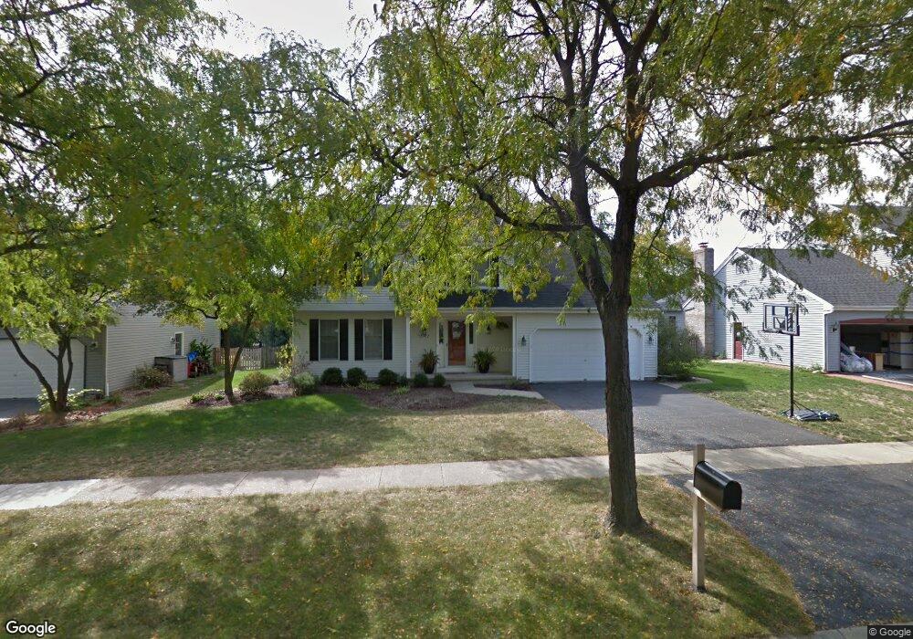
2002 Sheffield Ln Geneva, IL 60134
Northwest Central Geneva NeighborhoodEstimated Value: $458,646 - $510,000
3
Beds
3
Baths
1,937
Sq Ft
$251/Sq Ft
Est. Value
About This Home
This home is located at 2002 Sheffield Ln, Geneva, IL 60134 and is currently estimated at $485,412, approximately $250 per square foot. 2002 Sheffield Ln is a home located in Kane County with nearby schools including Williamsburg Elementary School, Geneva Community High School, and Kensington School - Geneva.
Ownership History
Date
Name
Owned For
Owner Type
Purchase Details
Closed on
Oct 22, 2003
Sold by
Kafer James K and Kafer Joyce H
Bought by
Dinovo Anthony J and Dinovo Lisa
Current Estimated Value
Home Financials for this Owner
Home Financials are based on the most recent Mortgage that was taken out on this home.
Original Mortgage
$221,000
Outstanding Balance
$101,785
Interest Rate
6.02%
Mortgage Type
Purchase Money Mortgage
Estimated Equity
$383,627
Purchase Details
Closed on
Jul 27, 1999
Sold by
Derrico Terry V and Derrico Kristine D
Bought by
Kafer James K and Kafer Joyce H
Home Financials for this Owner
Home Financials are based on the most recent Mortgage that was taken out on this home.
Original Mortgage
$113,000
Interest Rate
7.68%
Create a Home Valuation Report for This Property
The Home Valuation Report is an in-depth analysis detailing your home's value as well as a comparison with similar homes in the area
Home Values in the Area
Average Home Value in this Area
Purchase History
| Date | Buyer | Sale Price | Title Company |
|---|---|---|---|
| Dinovo Anthony J | $291,000 | Chicago Title Insurance Comp | |
| Kafer James K | $238,000 | Chicago Title Insurance Co |
Source: Public Records
Mortgage History
| Date | Status | Borrower | Loan Amount |
|---|---|---|---|
| Open | Dinovo Anthony J | $221,000 | |
| Previous Owner | Kafer James K | $113,000 | |
| Closed | Kafer James K | $42,000 |
Source: Public Records
Tax History
| Year | Tax Paid | Tax Assessment Tax Assessment Total Assessment is a certain percentage of the fair market value that is determined by local assessors to be the total taxable value of land and additions on the property. | Land | Improvement |
|---|---|---|---|---|
| 2024 | $9,260 | $128,972 | $34,159 | $94,813 |
| 2023 | $8,996 | $117,248 | $31,054 | $86,194 |
| 2022 | $8,627 | $108,946 | $28,855 | $80,091 |
| 2021 | $8,371 | $104,897 | $27,783 | $77,114 |
| 2020 | $8,272 | $103,296 | $27,359 | $75,937 |
| 2019 | $8,247 | $101,340 | $26,841 | $74,499 |
| 2018 | $8,074 | $99,480 | $26,841 | $72,639 |
| 2017 | $7,981 | $96,827 | $26,125 | $70,702 |
| 2016 | $7,567 | $90,460 | $25,772 | $64,688 |
| 2015 | -- | $86,005 | $24,503 | $61,502 |
| 2014 | -- | $86,005 | $24,503 | $61,502 |
| 2013 | -- | $86,005 | $24,503 | $61,502 |
Source: Public Records
Map
Nearby Homes
- 549 Bloomfield Cir
- 2187 Vanderbilt Dr
- 525 Bradbury Ln Unit 525
- 524 Bradbury Ln
- 1736 Kaneville Rd
- 544 Bradbury Ln Unit 544
- 2300 Kaneville Rd
- 369 Fritz Ln
- 2250 South St
- 1949 Gary Ln
- 301 Country Club Place
- 2719 Stone Cir
- 2692 Stone Cir Unit 209
- 1342 S 14th St Unit A2
- 2707 Stone Cir
- 2767 Stone Cir
- 2771 Stone Cir
- 2711 Stone Cir
- 2769 Stone Cir
- 629 N Lincoln Ave
- 2010 Sheffield Ln
- 2000 Sheffield Ln Unit 2A
- 2015 Williamsburg Ave Unit 2
- 2013 Williamsburg Ave
- 2016 Sheffield Ln
- 1996 Sheffield Ln
- 2017 Williamsburg Ave
- 325 Colonial Cir
- 1999 Williamsburg Ave
- 1997 Sheffield Ln Unit 2
- 2018 Sheffield Ln
- 1916 Sheffield Ln Unit 2
- 2019 Williamsburg Ave Unit 2
- 2009 Sheffield Ln Unit 2A
- 1921 Williamsburg Ave
- 327 Colonial Cir Unit 4
- 2020 Sheffield Ln
- 2019 Sheffield Ln
- 1912 Sheffield Ln
- 2021 Williamsburg Ave
Your Personal Tour Guide
Ask me questions while you tour the home.