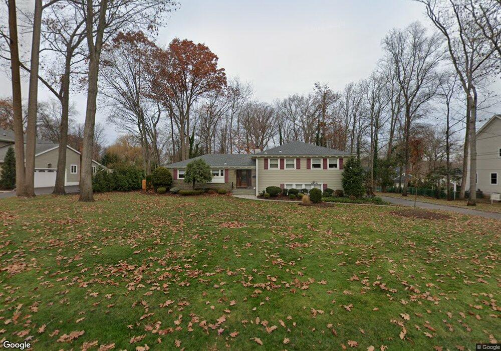
2002 Wood Rd Scotch Plains, NJ 07076
Estimated Value: $748,871 - $1,293,000
--
Bed
--
Bath
2,489
Sq Ft
$453/Sq Ft
Est. Value
About This Home
This home is located at 2002 Wood Rd, Scotch Plains, NJ 07076 and is currently estimated at $1,127,468, approximately $452 per square foot. 2002 Wood Rd is a home located in Union County with nearby schools including William J. McGinn Elementary School, Terrill Middle School, and Scotch Plains-Fanwood High School.
Ownership History
Date
Name
Owned For
Owner Type
Purchase Details
Closed on
Aug 13, 1976
Bought by
Weitzman Morton and Weitzman Laura
Current Estimated Value
Create a Home Valuation Report for This Property
The Home Valuation Report is an in-depth analysis detailing your home's value as well as a comparison with similar homes in the area
Home Values in the Area
Average Home Value in this Area
Purchase History
| Date | Buyer | Sale Price | Title Company |
|---|---|---|---|
| Weitzman Morton | $84,000 | -- |
Source: Public Records
Tax History Compared to Growth
Tax History
| Year | Tax Paid | Tax Assessment Tax Assessment Total Assessment is a certain percentage of the fair market value that is determined by local assessors to be the total taxable value of land and additions on the property. | Land | Improvement |
|---|---|---|---|---|
| 2025 | $16,122 | $137,000 | $53,100 | $83,900 |
| 2024 | $15,647 | $137,000 | $53,100 | $83,900 |
| 2023 | $15,647 | $137,000 | $53,100 | $83,900 |
| 2022 | $15,460 | $137,000 | $53,100 | $83,900 |
| 2021 | $15,434 | $137,000 | $53,100 | $83,900 |
| 2020 | $17,737 | $158,200 | $53,100 | $105,100 |
| 2019 | $17,606 | $158,200 | $53,100 | $105,100 |
| 2018 | $17,310 | $158,200 | $53,100 | $105,100 |
| 2017 | $16,926 | $158,200 | $53,100 | $105,100 |
| 2016 | $16,600 | $158,200 | $53,100 | $105,100 |
| 2015 | $16,328 | $158,200 | $53,100 | $105,100 |
| 2014 | $15,790 | $158,200 | $53,100 | $105,100 |
Source: Public Records
Map
Nearby Homes
- 2 Brookside Ct
- 1466 Lamberts Mill Rd
- 2154 W Broad St
- 119 Lamberts Mill Rd
- 314 Highgate Ave
- 1933 W Broad St
- 1933 Mary Ellen Ln
- 2 Dutch Ln
- 2116 Newark Ave
- 57 Rambling Dr
- 525 Edgar Rd
- 524 Edgar Rd
- 614 Dorian Rd
- 2212 Shady Ln
- 2 Unami Ln
- 187 King St
- 676 Vermont St
- 724 South Ave W Unit 724A
- 5 Robin Rd
- 2314 Longfellow Ave
- 2006 Wood Rd
- 1996 Wood Rd
- 2071 Oakhill Rd
- 2041 Parkwood Dr
- 2060 Brookside Dr
- 2042 Parkwood Dr
- 2042 Brookside Dr
- 2070 Oakhill Rd
- 2081 Oakhill Rd
- 2031 Parkwood Dr
- 1420 Golf St
- 1412 Golf St
- 2070 Brookside Dr
- 1991 Wood Rd
- 2032 Parkwood Dr
- 2032 Brookside Dr
- 2030 Wood Rd
- 2091 Oakhill Rd
- 2080 Oakhill Rd
- 2092 Brookside Dr