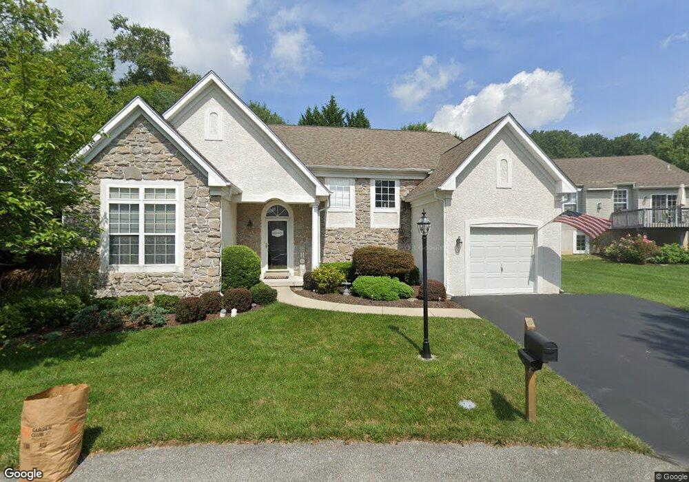
2003 Black Smith Cir Downingtown, PA 19335
Estimated Value: $452,940 - $541,000
2
Beds
2
Baths
2,250
Sq Ft
$223/Sq Ft
Est. Value
About This Home
This home is located at 2003 Black Smith Cir, Downingtown, PA 19335 and is currently estimated at $501,235, approximately $222 per square foot. 2003 Black Smith Cir is a home located in Chester County with nearby schools including Reeceville Elementary School, Coatesville Intermediate High School, and Coatesville Area Senior High School.
Ownership History
Date
Name
Owned For
Owner Type
Purchase Details
Closed on
Mar 30, 2007
Sold by
Albrecht John R and Albrecht Suzanne F
Bought by
Riggs Larry D and Riggs Kathy S
Current Estimated Value
Home Financials for this Owner
Home Financials are based on the most recent Mortgage that was taken out on this home.
Original Mortgage
$60,000
Outstanding Balance
$36,635
Interest Rate
6.33%
Mortgage Type
Purchase Money Mortgage
Estimated Equity
$464,600
Create a Home Valuation Report for This Property
The Home Valuation Report is an in-depth analysis detailing your home's value as well as a comparison with similar homes in the area
Home Values in the Area
Average Home Value in this Area
Purchase History
| Date | Buyer | Sale Price | Title Company |
|---|---|---|---|
| Riggs Larry D | $295,000 | None Available |
Source: Public Records
Mortgage History
| Date | Status | Borrower | Loan Amount |
|---|---|---|---|
| Open | Riggs Larry D | $60,000 |
Source: Public Records
Tax History Compared to Growth
Tax History
| Year | Tax Paid | Tax Assessment Tax Assessment Total Assessment is a certain percentage of the fair market value that is determined by local assessors to be the total taxable value of land and additions on the property. | Land | Improvement |
|---|---|---|---|---|
| 2025 | $7,550 | $145,260 | $27,120 | $118,140 |
| 2024 | $7,550 | $145,260 | $27,120 | $118,140 |
| 2023 | $7,393 | $145,260 | $27,120 | $118,140 |
| 2022 | $7,020 | $145,260 | $27,120 | $118,140 |
| 2021 | $6,800 | $145,260 | $27,120 | $118,140 |
| 2020 | $6,686 | $145,260 | $27,120 | $118,140 |
| 2019 | $6,563 | $145,260 | $27,120 | $118,140 |
| 2018 | $6,209 | $145,260 | $27,120 | $118,140 |
| 2017 | $5,997 | $145,260 | $27,120 | $118,140 |
| 2016 | $4,864 | $145,260 | $27,120 | $118,140 |
| 2015 | $4,864 | $145,260 | $27,120 | $118,140 |
| 2014 | $4,864 | $145,260 | $27,120 | $118,140 |
Source: Public Records
Map
Nearby Homes
- 2101 Jacobs Mill Cir
- 105 Helm Way
- 16 Parkside Ave
- 4701 Edges Mill Rd
- 114 Governors Cir
- 184 Race St
- 390 Mary St
- 340 Carlyn Ct
- 115 Whelen Ave
- 266 Carlyn Ct
- 137 W Lancaster Ave
- 604 Highland Ave
- 112 Bradford Ave
- 335 E Lancaster Ave Unit F-13
- 161 Jefferson Ave
- 230 Church St
- 900 Covington Dr
- 309 Jefferson Ave
- 6 Holleran Dr
- 222 Bradford Ave
- 1804 Burnt Coal Cir
- 2001 Black Smith Cir
- 2006 Black Smith Cir
- 1805 Burnt Coal Cir
- 1802 Burnt Coal Cir
- 2004 Black Smith Cir
- 2002 Black Smith Cir
- 1206 Bellows Ct
- 1205 Bellows Ct
- 1803 Burnt Coal Cir
- 2203 Potters Mill Cir
- 2102 Jacobs Mill Cir
- 2302 Higgins Cir
- 2201 Potters Mill Cir
- 1006 Millstone Ct
- 1801 Burnt Coal Cir
- 1204 Bellows Ct
- 1203 Bellows Ct
- 1405 Anvil Ct
- 2103 Jacobs Mill Cir