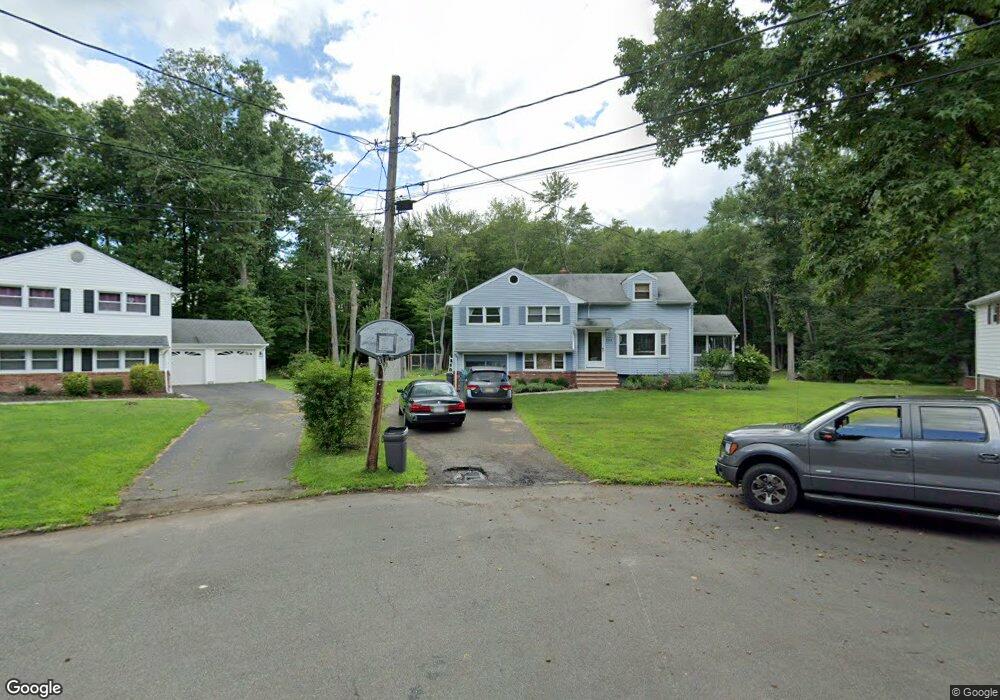
2003 Hill Top Rd Scotch Plains, NJ 07076
Estimated Value: $626,457 - $1,052,000
--
Bed
--
Bath
1,486
Sq Ft
$577/Sq Ft
Est. Value
About This Home
This home is located at 2003 Hill Top Rd, Scotch Plains, NJ 07076 and is currently estimated at $857,364, approximately $576 per square foot. 2003 Hill Top Rd is a home located in Union County with nearby schools including William J. McGinn Elementary School, Terrill Middle School, and Scotch Plains-Fanwood High School.
Ownership History
Date
Name
Owned For
Owner Type
Purchase Details
Closed on
May 20, 2009
Sold by
Warnock Sharon Marie
Bought by
Byrne Michael S and Byrne Lisa
Current Estimated Value
Home Financials for this Owner
Home Financials are based on the most recent Mortgage that was taken out on this home.
Original Mortgage
$364,000
Outstanding Balance
$230,231
Interest Rate
4.87%
Mortgage Type
Purchase Money Mortgage
Estimated Equity
$627,133
Create a Home Valuation Report for This Property
The Home Valuation Report is an in-depth analysis detailing your home's value as well as a comparison with similar homes in the area
Home Values in the Area
Average Home Value in this Area
Purchase History
| Date | Buyer | Sale Price | Title Company |
|---|---|---|---|
| Byrne Michael S | $455,000 | Multiple |
Source: Public Records
Mortgage History
| Date | Status | Borrower | Loan Amount |
|---|---|---|---|
| Open | Byrne Michael S | $364,000 |
Source: Public Records
Tax History Compared to Growth
Tax History
| Year | Tax Paid | Tax Assessment Tax Assessment Total Assessment is a certain percentage of the fair market value that is determined by local assessors to be the total taxable value of land and additions on the property. | Land | Improvement |
|---|---|---|---|---|
| 2025 | $12,792 | $108,700 | $45,100 | $63,600 |
| 2024 | $12,415 | $108,700 | $45,100 | $63,600 |
| 2023 | $12,415 | $108,700 | $45,100 | $63,600 |
| 2022 | $12,267 | $108,700 | $45,100 | $63,600 |
| 2021 | $12,246 | $108,700 | $45,100 | $63,600 |
| 2020 | $12,187 | $108,700 | $45,100 | $63,600 |
| 2019 | $12,097 | $108,700 | $45,100 | $63,600 |
| 2018 | $11,894 | $108,700 | $45,100 | $63,600 |
| 2017 | $11,630 | $108,700 | $45,100 | $63,600 |
| 2016 | $11,406 | $108,700 | $45,100 | $63,600 |
| 2015 | $11,219 | $108,700 | $45,100 | $63,600 |
| 2014 | $10,849 | $108,700 | $45,100 | $63,600 |
Source: Public Records
Map
Nearby Homes
- 1933 Mary Ellen Ln
- 1933 W Broad St
- 2116 Newark Ave
- 187 King St
- 5 Robin Rd
- 120 S Martine Ave
- 2 Brookside Ct
- 345 La Grande Ave
- 2212 Shady Ln
- 2154 W Broad St
- 119 Lamberts Mill Rd
- 40 1st St
- 21 Old South Ave
- 2219 North Ave Unit 6
- 2314 Longfellow Ave
- 36 2nd St
- 32 Gere Place
- 193 South Ave
- 1466 Lamberts Mill Rd
- 57 Rambling Dr
- 2001 Hill Top Rd
- 2005 Hill Top Rd
- 2000 Hill Top Rd
- 2007 Hill Top Rd
- 2002 Hill Top Rd
- 2004 Hill Top Rd
- 2009 Hill Top Rd
- 2006 Hill Top Rd
- 2011 Hill Top Rd
- 1230 Christine Cir
- 1224 Christine Cir
- 2008 Hill Top Rd
- 1236 Christine Cir
- 1218 Christine Cir
- 1240 White Oak Rd
- 2013 Hill Top Rd
- 2010 Hill Top Rd
- 1242 Christine Cir
- 1140 Roosevelt Ave
- 1246 White Oak Rd