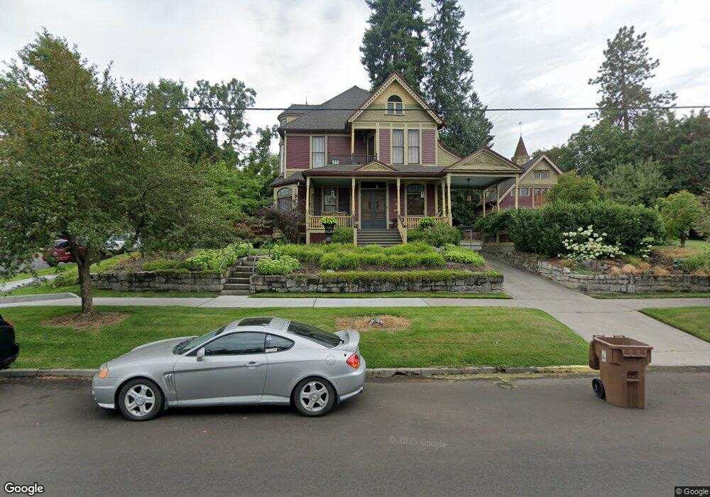
2003 W Riverside Ave Spokane, WA 99201
Browne's Addition NeighborhoodEstimated Value: $681,000 - $1,116,000
2
Beds
3
Baths
4,000
Sq Ft
$228/Sq Ft
Est. Value
About This Home
This home is located at 2003 W Riverside Ave, Spokane, WA 99201 and is currently estimated at $911,710, approximately $227 per square foot. 2003 W Riverside Ave is a home located in Spokane County with nearby schools including Roosevelt Elementary School, Sacajawea Middle School, and Lewis & Clark High School.
Ownership History
Date
Name
Owned For
Owner Type
Purchase Details
Closed on
Dec 7, 1999
Sold by
Poirier Brian L and Stout Joseph O
Bought by
Poirier Brian L and Stout Ii Joseph O
Current Estimated Value
Home Financials for this Owner
Home Financials are based on the most recent Mortgage that was taken out on this home.
Original Mortgage
$184,000
Outstanding Balance
$58,035
Interest Rate
7.96%
Estimated Equity
$853,675
Create a Home Valuation Report for This Property
The Home Valuation Report is an in-depth analysis detailing your home's value as well as a comparison with similar homes in the area
Home Values in the Area
Average Home Value in this Area
Purchase History
| Date | Buyer | Sale Price | Title Company |
|---|---|---|---|
| Poirier Brian L | -- | Spokane County Title Co | |
| Poirier Brian L | $230,000 | Spokane County Title Co |
Source: Public Records
Mortgage History
| Date | Status | Borrower | Loan Amount |
|---|---|---|---|
| Open | Poirier Brian L | $184,000 |
Source: Public Records
Tax History Compared to Growth
Tax History
| Year | Tax Paid | Tax Assessment Tax Assessment Total Assessment is a certain percentage of the fair market value that is determined by local assessors to be the total taxable value of land and additions on the property. | Land | Improvement |
|---|---|---|---|---|
| 2025 | $7,726 | $796,800 | $95,000 | $701,800 |
| 2024 | $7,726 | $779,800 | $100,000 | $679,800 |
| 2023 | $9,175 | $810,900 | $100,000 | $710,900 |
| 2022 | $8,046 | $939,800 | $160,500 | $779,300 |
| 2021 | $7,560 | $636,750 | $112,350 | $524,400 |
| 2020 | $7,453 | $604,850 | $112,350 | $492,500 |
| 2019 | $7,032 | $589,050 | $112,350 | $476,700 |
| 2018 | $7,789 | $560,650 | $112,350 | $448,300 |
| 2017 | $7,117 | $521,650 | $144,450 | $377,200 |
| 2016 | $7,030 | $504,150 | $144,450 | $359,700 |
| 2015 | $6,948 | $487,550 | $144,450 | $343,100 |
| 2014 | -- | $475,000 | $144,500 | $330,500 |
| 2013 | -- | $0 | $0 | $0 |
Source: Public Records
Map
Nearby Homes
- 1927 W Riverside Ave
- 220 S Elm St
- 2320 W Bennett Ave
- LOT W 3rd Ave
- 2025 W 4th Ave
- 174 S Coeur D'Alene #H301 St Unit H301
- 405 S Coeur D'Alene St Unit 11
- 2368 W Centennial Place
- 2128 W 5th Ave
- 2408 W Centennial Place
- 2103 W 5th Ave
- 2205 W Bridge Ave
- 1810 W Summit Pkwy
- 1827 W Bridge Ave
- 1415 W 67th Ave
- 1415 W 67th Ave Unit Lot 1 Block 4 - Tale
- 2203 W 5th Ave Unit 2A
- 2217 W 5th Ave
- 174 S Coeur D'Alene St Unit H 303
- 2435 W Summit Pkwy
- 2006 W 1st Ave
- 2019 W Riverside Ave
- 2014 W 1st Ave
- 2022 W 1st Ave
- 2014 W Riverside Ave
- 2027 W Riverside Ave
- 1934 W Riverside Ave
- 2008 W Riverside Ave
- 1922 W 1st Ave
- 2028 W 1st Ave
- 1930 W Riverside Ave
- 1920 W 1st Ave
- 2011 W 1st Ave
- 1926 W Riverside Ave
- 1916 W Riverside Ave Unit 4
- 1914 W 1st Ave
- 2027 W 1st Ave
- 000 W Riverside Ave
- 2036 W Riverside Ave
- 2106 W 1st Ave