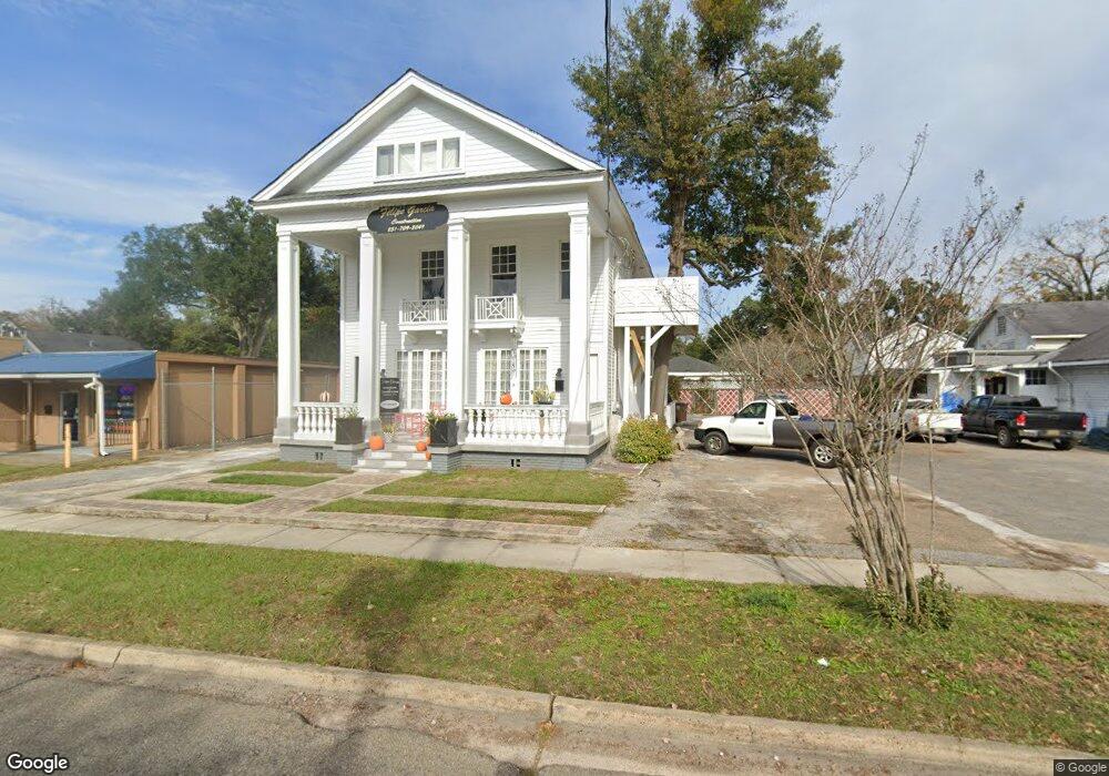
2004 Airport Blvd Mobile, AL 36606
Midtown Mobile NeighborhoodEstimated Value: $223,447 - $333,000
5
Beds
2
Baths
2,400
Sq Ft
$119/Sq Ft
Est. Value
About This Home
This home is located at 2004 Airport Blvd, Mobile, AL 36606 and is currently estimated at $284,862, approximately $118 per square foot. 2004 Airport Blvd is a home located in Mobile County with nearby schools including Leinkauf Elementary School, Booker T. Washington Middle School, and Murphy High School.
Ownership History
Date
Name
Owned For
Owner Type
Purchase Details
Closed on
Jan 26, 2024
Sold by
Garcia Felipe
Bought by
Midtown White House Llc
Current Estimated Value
Purchase Details
Closed on
Oct 24, 2011
Sold by
Garcia Felipe and Garcia Jill M
Bought by
Garcia Felipe
Purchase Details
Closed on
Dec 12, 2000
Sold by
Griffin Curtis E
Bought by
Garcia Felipe and Garcia Jill M
Home Financials for this Owner
Home Financials are based on the most recent Mortgage that was taken out on this home.
Original Mortgage
$60,000
Interest Rate
8%
Mortgage Type
Seller Take Back
Create a Home Valuation Report for This Property
The Home Valuation Report is an in-depth analysis detailing your home's value as well as a comparison with similar homes in the area
Home Values in the Area
Average Home Value in this Area
Purchase History
| Date | Buyer | Sale Price | Title Company |
|---|---|---|---|
| Midtown White House Llc | $89,500 | None Listed On Document | |
| Garcia Felipe | -- | Slt | |
| Garcia Felipe | -- | -- |
Source: Public Records
Mortgage History
| Date | Status | Borrower | Loan Amount |
|---|---|---|---|
| Previous Owner | Garcia Felipe | $60,000 |
Source: Public Records
Tax History
| Year | Tax Paid | Tax Assessment Tax Assessment Total Assessment is a certain percentage of the fair market value that is determined by local assessors to be the total taxable value of land and additions on the property. | Land | Improvement |
|---|---|---|---|---|
| 2025 | $2,050 | $32,120 | $7,200 | $24,920 |
| 2024 | $2,050 | $15,370 | $3,600 | $11,770 |
| 2023 | $1,133 | $8,920 | $2,980 | $5,940 |
| 2022 | $1,109 | $17,060 | $5,180 | $11,880 |
| 2021 | $1,030 | $15,820 | $3,940 | $11,880 |
| 2020 | $1,097 | $17,280 | $3,940 | $13,340 |
| 2019 | $972 | $15,300 | $3,940 | $11,360 |
| 2018 | $972 | $15,300 | $0 | $0 |
| 2017 | $972 | $15,300 | $0 | $0 |
| 2016 | $1,010 | $15,900 | $0 | $0 |
| 2013 | $1,287 | $19,980 | $0 | $0 |
Source: Public Records
Map
Nearby Homes
- 1956 Myrtle Ave
- 1958 Myrtle Ave
- 1954 Old Government St
- 1900 Old Government St
- 253 Cherokee St
- 266 Rickarby St
- 2054 Old Government St
- 1858 Old Government St
- 312 Glenwood St
- 266 Mohawk St
- 1961 Duncan St
- 165 S Fulton St
- 1821 Woodcock Place
- 1816 Woodcock Place
- 2155 Old Government St
- 203 Mohawk St
- 1817 Woodcock Place
- 1812 Woodcock Place
- 1813 Woodcock Place
- 1825 Woodcock St
- 2006 Airport Blvd
- 2000 Airport Blvd
- 2008 Airport Blvd
- 1951 Myrtle Ave
- 2010 Airport Blvd
- 1917 Myrtle Ave
- 1917 Myrtle Ave Unit B
- 1953 Myrtle Ave
- 1955 Myrtle Ave
- 1915 Myrtle Ave
- 1911 Myrtle Ave
- 1959 Myrtle Ave
- 1907 Myrtle Ave
- 1905 Myrtle Ave
- 1950 Myrtle Ave
- 1952 Myrtle Ave
- 1920 Myrtle Ave
- 1954 Myrtle Ave
- 1918 Myrtle Ave
- 1903 Myrtle Ave
Your Personal Tour Guide
Ask me questions while you tour the home.