Estimated Value: $286,482 - $347,000
3
Beds
3
Baths
1,450
Sq Ft
$222/Sq Ft
Est. Value
About This Home
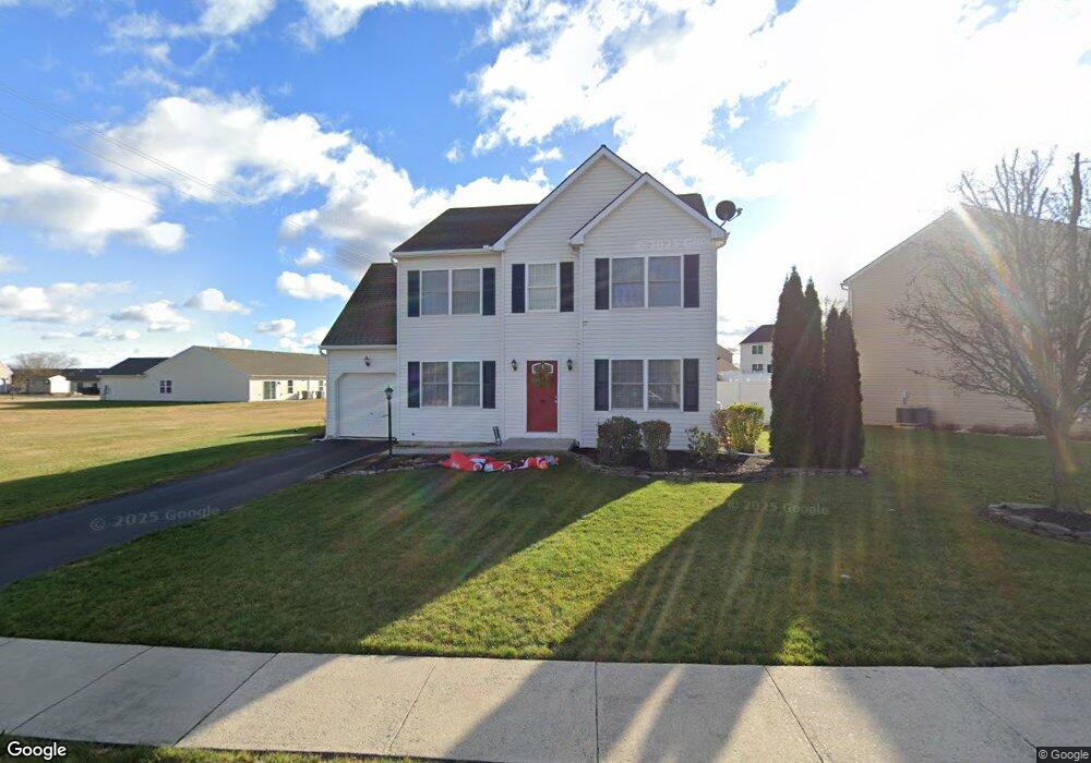
This home is located at 2004 Ashcombe Dr, Dover, PA 17315 and is currently estimated at $321,621, approximately $221 per square foot. 2004 Ashcombe Dr is a home located in York County with nearby schools including Dover Area High School and Lighthouse Christian School.
Ownership History
Date
Name
Owned For
Owner Type
Purchase Details
Closed on
Apr 8, 2008
Sold by
Russell Timothy Aaron and Russell Valerie M
Bought by
Rauhauser Robert and Cunningham Barbara Sue
Current Estimated Value
Home Financials for this Owner
Home Financials are based on the most recent Mortgage that was taken out on this home.
Original Mortgage
$188,411
Interest Rate
6.1%
Mortgage Type
FHA
Purchase Details
Closed on
Feb 3, 2006
Sold by
Afw Development Inc
Bought by
Russell Timothy Aaron and Russell Valerie M
Home Financials for this Owner
Home Financials are based on the most recent Mortgage that was taken out on this home.
Original Mortgage
$140,264
Interest Rate
6.16%
Mortgage Type
Purchase Money Mortgage
Create a Home Valuation Report for This Property
The Home Valuation Report is an in-depth analysis detailing your home's value as well as a comparison with similar homes in the area
Home Values in the Area
Average Home Value in this Area
Purchase History
| Date | Buyer | Sale Price | Title Company |
|---|---|---|---|
| Rauhauser Robert | $189,900 | None Available | |
| Russell Timothy Aaron | $175,331 | None Available |
Source: Public Records
Mortgage History
| Date | Status | Borrower | Loan Amount |
|---|---|---|---|
| Previous Owner | Rauhauser Robert | $188,411 | |
| Previous Owner | Russell Timothy Aaron | $140,264 |
Source: Public Records
Tax History
| Year | Tax Paid | Tax Assessment Tax Assessment Total Assessment is a certain percentage of the fair market value that is determined by local assessors to be the total taxable value of land and additions on the property. | Land | Improvement |
|---|---|---|---|---|
| 2025 | $4,649 | $141,720 | $36,020 | $105,700 |
| 2024 | $4,607 | $141,720 | $36,020 | $105,700 |
| 2023 | $4,607 | $141,720 | $36,020 | $105,700 |
| 2022 | $4,523 | $141,720 | $36,020 | $105,700 |
| 2021 | $4,268 | $141,720 | $36,020 | $105,700 |
| 2020 | $4,229 | $141,720 | $36,020 | $105,700 |
| 2019 | $4,177 | $141,720 | $36,020 | $105,700 |
| 2018 | $4,072 | $141,720 | $36,020 | $105,700 |
| 2017 | $4,072 | $141,720 | $36,020 | $105,700 |
| 2016 | $0 | $141,720 | $36,020 | $105,700 |
| 2015 | -- | $141,720 | $36,020 | $105,700 |
| 2014 | -- | $141,720 | $36,020 | $105,700 |
Source: Public Records
Map
Nearby Homes
- 1841 Wyatt Cir
- 46 Chipawa Ave
- 1915 Wyatt Cir
- 86 Cherokee Ave
- 122 Seneca Ave
- 4081 Mulberry Ln
- 143 Pawnee Ave
- 74 Chipawa Ave
- 140 Pawnee Ave
- 4008 Country Dr
- 3847 Country Dr
- 2311 Tower Dr
- 119 Cedar Dr
- 3570 Carlisle Rd
- 3836 Country Dr
- 3832 Country Dr
- 109 Maplewood Dr
- 107 Maplewood Dr
- 3510 Carlisle Rd
- 3425 Fox Ridge Ct
- 2000 Ashcombe Dr
- 2009 Wood Hall Way
- 2005 Ashcombe Dr
- 2008 Ashcombe Dr
- 2001 Ashcombe Dr
- 2012 Ashcombe Dr
- 2008 Wood Hall Way
- 3968 Lyn Cir
- 2013 Ashcombe Dr
- 2013 Wood Hall Way
- 2012 Wood Hall Way
- 1935 Deerfield Dr
- 1938 Ashcombe Dr
- 1933 Deerfield Dr
- 2017 Wood Hall Way
- 1931 Deerfield Dr
- 2017 Ashcombe Dr
- 2016 Ashcombe Dr
- 2021 Ashcombe Dr
- 1929 Deerfield Dr
Your Personal Tour Guide
Ask me questions while you tour the home.