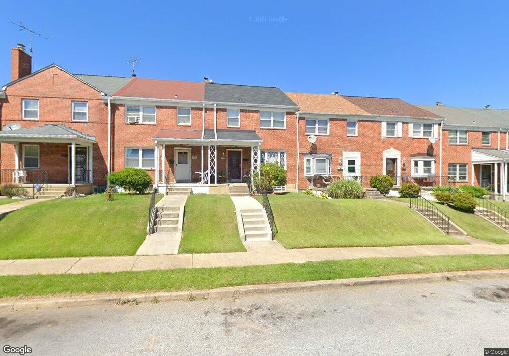
2004 Burnwood Rd Baltimore, MD 21239
Perring Loch NeighborhoodEstimated Value: $175,352 - $245,000
Studio
1
Bath
1,280
Sq Ft
$164/Sq Ft
Est. Value
About This Home
This home is located at 2004 Burnwood Rd, Baltimore, MD 21239 and is currently estimated at $210,176, approximately $164 per square foot. 2004 Burnwood Rd is a home located in Baltimore City with nearby schools including Northwood Elementary School, Booker T. Washington Middle School, and Paul Laurence Dunbar High School.
Ownership History
Date
Name
Owned For
Owner Type
Purchase Details
Closed on
Jun 23, 1994
Sold by
Nixon G A
Bought by
Addison Arnita D
Current Estimated Value
Home Financials for this Owner
Home Financials are based on the most recent Mortgage that was taken out on this home.
Original Mortgage
$73,900
Interest Rate
8.74%
Create a Home Valuation Report for This Property
The Home Valuation Report is an in-depth analysis detailing your home's value as well as a comparison with similar homes in the area
Home Values in the Area
Average Home Value in this Area
Purchase History
| Date | Buyer | Sale Price | Title Company |
|---|---|---|---|
| Addison Arnita D | $74,000 | -- |
Source: Public Records
Mortgage History
| Date | Status | Borrower | Loan Amount |
|---|---|---|---|
| Closed | Addison Arnita D | $73,900 |
Source: Public Records
Tax History
| Year | Tax Paid | Tax Assessment Tax Assessment Total Assessment is a certain percentage of the fair market value that is determined by local assessors to be the total taxable value of land and additions on the property. | Land | Improvement |
|---|---|---|---|---|
| 2025 | $3,025 | $152,833 | -- | -- |
| 2024 | $3,025 | $140,300 | $36,000 | $104,300 |
| 2023 | $2,942 | $137,100 | $0 | $0 |
| 2022 | $2,871 | $133,900 | $0 | $0 |
| 2021 | $3,085 | $130,700 | $36,000 | $94,700 |
| 2020 | $2,807 | $130,300 | $0 | $0 |
| 2019 | $2,783 | $129,900 | $0 | $0 |
| 2018 | $2,771 | $129,500 | $36,000 | $93,500 |
| 2017 | $2,690 | $128,467 | $0 | $0 |
| 2016 | $2,325 | $127,433 | $0 | $0 |
| 2015 | $2,325 | $126,400 | $0 | $0 |
| 2014 | $2,325 | $126,400 | $0 | $0 |
Source: Public Records
Map
Nearby Homes
- 1814 Winford Rd
- 2018 Winford Rd
- 5413 Hillen Rd
- 1808 Swansea Rd
- 1613 Winford Rd
- 4929 Herring Run Dr
- 2014 Crestview Rd
- 1903 Ramblewood Rd
- 2318 Ivy Ave
- 4902 Gilray Dr
- 2326 Ivy Ave
- 1647 Stonewood Rd
- 2203 Southern Ave
- 5102 Plymouth Rd
- 5033 Plymouth Rd
- 1607 Stonewood Rd
- 2107 Echodale Ave
- 5105 Plymouth Rd
- 1645 Sherwood Ave
- 1542 E Belvedere Ave
- 2006 Burnwood Rd
- 2002 Burnwood Rd
- 2008 Burnwood Rd
- 2000 Burnwood Rd
- 2010 Burnwood Rd
- 2012 Burnwood Rd
- 1930 Burnwood Rd
- 2014 Burnwood Rd
- 1928 Burnwood Rd
- 2005 Northbourne Rd
- 2003 Northbourne Rd
- 2007 Northbourne Rd
- 2001 Northbourne Rd
- 2009 Northbourne Rd
- 1926 Burnwood Rd
- 2011 Northbourne Rd
- 1931 Northbourne Rd
- 2013 Northbourne Rd
- 1924 Burnwood Rd
- 1929 Northbourne Rd
Your Personal Tour Guide
Ask me questions while you tour the home.