Estimated Value: $278,000 - $336,000
About This Home
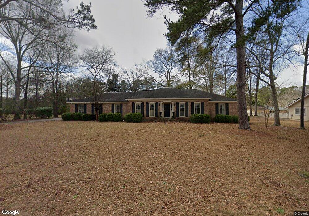
This home is located at 2004 Cedar Ridge Dr, Perry, GA 31069 and is currently estimated at $302,888, approximately $135 per square foot. 2004 Cedar Ridge Dr is a home located in Houston County with nearby schools including Morningside Elementary School, Perry Middle School, and Perry High School.
Ownership History
We collect this data history from publicly available records. To have your information removed, we recommend requesting removal directly through your county’s website.
Purchase Details
Purchase Details
Purchase Details
Home Values in the Area
Average Home Value in this Area
Purchase History
We collect this data history from publicly available records. To have your information removed, we recommend requesting removal directly through your county’s website.
| Date | Buyer | Sale Price | Title Company |
|---|---|---|---|
| -- | -- | ||
| -- | -- | ||
| -- | -- |
Tax History
We collect this data history from publicly available records. To have your information removed, we recommend requesting removal directly through your county’s website.
| Year | Tax Paid | Tax Assessment Tax Assessment Total Assessment is a certain percentage of the fair market value that is determined by local assessors to be the total taxable value of land and additions on the property. | Land | Improvement |
|---|---|---|---|---|
| 2025 | $2,894 | $93,320 | $12,000 | $81,320 |
| 2024 | $3,153 | $87,040 | $9,200 | $77,840 |
| 2023 | $2,615 | $71,920 | $9,200 | $62,720 |
| 2022 | $1,457 | $65,360 | $9,200 | $56,160 |
| 2021 | $1,278 | $57,280 | $9,200 | $48,080 |
| 2020 | $1,192 | $53,320 | $9,200 | $44,120 |
| 2019 | $1,239 | $53,320 | $9,200 | $44,120 |
| 2018 | $1,239 | $53,320 | $9,200 | $44,120 |
| 2017 | $1,193 | $53,320 | $9,200 | $44,120 |
| 2016 | $1,195 | $53,320 | $9,200 | $44,120 |
| 2015 | $1,195 | $53,320 | $9,200 | $44,120 |
| 2014 | -- | $53,320 | $9,200 | $44,120 |
| 2013 | -- | $53,320 | $9,200 | $44,120 |
Map
- 2008 Cedar Ridge Dr
- 110 Gwendolyn Ave
- 1015 Cherokee Rd
- 206 Londie Ln
- 206 Londe Ln
- 1021 Country Club Rd
- 212 Silverside Dr
- 208 Susanne's Retreat
- 1010 Ridge Cir S
- 105 Bedford Ct
- 504 Clifton Rd
- 1100 Pineneedle Dr
- 1031 Cherokee Rd
- 1011 Country Club Rd
- 411 Stonegate Trail
- 204 Spring Creek Dr
- 111 Rambo Way
- 106 Raspberry Trail
- 203 Ousley Way
- 215 Tyndall Way
- 2006 Cedar Ridge Dr
- 1922 Azalea Dr
- 1920 Azalea Dr
- 1926 Northside Rd
- 2005 Cedar Ridge Dr
- 2007 Cedar Ridge Dr
- 2001 Cedar Ridge Dr
- 2003 Cedar Ridge Dr
- 1924 Azalea Dr
- 2009 Cedar Ridge Dr
- 1918 Azalea Dr
- 2012 Northside Rd
- 2018 Laurel Dr
- 1921 Northside Rd
- 2016 Laurel Dr
- 1919 Northside Rd
- 2022 Laurel Dr
- 0 Azalea Dr
- 2014 Laurel Dr
- 1913 Northside Rd
Ask me questions while you tour the home.