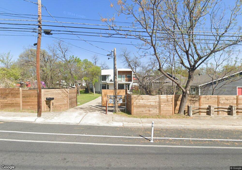
2004 E 12th St Unit A Austin, TX 78702
Chestnut NeighborhoodEstimated Value: $362,000 - $737,000
3
Beds
3
Baths
1,415
Sq Ft
$403/Sq Ft
Est. Value
About This Home
This home is located at 2004 E 12th St Unit A, Austin, TX 78702 and is currently estimated at $569,799, approximately $402 per square foot. 2004 E 12th St Unit A is a home located in Travis County with nearby schools including Campbell Elementary School, Kealing Middle School, and McCallum High School.
Ownership History
Date
Name
Owned For
Owner Type
Purchase Details
Closed on
Jun 13, 2022
Sold by
Csw Brown Lane Properties Llc
Bought by
Ag & M Holding Llc
Current Estimated Value
Purchase Details
Closed on
Jan 24, 2020
Sold by
Altman Beverly and Altman Isaac
Bought by
2020 East 12Th Unit A Lp
Home Financials for this Owner
Home Financials are based on the most recent Mortgage that was taken out on this home.
Original Mortgage
$438,750
Interest Rate
3.73%
Mortgage Type
Commercial
Create a Home Valuation Report for This Property
The Home Valuation Report is an in-depth analysis detailing your home's value as well as a comparison with similar homes in the area
Home Values in the Area
Average Home Value in this Area
Purchase History
| Date | Buyer | Sale Price | Title Company |
|---|---|---|---|
| Ag & M Holding Llc | -- | Heritage Title | |
| 2020 East 12Th Unit A Lp | -- | Heritage Title |
Source: Public Records
Mortgage History
| Date | Status | Borrower | Loan Amount |
|---|---|---|---|
| Previous Owner | 2020 East 12Th Unit A Lp | $438,750 |
Source: Public Records
Tax History
| Year | Tax Paid | Tax Assessment Tax Assessment Total Assessment is a certain percentage of the fair market value that is determined by local assessors to be the total taxable value of land and additions on the property. | Land | Improvement |
|---|---|---|---|---|
| 2025 | $11,114 | $543,059 | $103,125 | $439,934 |
| 2023 | $13,850 | $765,534 | $154,688 | $610,846 |
| 2022 | $13,963 | $707,022 | $154,688 | $552,334 |
| 2021 | $10,877 | $499,709 | $103,125 | $396,584 |
| 2020 | $9,658 | $450,285 | $103,125 | $347,160 |
| 2018 | $8,799 | $397,423 | $62,500 | $334,923 |
| 2017 | $8,977 | $402,513 | $45,000 | $357,513 |
Source: Public Records
Map
Nearby Homes
- 2103 E 12th St
- 1197 Coleto St
- 1199 Coleto St
- 1210 Coleto St
- 2204 E 13th St Unit A and B
- 2002 E 13th St Unit A
- 1191 Chicon St
- 1301 Chicon St Unit 203
- 1907 E 14th St Unit A
- 2006 Sl Davis Ave Unit 1
- 2006 Sl Davis Ave Unit 3
- 2006 Sl Davis Ave Unit 2
- 1309 Chicon St Unit 202
- 2206 E 14th St Unit 2
- 1706 Pennsylvania Ave
- 2004 E 16th St Unit B
- 1702 Pennsylvania Ave
- 1800 E 14th St
- 1700 Pennsylvania Ave
- TBD Rosewood Ave
- 2004 E 12th St Unit B
- 2004 E 12th St Unit C
- 2004 E 12th St Unit A
- 2004 E 12th St
- 1206 Alamo St
- 2008 E 12th St
- 2009 E 13th St
- 2003 E 13th St Unit A
- 2003 E 13th St
- 2003 E 13th St Unit B
- 2007 E 13th St Unit B
- 2007 E 13th St
- 2007 E 13th St
- 2007 E 13th St Unit 2
- 2100 E 12th St
- 1303 Alamo St
- 2001 E 13th St
- 1207 Alamo St
- 2005 E 12th St
- 2101 E 13th St
Your Personal Tour Guide
Ask me questions while you tour the home.