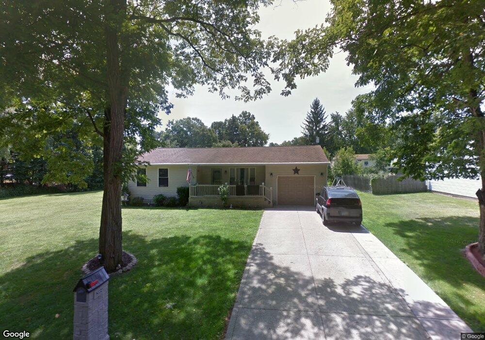
2004 Outer Dr Mansfield, OH 44905
Estimated Value: $145,000 - $192,000
2
Beds
2
Baths
992
Sq Ft
$172/Sq Ft
Est. Value
About This Home
This home is located at 2004 Outer Dr, Mansfield, OH 44905 and is currently estimated at $170,970, approximately $172 per square foot. 2004 Outer Dr is a home located in Richland County with nearby schools including Madison High School, St. Mary Catholic School, and Temple-Christian School.
Ownership History
Date
Name
Owned For
Owner Type
Purchase Details
Closed on
Aug 30, 2002
Sold by
Ferguson Steven C
Bought by
Brown Randall S and Brown Marie L
Current Estimated Value
Home Financials for this Owner
Home Financials are based on the most recent Mortgage that was taken out on this home.
Original Mortgage
$67,000
Outstanding Balance
$28,641
Interest Rate
6.56%
Mortgage Type
New Conventional
Estimated Equity
$142,329
Purchase Details
Closed on
Mar 13, 2000
Sold by
Spillman Norman G
Bought by
Ferguson Steven C
Home Financials for this Owner
Home Financials are based on the most recent Mortgage that was taken out on this home.
Original Mortgage
$77,900
Interest Rate
8.26%
Mortgage Type
New Conventional
Purchase Details
Closed on
Mar 9, 1990
Create a Home Valuation Report for This Property
The Home Valuation Report is an in-depth analysis detailing your home's value as well as a comparison with similar homes in the area
Home Values in the Area
Average Home Value in this Area
Purchase History
| Date | Buyer | Sale Price | Title Company |
|---|---|---|---|
| Brown Randall S | $87,000 | -- | |
| Ferguson Steven C | $2,000 | -- | |
| -- | $300 | -- |
Source: Public Records
Mortgage History
| Date | Status | Borrower | Loan Amount |
|---|---|---|---|
| Open | Brown Randall S | $67,000 | |
| Previous Owner | Ferguson Steven C | $77,900 |
Source: Public Records
Tax History
| Year | Tax Paid | Tax Assessment Tax Assessment Total Assessment is a certain percentage of the fair market value that is determined by local assessors to be the total taxable value of land and additions on the property. | Land | Improvement |
|---|---|---|---|---|
| 2024 | $1,854 | $47,880 | $3,250 | $44,630 |
| 2023 | $1,923 | $47,880 | $3,250 | $44,630 |
| 2022 | $1,558 | $37,180 | $2,930 | $34,250 |
| 2021 | $2,089 | $37,180 | $2,930 | $34,250 |
| 2020 | $2,105 | $37,180 | $2,930 | $34,250 |
| 2019 | $1,915 | $31,540 | $2,490 | $29,050 |
| 2018 | $1,899 | $31,540 | $2,490 | $29,050 |
| 2017 | $1,864 | $31,540 | $2,490 | $29,050 |
| 2016 | $1,901 | $31,400 | $2,360 | $29,040 |
| 2015 | $1,870 | $31,400 | $2,360 | $29,040 |
| 2014 | $1,863 | $31,400 | $2,360 | $29,040 |
| 2012 | $1,653 | $33,060 | $2,490 | $30,570 |
Source: Public Records
Map
Nearby Homes
- 1990 Woodmont Rd
- 690 Ashland Rd
- 2202 Lakewood Dr
- 811 Mayflower Ave
- 1495 Timber Rd
- 1674 Honeysuckle Dr
- 1187 -1189 Fleming Falls Rd
- 620 Running Brook Way
- 1098 Stewart Rd N
- 1359 N Stewart Rd
- 937 Expressview Dr
- 683 Coachman Rd
- 671 Coachman Rd
- 632 Coachman Rd
- 1226 Evergreen Ave W
- 602 Champion Rd
- 1217 Evergreen Ave W
- 644 Skyline Rd
- 615 Champion Rd
- 474 Biscayne Dr
- 0 Outer Dr
- 2005 Woodmont Rd
- 1992 Outer Dr
- 1992 Outer Dr
- 1997 Woodmont Rd
- 2161 Woodmont Rd
- 1991 Woodmont Rd
- 1982 Outer Dr
- 1985 Woodmont Rd
- 2025 Woodmont Rd
- 1978 Outer Dr
- 1979 Woodmont Rd
- 2033 Woodmont Rd
- 1970 Outer Dr
- 2004 Woodmont Rd
- 1949 Outer Dr
- 1996 Woodmont Rd
- 2010 Woodmont Rd
- 1971 Woodmont Rd
- 2018 Woodmont Rd
Your Personal Tour Guide
Ask me questions while you tour the home.