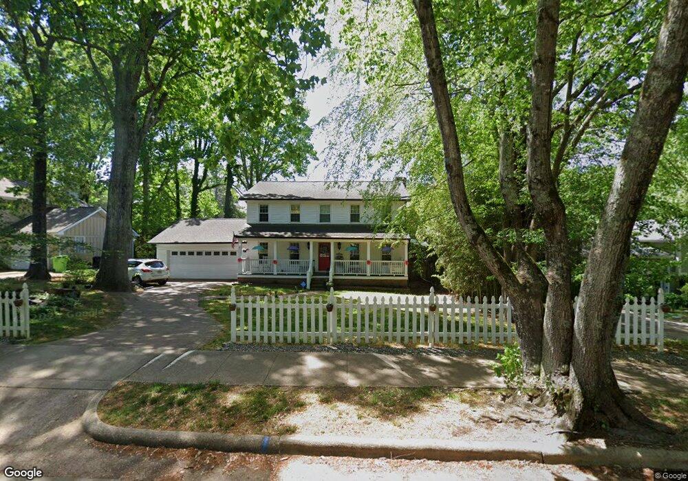
2004 Port Royal Rd Raleigh, NC 27609
Estimated Value: $553,207 - $594,000
4
Beds
3
Baths
2,440
Sq Ft
$234/Sq Ft
Est. Value
About This Home
This home is located at 2004 Port Royal Rd, Raleigh, NC 27609 and is currently estimated at $569,802, approximately $233 per square foot. 2004 Port Royal Rd is a home located in Wake County with nearby schools including Millbrook Elementary School, East Millbrook Middle, and Millbrook High School.
Ownership History
Date
Name
Owned For
Owner Type
Purchase Details
Closed on
Oct 10, 2001
Sold by
Matt Fred J and Matt Gail S
Bought by
Hill Chad M and Hill Nicole B
Current Estimated Value
Home Financials for this Owner
Home Financials are based on the most recent Mortgage that was taken out on this home.
Original Mortgage
$161,000
Outstanding Balance
$62,929
Interest Rate
6.87%
Estimated Equity
$506,873
Purchase Details
Closed on
Feb 10, 2000
Sold by
Matt Fred J and Matt Gail S
Bought by
Novak Angela L
Home Financials for this Owner
Home Financials are based on the most recent Mortgage that was taken out on this home.
Original Mortgage
$67,000
Interest Rate
8.3%
Create a Home Valuation Report for This Property
The Home Valuation Report is an in-depth analysis detailing your home's value as well as a comparison with similar homes in the area
Home Values in the Area
Average Home Value in this Area
Purchase History
| Date | Buyer | Sale Price | Title Company |
|---|---|---|---|
| Hill Chad M | $161,000 | -- | |
| Novak Angela L | $79,000 | -- |
Source: Public Records
Mortgage History
| Date | Status | Borrower | Loan Amount |
|---|---|---|---|
| Open | Hill Chad M | $161,000 | |
| Previous Owner | Novak Angela L | $67,000 |
Source: Public Records
Tax History Compared to Growth
Tax History
| Year | Tax Paid | Tax Assessment Tax Assessment Total Assessment is a certain percentage of the fair market value that is determined by local assessors to be the total taxable value of land and additions on the property. | Land | Improvement |
|---|---|---|---|---|
| 2025 | $4,275 | $487,916 | $200,000 | $287,916 |
| 2024 | $4,258 | $487,916 | $200,000 | $287,916 |
| 2023 | $3,458 | $315,369 | $100,000 | $215,369 |
| 2022 | $3,213 | $315,369 | $100,000 | $215,369 |
| 2021 | $3,089 | $315,369 | $100,000 | $215,369 |
| 2020 | $3,032 | $315,369 | $100,000 | $215,369 |
| 2019 | $2,685 | $229,959 | $63,000 | $166,959 |
| 2018 | $2,533 | $229,959 | $63,000 | $166,959 |
| 2017 | $2,412 | $229,959 | $63,000 | $166,959 |
| 2016 | $2,363 | $229,959 | $63,000 | $166,959 |
| 2015 | $2,458 | $235,486 | $68,000 | $167,486 |
| 2014 | $2,332 | $235,486 | $68,000 | $167,486 |
Source: Public Records
Map
Nearby Homes
- 5718 Sentinel Dr
- 1717 Falls Church Rd
- 5721 Timber Ridge Dr
- 1707 Falls Church Rd
- 5812 Old Forge Cir
- 5810 Shady Grove Cir
- 1524 Edgeside Ct
- 1782 Quail Ridge Rd
- 1776 Quail Ridge Rd
- 2031 Township Cir
- 1738 Quail Ridge Rd
- 5604 Windy Hollow Ct
- 6309 Johnsdale Rd
- 1708 Quail Ridge Rd
- 1605 Beechwood Dr
- 1516 Hemphill Dr
- 5816 Pointer Dr Unit 102
- 1523 Ivy Ln
- 1220 Manassas Ct Unit B
- 6016 Volant Dr
- 2008 Port Royal Rd
- 2002 Port Royal Rd
- 2013 Mallard Ln
- 2012 Port Royal Rd
- 2005 Mallard Ln
- 2000 Port Royal Rd
- 2017 Mallard Ln
- 2005 Port Royal Rd
- 2009 Port Royal Rd
- 2001 Port Royal Rd
- 2013 Port Royal Rd
- 2016 Port Royal Rd
- 5800 Partridge Ln
- 1925 Port Royal Rd
- 2021 Mallard Ln
- 2017 Port Royal Rd
- 2008 Mallard Ln
- 2012 Mallard Ln
- 2004 Hunterfield Ln
- 2004 Mallard Ln