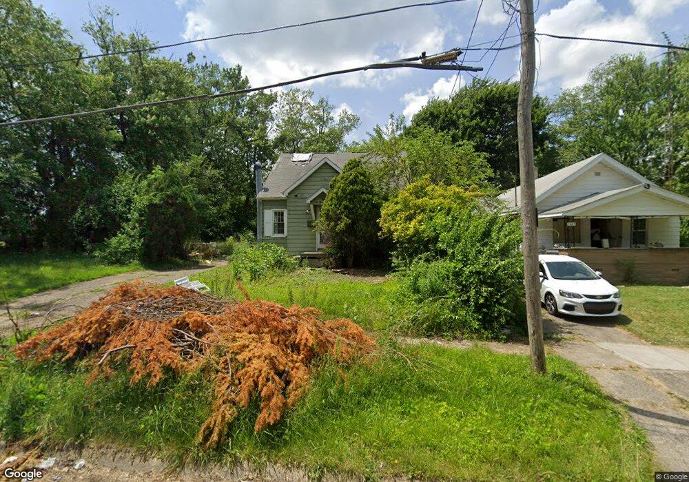
2005 Burns St Flint, MI 48506
Eastside NeighborhoodEstimated Value: $35,000 - $67,000
3
Beds
2
Baths
1,364
Sq Ft
$39/Sq Ft
Est. Value
About This Home
This home is located at 2005 Burns St, Flint, MI 48506 and is currently estimated at $52,682, approximately $38 per square foot. 2005 Burns St is a home located in Genesee County with nearby schools including Potter School, Flint Cultural Center Academy, and WAY Academy of Flint.
Ownership History
Date
Name
Owned For
Owner Type
Purchase Details
Closed on
Apr 7, 2025
Sold by
To Life Real Estate Llc
Bought by
Chavez Lopez Carolyn E
Current Estimated Value
Purchase Details
Closed on
Aug 13, 2018
Sold by
Buzzard Christopher Erick
Bought by
Buzard Christopher Eric and Love Cody Roy
Purchase Details
Closed on
Dec 3, 2009
Sold by
Wells Fargo Bank Na
Bought by
Federal National Mortgage Association
Purchase Details
Closed on
Dec 2, 2009
Sold by
Waskiewicz Thomas A and Waskiewicz Patty A
Bought by
Wells Fargo Bank Na
Purchase Details
Closed on
Aug 1, 2005
Sold by
Isaac Samuel J and Isaac Stephanie
Bought by
Waskiewicz Thomas A and Waskiewicz Patty Ann
Home Financials for this Owner
Home Financials are based on the most recent Mortgage that was taken out on this home.
Original Mortgage
$44,100
Interest Rate
5.93%
Mortgage Type
Fannie Mae Freddie Mac
Create a Home Valuation Report for This Property
The Home Valuation Report is an in-depth analysis detailing your home's value as well as a comparison with similar homes in the area
Home Values in the Area
Average Home Value in this Area
Purchase History
| Date | Buyer | Sale Price | Title Company |
|---|---|---|---|
| Chavez Lopez Carolyn E | -- | Dream Title & Escrow | |
| Buzard Christopher Eric | -- | None Available | |
| Federal National Mortgage Association | -- | None Available | |
| Wells Fargo Bank Na | $36,718 | None Available | |
| Waskiewicz Thomas A | $49,000 | Garrow Title Agency |
Source: Public Records
Mortgage History
| Date | Status | Borrower | Loan Amount |
|---|---|---|---|
| Previous Owner | Waskiewicz Thomas A | $44,100 |
Source: Public Records
Tax History
| Year | Tax Paid | Tax Assessment Tax Assessment Total Assessment is a certain percentage of the fair market value that is determined by local assessors to be the total taxable value of land and additions on the property. | Land | Improvement |
|---|---|---|---|---|
| 2025 | $1,747 | $19,300 | $0 | $0 |
| 2024 | $1,624 | $17,900 | $0 | $0 |
| 2023 | $1,131 | $15,700 | $0 | $0 |
| 2022 | $0 | $12,600 | $0 | $0 |
| 2021 | $1,107 | $12,100 | $0 | $0 |
| 2020 | $1,035 | $10,700 | $0 | $0 |
| 2019 | $850 | $10,600 | $0 | $0 |
| 2018 | $874 | $7,200 | $0 | $0 |
| 2017 | $909 | $0 | $0 | $0 |
| 2016 | $931 | $0 | $0 | $0 |
| 2015 | -- | $0 | $0 | $0 |
| 2014 | -- | $0 | $0 | $0 |
| 2012 | -- | $11,000 | $0 | $0 |
Source: Public Records
Map
Nearby Homes
- 2426 Broadway Blvd
- 1622 Arlington Ave
- 1510 N Vernon Ave
- 2321 Levern St
- 2601 Illinois Ave
- 2211 Torrance St
- 1805 Bennett Ave
- 2415 Pennsylvania Ave
- 2506 Arlington Ave
- 2426 Hoff St
- 2301 Missouri Ave
- 1318 Cronk Ave
- 2610 Pennsylvania Ave
- 1734 Missouri Ave
- 1721 New York Ave
- 2217 Maryland Ave
- 1609 Ohio Ave
- 1216 Minnesota Ave
- 2605 Nebraska Ave
- 1529 Broadway Blvd
- 2009 Burns St
- 1923 Burns St
- 2013 Burns St
- 1932 N Vernon Ave
- 1928 N Vernon Ave
- 2000 N Vernon Ave
- 1924 N Vernon Ave
- 2004 N Vernon Ave
- 2017 Burns St
- 2004 Burns St
- 1916 N Vernon Ave
- 1915 Burns St
- 1926 Burns St
- 2210 Broadway Blvd
- 2010 Burns St
- 1922 Burns St
- 2206 Broadway Blvd
- 2022 Burns St
- 1918 Burns St
- 2202 Broadway Blvd
Your Personal Tour Guide
Ask me questions while you tour the home.