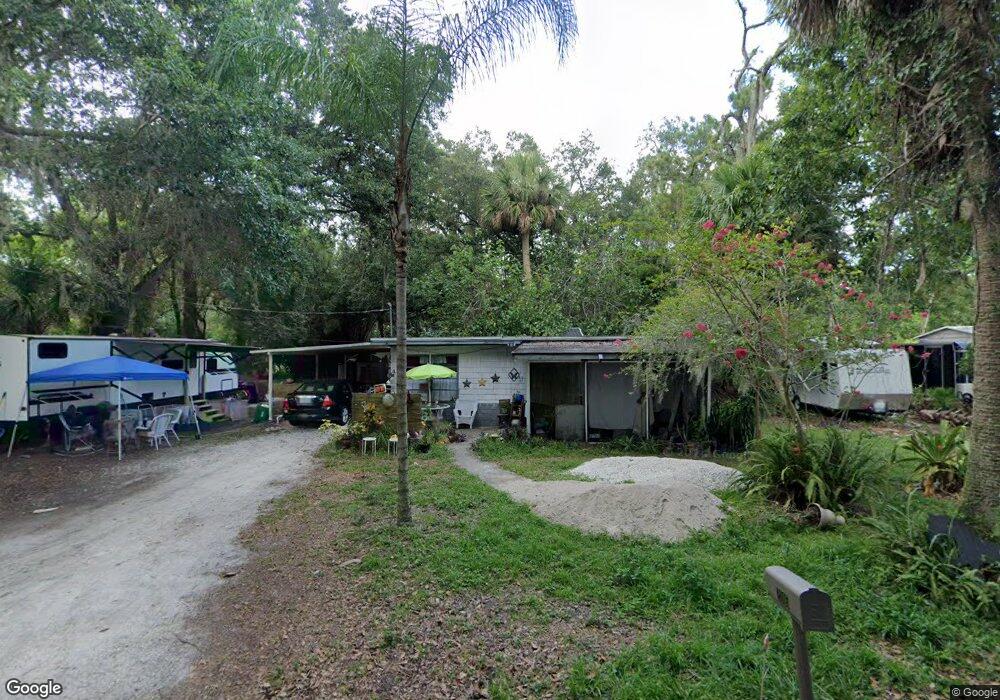
2005 Euclid St New Smyrna Beach, FL 32168
Ellison Acres NeighborhoodEstimated Value: $99,000 - $214,000
1
Bed
1
Bath
736
Sq Ft
$195/Sq Ft
Est. Value
About This Home
This home is located at 2005 Euclid St, New Smyrna Beach, FL 32168 and is currently estimated at $143,576, approximately $195 per square foot. 2005 Euclid St is a home located in Volusia County with nearby schools including Read-Pattillo Elementary School, New Smyrna Beach Middle School, and New Smyrna Beach High School.
Ownership History
Date
Name
Owned For
Owner Type
Purchase Details
Closed on
Aug 30, 2024
Sold by
Walborn Billy and Walborn Alicia Lynn
Bought by
Le Minh
Current Estimated Value
Purchase Details
Closed on
Apr 8, 2022
Sold by
Carolyn Walborn
Bought by
Walborn Billy
Purchase Details
Closed on
Nov 19, 2019
Sold by
Walborn Carolyn
Bought by
Walborn Billy and Tobias Samuel
Purchase Details
Closed on
Sep 13, 1995
Sold by
Putnal Thelma and Schmidt Richard
Bought by
Walborn Carolyn
Home Financials for this Owner
Home Financials are based on the most recent Mortgage that was taken out on this home.
Original Mortgage
$15,000
Interest Rate
7.74%
Purchase Details
Closed on
Dec 15, 1985
Bought by
Walborn Carolyn
Purchase Details
Closed on
Feb 15, 1985
Bought by
Walborn Carolyn
Purchase Details
Closed on
Sep 15, 1978
Bought by
Walborn Carolyn
Create a Home Valuation Report for This Property
The Home Valuation Report is an in-depth analysis detailing your home's value as well as a comparison with similar homes in the area
Home Values in the Area
Average Home Value in this Area
Purchase History
| Date | Buyer | Sale Price | Title Company |
|---|---|---|---|
| Le Minh | $100,000 | Orlando Title Professionals | |
| Walborn Billy | -- | None Listed On Document | |
| Walborn Billy | -- | Attorney | |
| Walborn Carolyn | $10,200 | -- | |
| Walborn Carolyn | $25,000 | -- | |
| Walborn Carolyn | $17,500 | -- | |
| Walborn Carolyn | $12,000 | -- |
Source: Public Records
Mortgage History
| Date | Status | Borrower | Loan Amount |
|---|---|---|---|
| Previous Owner | Walborn Carolyn | $15,000 |
Source: Public Records
Tax History Compared to Growth
Tax History
| Year | Tax Paid | Tax Assessment Tax Assessment Total Assessment is a certain percentage of the fair market value that is determined by local assessors to be the total taxable value of land and additions on the property. | Land | Improvement |
|---|---|---|---|---|
| 2025 | $1,963 | $107,907 | $54,060 | $53,847 |
| 2024 | $1,963 | $110,465 | $54,060 | $56,405 |
| 2023 | $1,963 | $105,379 | $50,490 | $54,889 |
| 2022 | $151 | $103,733 | $54,060 | $49,673 |
| 2021 | $148 | $35,796 | $0 | $0 |
| 2020 | $146 | $35,302 | $0 | $0 |
| 2019 | $396 | $34,508 | $0 | $0 |
| 2018 | $379 | $33,865 | $0 | $0 |
| 2017 | $348 | $33,168 | $0 | $0 |
| 2016 | $436 | $32,486 | $0 | $0 |
| 2015 | $437 | $32,260 | $0 | $0 |
| 2014 | $429 | $32,004 | $0 | $0 |
Source: Public Records
Map
Nearby Homes
- 2005 Sunny Ln
- 1910 Enterprise Ave Unit 17
- 181 Fox Fire Cir
- 1926 Pioneer Trail
- 163 Fox Fire Cir
- 211 Mourning Dove Dr
- 1818 Enterprise Ave Unit B
- 241 Quail Hollow Dr
- 69 Pelican Dr
- 1219 Wayne Ave
- 5 Quail Hollow Dr Unit 5
- 2051 Pioneer Trail Unit 32
- 2051 Pioneer Trail Unit 197
- 2051 Pioneer Trail Unit 14
- 2051 Pioneer Trail Unit 109
- 2051 Pioneer Trail Unit 18
- 2051 Pioneer Trail Unit 221
- 2051 Pioneer Trail Unit 48
- 1227 Wayne Ave
- 56 Pelican Dr
- 2006 Pioneer Trail
- 2001 Euclid St
- 2010 Pioneer Trail
- 1994 Pioneer Trail
- 1976 Pioneer Trail
- 2010 Euclid St
- 2014 Pioneer Trail
- 0 Euclid St
- 2016 Pioneer Trail
- 2005 Debbie St
- 479 Hammond St
- 2009 Debbie St
- 513 Mill Run Dr
- 511 Mill Run Dr
- 1981 Pioneer Trail
- 1991 Pioneer Trail
- 457 Hammond St
- 443 Hammond St
- 1968 Pioneer Trail
- 2013 Debbie St