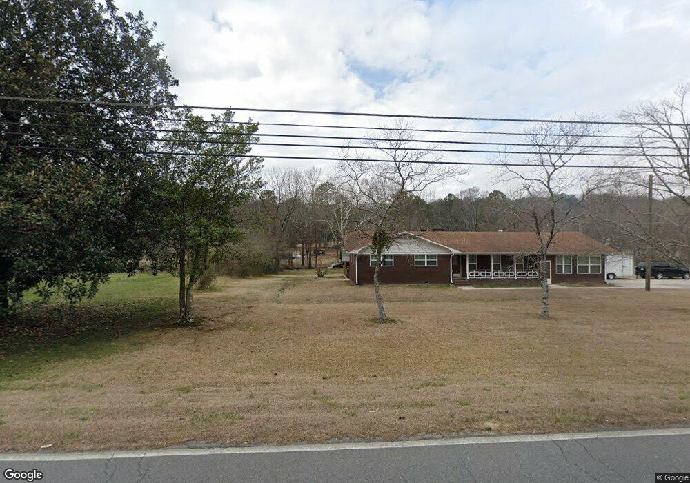
2005 Freeport Rd NW Dalton, GA 30720
Estimated Value: $259,000 - $297,000
--
Bed
2
Baths
1,940
Sq Ft
$143/Sq Ft
Est. Value
About This Home
This home is located at 2005 Freeport Rd NW, Dalton, GA 30720 and is currently estimated at $277,025, approximately $142 per square foot. 2005 Freeport Rd NW is a home located in Whitfield County with nearby schools including Pleasant Grove Elementary School, New Hope Middle School, and Northwest Whitfield County High School.
Ownership History
Date
Name
Owned For
Owner Type
Purchase Details
Closed on
Jun 7, 2024
Sold by
Castro Enrique Paniagua and Paniagua Enrique Castro
Bought by
Paniagua Enrique Castro and Paniagua Luis E
Current Estimated Value
Home Financials for this Owner
Home Financials are based on the most recent Mortgage that was taken out on this home.
Original Mortgage
$112,800
Outstanding Balance
$111,415
Interest Rate
7.22%
Mortgage Type
Credit Line Revolving
Estimated Equity
$165,610
Purchase Details
Closed on
Jan 1, 1999
Bought by
Paniagua Enrique Castro
Create a Home Valuation Report for This Property
The Home Valuation Report is an in-depth analysis detailing your home's value as well as a comparison with similar homes in the area
Home Values in the Area
Average Home Value in this Area
Purchase History
| Date | Buyer | Sale Price | Title Company |
|---|---|---|---|
| Paniagua Enrique Castro | -- | Priority Title | |
| Paniagua Enrique Castro | $77,000 | -- |
Source: Public Records
Mortgage History
| Date | Status | Borrower | Loan Amount |
|---|---|---|---|
| Open | Paniagua Enrique Castro | $112,800 |
Source: Public Records
Tax History Compared to Growth
Tax History
| Year | Tax Paid | Tax Assessment Tax Assessment Total Assessment is a certain percentage of the fair market value that is determined by local assessors to be the total taxable value of land and additions on the property. | Land | Improvement |
|---|---|---|---|---|
| 2024 | $1,618 | $100,001 | $13,778 | $86,223 |
| 2023 | $1,618 | $60,054 | $4,988 | $55,066 |
| 2022 | $958 | $41,029 | $4,988 | $36,041 |
| 2021 | $958 | $41,029 | $4,988 | $36,041 |
| 2020 | $979 | $41,029 | $4,988 | $36,041 |
| 2019 | $990 | $41,029 | $4,988 | $36,041 |
| 2018 | $992 | $40,781 | $4,740 | $36,041 |
| 2017 | $993 | $40,781 | $4,740 | $36,041 |
| 2016 | $869 | $37,520 | $4,740 | $32,780 |
| 2014 | $762 | $35,681 | $2,901 | $32,780 |
| 2013 | -- | $35,680 | $2,900 | $32,780 |
Source: Public Records
Map
Nearby Homes
- 213 Grassdale Rd
- 503 Moore Dr
- 110 Pinewood Way
- 000 Reed Rd
- 486 Haig Mill Rd
- 1903 Summit View Dr
- 1903 Middle Summit Dr
- 1899 Middle Summit Dr Unit 98
- 1899 N Summit Dr Unit 66
- 439 Westbrook Rd
- 522 Westbrook Rd
- 1247 Reed Rd
- 1709 Willow Oak Ln Unit 53
- 1706 Chestnut Oak Dr Unit 90
- 2215 Kerr Rd NW
- 1702 Chestnut Oak Dr
- 1702 Chestnut Oak Dr Unit 83
- 1614 Waring Rd NW
- 1699 Pin Oak Dr Unit 133
- 1730 Brighton Way
- 0 Freeport Rd NW Unit 114404
- 0 Freeport Rd NW Unit 8473465
- 0 Freeport Rd NW
- 1999 Freeport Rd NW
- 00 Luke Powell Rd NW
- 533 Luke Powell Rd NW
- 2009 Freeport Rd NW
- 514 Luke Powell Rd NW
- 1995 Freeport Rd NW
- 527 Luke Powell Rd NW
- 522 Luke Powell Rd NW
- 622 Pecan Way NW
- 528 Luke Powell Rd NW
- 4026 Sydney Cir
- 626 Pecan Way NW
- 4022 Sydney Cir
- 624 Pecan Way NW
- 4018 Sydney Cir
- 4030 Sydney Cir
- 628 Pecan Way NW