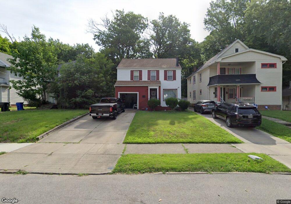
2005 Hilton Rd Cleveland, OH 44112
Euclid-Green NeighborhoodEstimated Value: $74,000 - $107,000
3
Beds
1
Bath
1,212
Sq Ft
$70/Sq Ft
Est. Value
About This Home
This home is located at 2005 Hilton Rd, Cleveland, OH 44112 and is currently estimated at $84,484, approximately $69 per square foot. 2005 Hilton Rd is a home located in Cuyahoga County with nearby schools including Bolton, Anton Grdina School, and Andrew J. Rickoff School.
Ownership History
Date
Name
Owned For
Owner Type
Purchase Details
Closed on
Oct 14, 2025
Sold by
Burton Alice M
Bought by
Jkv Ohio Partners Lp
Current Estimated Value
Purchase Details
Closed on
Nov 14, 2007
Sold by
Estate Of Donald T Burton
Bought by
Burton Alice M
Purchase Details
Closed on
May 22, 1986
Sold by
Burton Donald T and Burton Bettie A
Bought by
Burton Donald T
Purchase Details
Closed on
Jan 2, 1985
Sold by
Burton Donald T
Bought by
Burton Donald T and Burton Bettie A
Purchase Details
Closed on
Oct 19, 1984
Sold by
Burton Donald T and Burton Evon
Bought by
Burton Donald T
Purchase Details
Closed on
Jan 1, 1975
Bought by
Burton Donald T and Burton Evon
Create a Home Valuation Report for This Property
The Home Valuation Report is an in-depth analysis detailing your home's value as well as a comparison with similar homes in the area
Home Values in the Area
Average Home Value in this Area
Purchase History
| Date | Buyer | Sale Price | Title Company |
|---|---|---|---|
| Jkv Ohio Partners Lp | $57,500 | Empora Title | |
| Burton Alice M | -- | None Available | |
| Burton Donald T | -- | -- | |
| Burton Donald T | -- | -- | |
| Burton Donald T | -- | -- | |
| Burton Donald T | -- | -- |
Source: Public Records
Tax History Compared to Growth
Tax History
| Year | Tax Paid | Tax Assessment Tax Assessment Total Assessment is a certain percentage of the fair market value that is determined by local assessors to be the total taxable value of land and additions on the property. | Land | Improvement |
|---|---|---|---|---|
| 2024 | $606 | $19,040 | $3,920 | $15,120 |
| 2023 | $93 | $10,400 | $1,860 | $8,540 |
| 2022 | $124 | $10,400 | $1,860 | $8,540 |
| 2021 | $123 | $10,400 | $1,860 | $8,540 |
| 2020 | $0 | $8,650 | $1,540 | $7,110 |
| 2019 | $1,330 | $24,700 | $4,400 | $20,300 |
| 2018 | $94 | $8,650 | $1,540 | $7,110 |
| 2017 | $190 | $11,060 | $420 | $10,640 |
| 2016 | $189 | $11,060 | $420 | $10,640 |
| 2015 | $218 | $11,060 | $420 | $10,640 |
| 2014 | $218 | $11,410 | $420 | $10,990 |
Source: Public Records
Map
Nearby Homes
- 2116 Reyburn Rd
- 2133 Reyburn Rd
- 2121 Alton Rd
- 1875 Lampson Rd
- 3595 Runnymede Blvd
- 1816 Lampson Rd
- 1897 Torbenson Dr
- 1767 Algonac Rd Unit 2
- 1758 Algonac Rd
- 3609 Langton Rd
- 3511 Randolph Rd
- 1762 Alcoy Rd
- 3655 Langton Rd
- 16208 Greyton Rd
- 3547 Randolph Rd
- 3598 Atherstone Rd
- 825 Helmsdale Rd
- 1738 Burgess Rd
- 693 Quilliams Rd
- 833 Nela View Rd
- 2001 Hilton Rd
- 2009 Hilton Rd
- 1997 Hilton Rd
- 2013 Hilton Rd
- 1993 Hilton Rd
- 2017 Hilton Rd
- 2010 Hilton Rd
- 2004 Hilton Rd
- 1989 Hilton Rd
- 2012 Hilton Rd
- 2000 Hilton Rd
- 1970 Haverhill Rd
- 1983 Hilton Rd
- 1983 Hilton Rd Unit 85
- 1966 Haverhill Rd
- 1981 Hilton Rd
- 2001 Reyburn Rd
- 1981 Reyburn Rd
- 2005 Reyburn Rd
- 1962 Haverhill Rd