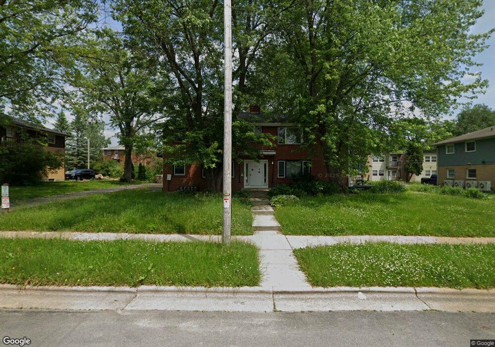
2005 Leland Dr Madison, WI 53711
Meadowood NeighborhoodEstimated Value: $607,000 - $623,000
8
Beds
4
Baths
3,200
Sq Ft
$192/Sq Ft
Est. Value
About This Home
This home is located at 2005 Leland Dr, Madison, WI 53711 and is currently estimated at $615,000, approximately $192 per square foot. 2005 Leland Dr is a home located in Dane County with nearby schools including Orchard Ridge Elementary School, Toki Middle School, and Vel Phillips Memorial High School.
Ownership History
Date
Name
Owned For
Owner Type
Purchase Details
Closed on
Aug 26, 2013
Sold by
Oak Hill Investments Llc
Bought by
Common Wealth Development Inc
Current Estimated Value
Home Financials for this Owner
Home Financials are based on the most recent Mortgage that was taken out on this home.
Original Mortgage
$290,000
Outstanding Balance
$216,236
Interest Rate
4.38%
Mortgage Type
Commercial
Estimated Equity
$398,764
Purchase Details
Closed on
Aug 31, 2005
Sold by
Weber Jason M and Lukas Diane M
Bought by
Oak Hill Investments Llc
Home Financials for this Owner
Home Financials are based on the most recent Mortgage that was taken out on this home.
Original Mortgage
$237,600
Interest Rate
5.89%
Mortgage Type
Future Advance Clause Open End Mortgage
Create a Home Valuation Report for This Property
The Home Valuation Report is an in-depth analysis detailing your home's value as well as a comparison with similar homes in the area
Home Values in the Area
Average Home Value in this Area
Purchase History
| Date | Buyer | Sale Price | Title Company |
|---|---|---|---|
| Common Wealth Development Inc | $480,000 | None Available | |
| Oak Hill Investments Llc | $297,000 | None Available |
Source: Public Records
Mortgage History
| Date | Status | Borrower | Loan Amount |
|---|---|---|---|
| Open | Common Wealth Development Inc | $290,000 | |
| Previous Owner | Oak Hill Investments Llc | $237,600 |
Source: Public Records
Tax History Compared to Growth
Tax History
| Year | Tax Paid | Tax Assessment Tax Assessment Total Assessment is a certain percentage of the fair market value that is determined by local assessors to be the total taxable value of land and additions on the property. | Land | Improvement |
|---|---|---|---|---|
| 2024 | -- | -- | -- | -- |
| 2021 | $32 | $0 | $0 | $0 |
| 2020 | $33 | $0 | $0 | $0 |
| 2019 | $34 | $0 | $0 | $0 |
| 2018 | $35 | $0 | $0 | $0 |
| 2017 | $36 | $0 | $0 | $0 |
| 2016 | $37 | $0 | $0 | $0 |
| 2015 | $6,982 | $0 | $0 | $0 |
| 2014 | $6,982 | $0 | $0 | $0 |
| 2013 | $6,982 | $151,600 | $92,600 | $59,000 |
Source: Public Records
Map
Nearby Homes
- 5826 Balsam Rd
- 5701 Bartlett Ln
- 2118 Gilbert Rd
- 6017 Mayhill Dr
- 5517 Dorsett Dr
- 2218 Teal Dr
- 1506 Lynndale Rd
- 2201 Tawhee Dr
- 2621 Smithfield Dr Unit 3
- 5726 Hempstead Rd
- 403 Williamsburg Way Ct Unit 403
- 2310 Ravenswood Rd
- 5837 Suffolk Rd
- 6305-6307 Hammersley Rd
- 5201 Hammersley Rd
- 5914 Stanton Ln
- 2954 King James Way Unit 4
- 13 Jacobs Ct
- 2309 Mckenna Blvd
- 6106 Davenport Dr
- 2001 Leland Dr
- 2001 Leland Dr Unit 2
- 2009 Leland Dr
- 5725 Raymond Rd
- 5725 Raymond Rd Unit 2
- 5726 Balsam Rd
- 5802 Balsam Rd
- 5718-5826 Balsam Rd
- 2101 Leland Dr
- 5806 Balsam Rd
- 5725 Balsam Rd
- 2102 Leland Dr
- 5809 Raymond Rd
- 2105 Leland Dr
- 5802 Raymond Rd
- 5813 Raymond Rd
- 2102 Iris Ln
- 2101 Iris Ln
- 5815 Raymond Rd
- 2106 Iris Ln