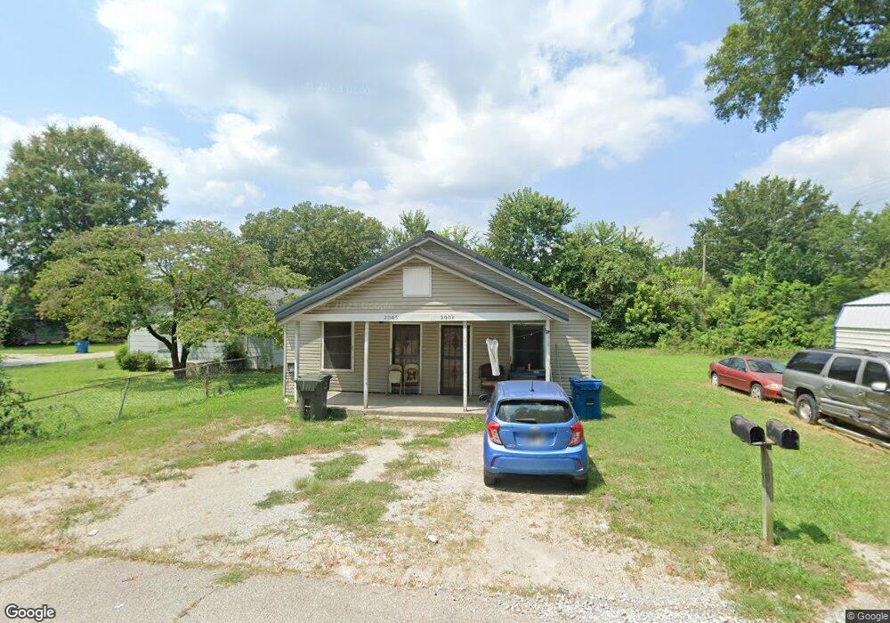
2005 North St Unit 2007 Humboldt, TN 38343
Estimated Value: $41,000 - $136,000
--
Bed
2
Baths
1,274
Sq Ft
$67/Sq Ft
Est. Value
About This Home
This home is located at 2005 North St Unit 2007, Humboldt, TN 38343 and is currently estimated at $85,740, approximately $67 per square foot. 2005 North St Unit 2007 is a home located in Gibson County with nearby schools including Stigall Primary School, East Elementary School, and Humboldt Middle School.
Ownership History
Date
Name
Owned For
Owner Type
Purchase Details
Closed on
May 23, 2017
Sold by
Hardee George Phillip
Bought by
York Brad M and York Courtney L
Current Estimated Value
Purchase Details
Closed on
Jan 6, 2017
Sold by
Lewis Danny E
Bought by
Hardee George Phillip and Hardee Morgan Paige
Purchase Details
Closed on
Jan 19, 1994
Bought by
Lewis Danny E and Lewis Teresa A
Purchase Details
Closed on
Feb 28, 1992
Bought by
Watt Tim
Purchase Details
Closed on
Mar 18, 1988
Bought by
Larry Mcknight
Purchase Details
Closed on
Jan 1, 1978
Bought by
G & H Leasing Co
Purchase Details
Closed on
Jan 3, 1900
Create a Home Valuation Report for This Property
The Home Valuation Report is an in-depth analysis detailing your home's value as well as a comparison with similar homes in the area
Home Values in the Area
Average Home Value in this Area
Purchase History
| Date | Buyer | Sale Price | Title Company |
|---|---|---|---|
| York Brad M | $10,500 | -- | |
| Hardee George Phillip | $27,500 | -- | |
| Lewis Danny E | $23,000 | -- | |
| Watt Tim | $8,600 | -- | |
| Larry Mcknight | $46,000 | -- | |
| G & H Leasing Co | -- | -- | |
| -- | -- | -- |
Source: Public Records
Tax History Compared to Growth
Tax History
| Year | Tax Paid | Tax Assessment Tax Assessment Total Assessment is a certain percentage of the fair market value that is determined by local assessors to be the total taxable value of land and additions on the property. | Land | Improvement |
|---|---|---|---|---|
| 2025 | $564 | $20,800 | $0 | $0 |
| 2024 | $564 | $20,800 | $3,600 | $17,200 |
| 2023 | $124 | $11,240 | $1,600 | $9,640 |
| 2022 | $116 | $11,240 | $1,600 | $9,640 |
| 2021 | $116 | $11,240 | $1,600 | $9,640 |
| 2020 | $423 | $11,240 | $1,600 | $9,640 |
| 2019 | $423 | $11,240 | $1,600 | $9,640 |
| 2018 | $465 | $11,440 | $1,600 | $9,840 |
| 2017 | $459 | $11,440 | $1,600 | $9,840 |
| 2016 | $459 | $11,440 | $1,600 | $9,840 |
| 2015 | $455 | $11,440 | $1,600 | $9,840 |
| 2014 | $455 | $11,440 | $1,600 | $9,840 |
Source: Public Records
Map
Nearby Homes
- 0 Eastend Dr
- 00000 Lot 7 Mullins St
- 0000 lot 6-C Mullins St
- 000Lot 6-B Mullins St
- 00-lot 6-A Mullins St
- 2310 Dodson St
- 1211 N 29th Ave
- 1338 Dungan St
- 2162 Dodson St
- 1320 Eastview Dr
- 2107 Campbell St
- 3117 Laurel St
- 1438 N 19th Ave
- 0 Highway 45 Bypass
- 0 Viking Dr
- 811 N 24th Ave
- 1416 N 18th Ave
- 1730 Stallings Rd
- 2508 Vine St
- 2425 St Mary Dr
- 2007 North St
- 2613 Mcdearmon Ave
- 2011 North St Unit 2013
- 2019 North St
- 2611 Mcdearmon Ave
- 1923 North St
- 2023 North St
- 2006 North St
- 2014 North St
- 2002 North St
- 2612 Mape St
- 1919 North St
- 2020 North St
- 2025 North St
- 2603 Mcdearmon Ave
- 2610 Mcdearmon Ave
- 2024 North St
- 2604 Mape St
- 1915 North St
- 2606 Mcdearmon Ave