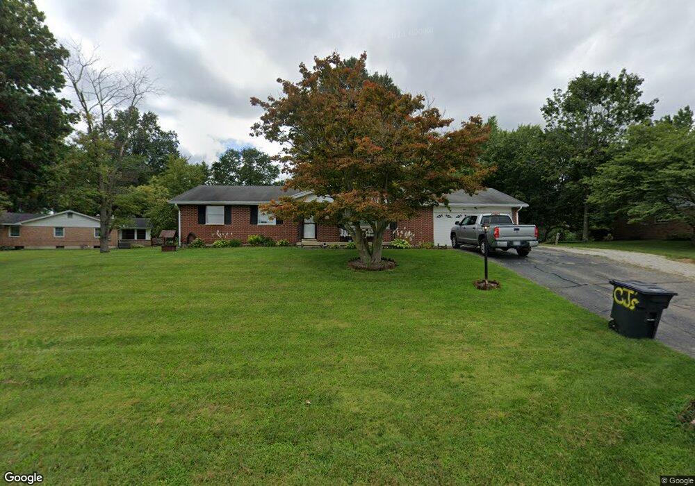
2005 Perkins Dr Springfield, OH 45505
Estimated Value: $186,000 - $289,000
3
Beds
3
Baths
1,392
Sq Ft
$182/Sq Ft
Est. Value
About This Home
This home is located at 2005 Perkins Dr, Springfield, OH 45505 and is currently estimated at $253,052, approximately $181 per square foot. 2005 Perkins Dr is a home located in Clark County with nearby schools including Possum Elementary School and Shawnee Middle School/High School.
Ownership History
Date
Name
Owned For
Owner Type
Purchase Details
Closed on
Jun 8, 2011
Sold by
Federal Home Loan Mortgage Corporation
Bought by
Howard Michael Allen
Current Estimated Value
Home Financials for this Owner
Home Financials are based on the most recent Mortgage that was taken out on this home.
Original Mortgage
$77,972
Interest Rate
4.64%
Mortgage Type
FHA
Purchase Details
Closed on
Mar 10, 2011
Sold by
Mamer Andrew
Bought by
Federal Home Loan Mortgage Corp
Purchase Details
Closed on
Sep 19, 2002
Sold by
Litteral Ruth
Bought by
Mamer Andrew
Home Financials for this Owner
Home Financials are based on the most recent Mortgage that was taken out on this home.
Original Mortgage
$138,985
Interest Rate
6.4%
Mortgage Type
Purchase Money Mortgage
Purchase Details
Closed on
Mar 24, 1997
Sold by
Cartwright Larry D
Bought by
Litteral Leon and Litteral Ruth
Home Financials for this Owner
Home Financials are based on the most recent Mortgage that was taken out on this home.
Original Mortgage
$40,000
Interest Rate
7.82%
Mortgage Type
New Conventional
Create a Home Valuation Report for This Property
The Home Valuation Report is an in-depth analysis detailing your home's value as well as a comparison with similar homes in the area
Home Values in the Area
Average Home Value in this Area
Purchase History
| Date | Buyer | Sale Price | Title Company |
|---|---|---|---|
| Howard Michael Allen | $80,000 | Attorney | |
| Federal Home Loan Mortgage Corp | $73,400 | Attorney | |
| Mamer Andrew | $146,300 | -- | |
| Litteral Leon | $125,000 | -- |
Source: Public Records
Mortgage History
| Date | Status | Borrower | Loan Amount |
|---|---|---|---|
| Previous Owner | Howard Michael Allen | $77,972 | |
| Previous Owner | Mamer Andrew | $138,985 | |
| Previous Owner | Litteral Leon | $40,000 |
Source: Public Records
Tax History
| Year | Tax Paid | Tax Assessment Tax Assessment Total Assessment is a certain percentage of the fair market value that is determined by local assessors to be the total taxable value of land and additions on the property. | Land | Improvement |
|---|---|---|---|---|
| 2025 | $3,097 | $78,830 | $15,850 | $62,980 |
| 2024 | $3,016 | $60,380 | $14,410 | $45,970 |
| 2023 | $3,016 | $60,380 | $14,410 | $45,970 |
| 2022 | $2,991 | $60,380 | $14,410 | $45,970 |
| 2021 | $2,428 | $43,870 | $10,290 | $33,580 |
| 2020 | $2,448 | $43,870 | $10,290 | $33,580 |
| 2019 | $2,487 | $43,870 | $10,290 | $33,580 |
| 2018 | $2,660 | $46,260 | $11,530 | $34,730 |
| 2017 | $2,728 | $43,887 | $11,526 | $32,361 |
| 2016 | $2,467 | $43,887 | $11,526 | $32,361 |
| 2015 | $2,338 | $38,959 | $10,290 | $28,669 |
| 2014 | $2,344 | $38,959 | $10,290 | $28,669 |
| 2013 | $2,044 | $38,959 | $10,290 | $28,669 |
Source: Public Records
Map
Nearby Homes
- 2076-2078 Stowe Dr
- 2224 Cheviot Hills Dr
- 2208 Hackberry St
- 2210 Hackberry St
- 2214 Hackberry St
- 2216 Hackberry St
- 2207 Hackberry St
- 2209 Hackberry St
- 2211 Hackberry St
- 2215 Hackberry St
- 2809 Morton Dr
- 1011 Mount Joy St
- 631 Kramer Rd
- 2037 Gerald Dr
- 2040 N Hadley Rd
- 2108 Sunset Ave
- 1724 S Belmont Ave
- 2745 Share St
- 1835 S Sweetbriar Ln
- 1554 S Belmont Ave
- 3040 Broadview Dr
- 1931 Perkins Dr
- 3030 Broadview Dr
- 2030 Perkins Dr
- 1919 Perkins Dr
- 1928 Cheviot Hills Dr
- 2000 Cheviot Hills Dr
- 2000 Perkins Dr
- 1916 Cheviot Hills Dr
- 1926 Perkins Dr
- 3035 Broadview Dr
- 2050 Perkins Dr
- 2020 Cheviot Hills Dr
- 1911 Perkins Dr
- 1908 Cheviot Hills Dr
- 1916 Perkins Dr
- 3019 Broadview Dr
- 1900 Cheviot Hills Dr
- 1908 Perkins Dr
- 1861 Perkins Dr
Your Personal Tour Guide
Ask me questions while you tour the home.