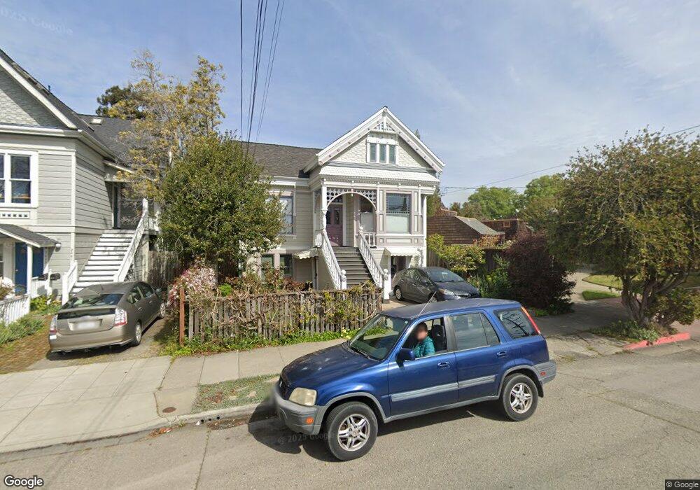
2005 Stuart St Berkeley, CA 94703
South Berkeley NeighborhoodEstimated Value: $1,106,000 - $1,633,303
6
Beds
3
Baths
2,404
Sq Ft
$580/Sq Ft
Est. Value
About This Home
This home is located at 2005 Stuart St, Berkeley, CA 94703 and is currently estimated at $1,394,576, approximately $580 per square foot. 2005 Stuart St is a home located in Alameda County with nearby schools including Malcolm X Elementary School, Emerson Elementary School, and John Muir Elementary School.
Ownership History
Date
Name
Owned For
Owner Type
Purchase Details
Closed on
Apr 28, 1998
Sold by
Treuhaft Robert E & Jessica L Trust and Robert E
Bought by
Rosenthal Monica
Current Estimated Value
Home Financials for this Owner
Home Financials are based on the most recent Mortgage that was taken out on this home.
Original Mortgage
$226,000
Outstanding Balance
$44,005
Interest Rate
7.06%
Estimated Equity
$1,350,571
Create a Home Valuation Report for This Property
The Home Valuation Report is an in-depth analysis detailing your home's value as well as a comparison with similar homes in the area
Home Values in the Area
Average Home Value in this Area
Purchase History
| Date | Buyer | Sale Price | Title Company |
|---|---|---|---|
| Rosenthal Monica | $282,500 | American Title Co |
Source: Public Records
Mortgage History
| Date | Status | Borrower | Loan Amount |
|---|---|---|---|
| Open | Rosenthal Monica | $226,000 |
Source: Public Records
Tax History
| Year | Tax Paid | Tax Assessment Tax Assessment Total Assessment is a certain percentage of the fair market value that is determined by local assessors to be the total taxable value of land and additions on the property. | Land | Improvement |
|---|---|---|---|---|
| 2025 | $12,415 | $506,763 | $135,397 | $378,366 |
| 2024 | $12,415 | $496,692 | $132,743 | $370,949 |
| 2023 | $12,065 | $493,816 | $130,140 | $363,676 |
| 2022 | $11,914 | $477,135 | $127,589 | $356,546 |
| 2021 | $11,882 | $467,642 | $125,087 | $349,555 |
| 2020 | $11,071 | $469,778 | $123,805 | $345,973 |
| 2019 | $10,428 | $460,568 | $121,378 | $339,190 |
| 2018 | $10,175 | $451,539 | $118,998 | $332,541 |
| 2017 | $9,807 | $442,688 | $116,666 | $326,022 |
| 2016 | $9,323 | $434,010 | $114,379 | $319,631 |
| 2015 | $9,158 | $427,491 | $112,661 | $314,830 |
| 2014 | $9,049 | $419,117 | $110,454 | $308,663 |
Source: Public Records
Map
Nearby Homes
- 2701 Grant St
- 1901 Parker St Unit 3
- 2018 Blake St
- 2057 Emerson St
- 2110 Ashby Ave
- 2923 Wheeler St
- 2727 McGee Ave
- 2926 Ellis St
- 2243 Ashby Ave
- 2319 Ward St
- 2124 Prince St
- 3046 Deakin St
- 1646 Ashby Ave
- 1612 Carleton St
- 1612 Parker St
- 2702 Dana St
- 1645 Dwight Way
- 1530 Stuart St
- 6555 Shattuck Ave
- 2917 Telegraph Ave
- 2001 Stuart St
- 2736 Milvia St
- 2000 Ward St
- 2734 Milvia St
- 2730 Milvia St
- 1939 Stuart St Unit 3
- 1939 Stuart St
- 1940 Ward St
- 1938 Ward St
- 2808 Adeline St
- 2808 Adeline St Unit 3
- 2808 Adeline St Unit 2
- 2819 Martin Luther King jr Way
- 1907 Oregon St
- 1911 Oregon St
- 1935 Stuart St
- 1938 Stuart St
- 1934 Ward St
- 2810 Adeline St
- 1933 Stuart St
Your Personal Tour Guide
Ask me questions while you tour the home.