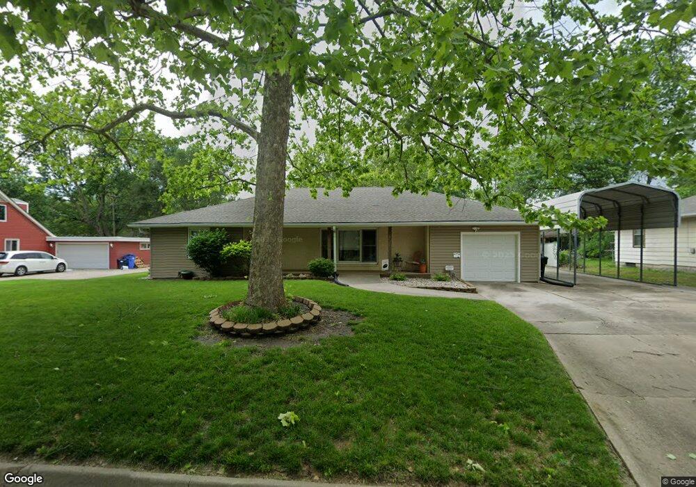
2005 SW Burnett Rd Topeka, KS 66604
West Topeka NeighborhoodEstimated Value: $176,000 - $197,000
3
Beds
2
Baths
1,468
Sq Ft
$127/Sq Ft
Est. Value
About This Home
This home is located at 2005 SW Burnett Rd, Topeka, KS 66604 and is currently estimated at $187,016, approximately $127 per square foot. 2005 SW Burnett Rd is a home located in Shawnee County with nearby schools including Whitson Elementary School, Marjorie French Middle School, and Topeka West High School.
Ownership History
Date
Name
Owned For
Owner Type
Purchase Details
Closed on
Dec 21, 2017
Sold by
Remy Shila A
Bought by
Kaberline Carrie L
Current Estimated Value
Home Financials for this Owner
Home Financials are based on the most recent Mortgage that was taken out on this home.
Original Mortgage
$91,805
Outstanding Balance
$77,212
Interest Rate
3.9%
Mortgage Type
FHA
Estimated Equity
$109,804
Purchase Details
Closed on
Feb 1, 2010
Sold by
Macmillan John P and Macmillan Doris M
Bought by
Remy Joseph L and Remy Sheila A
Home Financials for this Owner
Home Financials are based on the most recent Mortgage that was taken out on this home.
Original Mortgage
$81,908
Interest Rate
5.25%
Mortgage Type
FHA
Create a Home Valuation Report for This Property
The Home Valuation Report is an in-depth analysis detailing your home's value as well as a comparison with similar homes in the area
Home Values in the Area
Average Home Value in this Area
Purchase History
| Date | Buyer | Sale Price | Title Company |
|---|---|---|---|
| Kaberline Carrie L | -- | Lawyers Title Of Topeka Inc | |
| Remy Joseph L | -- | Capital Title Insurance Comp |
Source: Public Records
Mortgage History
| Date | Status | Borrower | Loan Amount |
|---|---|---|---|
| Open | Kaberline Carrie L | $91,805 | |
| Previous Owner | Remy Joseph L | $81,908 |
Source: Public Records
Tax History Compared to Growth
Tax History
| Year | Tax Paid | Tax Assessment Tax Assessment Total Assessment is a certain percentage of the fair market value that is determined by local assessors to be the total taxable value of land and additions on the property. | Land | Improvement |
|---|---|---|---|---|
| 2025 | $2,503 | $18,502 | -- | -- |
| 2023 | $2,503 | $16,787 | $0 | $0 |
| 2022 | $2,165 | $14,598 | $0 | $0 |
| 2021 | $1,986 | $12,693 | $0 | $0 |
| 2020 | $1,868 | $12,088 | $0 | $0 |
| 2019 | $1,842 | $11,852 | $0 | $0 |
| 2018 | $1,789 | $11,507 | $0 | $0 |
| 2017 | $1,756 | $11,281 | $0 | $0 |
| 2014 | $1,667 | $10,620 | $0 | $0 |
Source: Public Records
Map
Nearby Homes
- 1944 SW Quivira Dr
- 4230 SW 19th St
- 4221 SW 17th St
- 2124 SW Meadow Ln
- 2401 SW James St
- 1609 SW Burnett Rd
- 2028 SW Stone Ave
- 1744 SW Atwood Ave
- 2425 SW James St
- 4200 SW Stratford Rd
- 3900 SW Holly Ln
- 4401 SW Connemara Ln
- 4405 SW Connemara Ln
- 1728 SW Fairlawn Rd
- 1625 SW Lakeside Dr
- 3636 SW Stratford Rd
- 1421 SW Mcalister Ave
- 2401 SW Crest Dr
- 2012 SW Westwood Dr
- 1274 SW Indian Trail Ct
- 2001 SW Burnett Rd
- 2015 SW Burnett Rd
- 2010 SW James St
- 2000 SW James St
- 1941 SW Burnett Rd
- 2016 SW James St
- 2004 SW Burnett Rd
- 2008 SW Burnett Rd
- 2000 SW Burnett Rd
- 1940 SW James St
- 2014 SW Burnett Rd
- 1935 SW Burnett Rd
- 2024 SW James St
- 1940 SW Burnett Rd
- 2018 SW Burnett Rd
- 1936 SW James St
- 2005 SW Mcalister Ave
- 2009 SW Mcalister Ave
- 1934 SW Burnett Rd
- 2030 SW James St