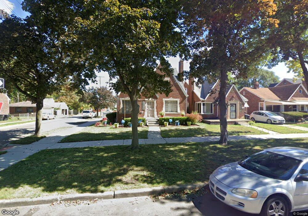
20050 Spencer St Detroit, MI 48234
Sherwood NeighborhoodEstimated Value: $120,000 - $146,000
4
Beds
2
Baths
1,565
Sq Ft
$85/Sq Ft
Est. Value
About This Home
This home is located at 20050 Spencer St, Detroit, MI 48234 and is currently estimated at $133,567, approximately $85 per square foot. 20050 Spencer St is a home located in Wayne County with nearby schools including Marion Law Academy, Edward 'Duke' Ellington Conservatory of Music and Art, and Charles L. Spain Elementary-Middle School.
Ownership History
Date
Name
Owned For
Owner Type
Purchase Details
Closed on
Mar 4, 2022
Sold by
Ann Glover and Ann Tonya
Bought by
Deandre And La Tonya Ann Glover Living Trust
Current Estimated Value
Purchase Details
Closed on
May 23, 2019
Sold by
Glover Deandre
Bought by
Glover Deandre and Glover La Tonya Ann
Purchase Details
Closed on
May 7, 2008
Sold by
Banks Danny and Banks Tracy
Bought by
Us Bank Na and Structured Asset Securities Corp Series
Purchase Details
Closed on
Jan 14, 2005
Sold by
Crossland Michael R and Crossland Arlinda H
Bought by
Banks Danny
Create a Home Valuation Report for This Property
The Home Valuation Report is an in-depth analysis detailing your home's value as well as a comparison with similar homes in the area
Home Values in the Area
Average Home Value in this Area
Purchase History
| Date | Buyer | Sale Price | Title Company |
|---|---|---|---|
| Deandre And La Tonya Ann Glover Living Trust | -- | Land Title | |
| Glover Deandre | -- | None Available | |
| Us Bank Na | $18,900 | None Available | |
| Banks Danny | $120,000 | None Available |
Source: Public Records
Tax History Compared to Growth
Tax History
| Year | Tax Paid | Tax Assessment Tax Assessment Total Assessment is a certain percentage of the fair market value that is determined by local assessors to be the total taxable value of land and additions on the property. | Land | Improvement |
|---|---|---|---|---|
| 2025 | $2,470 | $52,800 | $0 | $0 |
| 2024 | $2,470 | $45,000 | $0 | $0 |
| 2023 | $2,398 | $36,100 | $0 | $0 |
| 2022 | $1,188 | $30,400 | $0 | $0 |
| 2021 | $1,158 | $21,800 | $0 | $0 |
| 2020 | $1,146 | $20,900 | $0 | $0 |
| 2019 | $1,129 | $16,600 | $0 | $0 |
| 2018 | $967 | $14,300 | $0 | $0 |
| 2017 | $230 | $12,100 | $0 | $0 |
| 2016 | $2,215 | $39,800 | $0 | $0 |
| 2015 | $3,280 | $32,800 | $0 | $0 |
| 2013 | $4,092 | $40,915 | $0 | $0 |
| 2010 | -- | $60,018 | $1,336 | $58,682 |
Source: Public Records
Map
Nearby Homes
- 20124 Spencer St
- 20178 Stotter St
- 19985 Packard St
- 20209 Stotter St
- 20215 Stotter St
- 20220 Spencer St
- 20229 Stotter St
- 20234 Stotter St
- 20192 Rogge St
- 20143 Rogge St
- 4470 Outer Dr E
- 20400 Packard St
- 19721 Spencer St
- 20170 Carrie St
- 20035 Carrie St
- 19698 Packard St
- 20119 Carrie St
- 20185 Carrie St
- 20225 Terrell St
- 20151 Carrie St
- 20044 Spencer St
- 20036 Spencer St
- 20100 Spencer St
- 20028 Spencer St
- 20110 Spencer St
- 20051 Stotter St
- 20043 Stotter St
- 20020 Spencer St
- 20037 Stotter St
- 20103 Stotter St
- 20118 Spencer St
- 20031 Stotter St
- 20014 Spencer St
- 20109 Stotter St
- 20124 Spencer Ave
- 20051 Spencer St
- 20021 Stotter St
- 20043 Spencer St
- 20037 Spencer St
- 20117 Stotter St