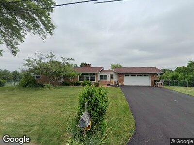
2006 Black Oak Dr Red Lion, PA 17356
Estimated Value: $245,450 - $303,000
2
Beds
1
Bath
1,236
Sq Ft
$221/Sq Ft
Est. Value
About This Home
This home is located at 2006 Black Oak Dr, Red Lion, PA 17356 and is currently estimated at $272,613, approximately $220 per square foot. 2006 Black Oak Dr is a home located in York County with nearby schools including Locust Grove Elementary School, Red Lion Area Junior High School, and Red Lion Area Senior High School.
Ownership History
Date
Name
Owned For
Owner Type
Purchase Details
Closed on
Sep 18, 2002
Sold by
Figdore Helen Q
Bought by
Hine Richard W and Hine Dianne M
Current Estimated Value
Home Financials for this Owner
Home Financials are based on the most recent Mortgage that was taken out on this home.
Original Mortgage
$75,000
Interest Rate
6.9%
Purchase Details
Closed on
Feb 4, 1993
Bought by
Figdore Helen Q
Create a Home Valuation Report for This Property
The Home Valuation Report is an in-depth analysis detailing your home's value as well as a comparison with similar homes in the area
Home Values in the Area
Average Home Value in this Area
Purchase History
| Date | Buyer | Sale Price | Title Company |
|---|---|---|---|
| Hine Richard W | $134,900 | -- | |
| Figdore Helen Q | -- | -- |
Source: Public Records
Mortgage History
| Date | Status | Borrower | Loan Amount |
|---|---|---|---|
| Open | Hine Richard W | $96,400 | |
| Closed | Hine Richard W | $115,940 | |
| Closed | Hine Richard W | $115,000 | |
| Closed | Hine Richard W | $75,000 |
Source: Public Records
Tax History Compared to Growth
Tax History
| Year | Tax Paid | Tax Assessment Tax Assessment Total Assessment is a certain percentage of the fair market value that is determined by local assessors to be the total taxable value of land and additions on the property. | Land | Improvement |
|---|---|---|---|---|
| 2025 | $4,225 | $135,150 | $36,390 | $98,760 |
| 2024 | $4,058 | $135,150 | $36,390 | $98,760 |
| 2023 | $4,058 | $135,150 | $36,390 | $98,760 |
| 2022 | $4,058 | $135,150 | $36,390 | $98,760 |
| 2021 | $3,944 | $135,150 | $36,390 | $98,760 |
| 2020 | $3,944 | $135,150 | $36,390 | $98,760 |
| 2019 | $3,930 | $135,150 | $36,390 | $98,760 |
| 2018 | $3,910 | $135,150 | $36,390 | $98,760 |
| 2017 | $3,876 | $135,150 | $36,390 | $98,760 |
| 2016 | $0 | $135,150 | $36,390 | $98,760 |
| 2015 | -- | $135,150 | $36,390 | $98,760 |
| 2014 | -- | $135,150 | $36,390 | $98,760 |
Source: Public Records
Map
Nearby Homes
- 0 Windsor Rd Unit LotWP001
- 445 Steinfelt Rd
- 1205 Cranberry Ln W
- 1100 Dietz Rd Unit LACHLAN
- 1120 Dietz Rd
- 1245 Dietz Rd
- 1265 Dietz Rd
- 55 Liborio Ln
- 2805 Alperton Dr
- 30 Carson Ln
- 180 Sunbury Way
- 1540 Pleader Ln
- 785 Clydesdale Dr
- 2540 Cape Horn Rd
- 4049 Woodspring Ln Unit 4049
- 4045 Woodspring Ln Unit 4045
- 2410 Cape Horn Rd
- 902 Kavanagh Cir
- 35 Percheron Dr
- 15 Nina Dr
- 2006 Black Oak Dr
- 2008 Black Oak Dr
- 2005 Black Oak Dr
- 2004 Black Oak Dr
- 2007 Black Oak Dr
- 2010 Black Oak Dr
- Lot Black Oak Dr
- 2001 Black Oak Dr
- 2009 Black Oak Dr
- 2012 Black Oak Dr
- 785 Windsor Rd
- 805 Windsor Rd
- 125 Wynshire Ln
- 2011 Black Oak Dr
- 2014 Black Oak Dr
- 2 Blueberry Ln
- 105 Wynshire Ln
- 755 Windsor Rd
- 135 Wynshire Ln