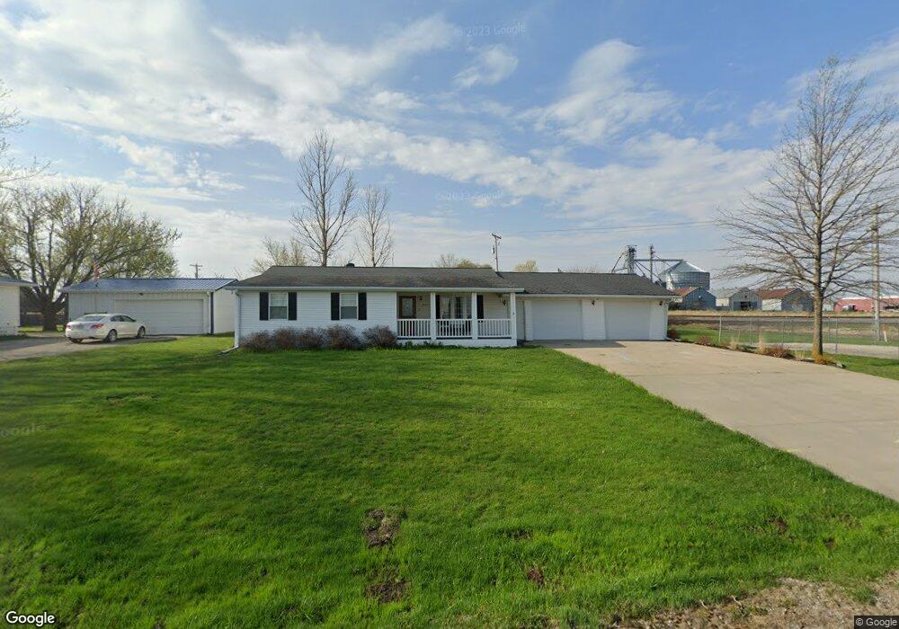
2006 Curtis Ave Chariton, IA 50049
Estimated Value: $220,428 - $267,000
3
Beds
1
Bath
1,964
Sq Ft
$127/Sq Ft
Est. Value
About This Home
This home is located at 2006 Curtis Ave, Chariton, IA 50049 and is currently estimated at $250,357, approximately $127 per square foot. 2006 Curtis Ave is a home located in Lucas County with nearby schools including Van Allen Elementary School, Columbus Elementary School, and Chariton Middle School.
Ownership History
Date
Name
Owned For
Owner Type
Purchase Details
Closed on
Feb 28, 2023
Sold by
Mccormick Brandon Arlo
Bought by
Peterson Cork A
Current Estimated Value
Home Financials for this Owner
Home Financials are based on the most recent Mortgage that was taken out on this home.
Original Mortgage
$161,000
Outstanding Balance
$155,591
Interest Rate
5.75%
Mortgage Type
New Conventional
Estimated Equity
$94,766
Purchase Details
Closed on
Mar 23, 2022
Sold by
Iowa Electric Light And Power Company
Bought by
Mccormick Brandon C
Create a Home Valuation Report for This Property
The Home Valuation Report is an in-depth analysis detailing your home's value as well as a comparison with similar homes in the area
Home Values in the Area
Average Home Value in this Area
Purchase History
| Date | Buyer | Sale Price | Title Company |
|---|---|---|---|
| Peterson Cork A | $171,000 | None Listed On Document | |
| Mccormick Brandon C | $1,000 | Howes Law Firm Pc |
Source: Public Records
Mortgage History
| Date | Status | Borrower | Loan Amount |
|---|---|---|---|
| Open | Peterson Cork A | $161,000 |
Source: Public Records
Tax History Compared to Growth
Tax History
| Year | Tax Paid | Tax Assessment Tax Assessment Total Assessment is a certain percentage of the fair market value that is determined by local assessors to be the total taxable value of land and additions on the property. | Land | Improvement |
|---|---|---|---|---|
| 2024 | $4,504 | $217,346 | $23,518 | $193,828 |
| 2023 | $4,106 | $210,361 | $23,518 | $186,843 |
| 2022 | $3,140 | $143,450 | $11,590 | $131,860 |
| 2021 | $2,702 | $143,450 | $11,590 | $131,860 |
| 2020 | $2,702 | $119,542 | $9,661 | $109,881 |
| 2019 | $2,482 | $229,423 | $119,542 | $109,881 |
| 2018 | $2,452 | $103,950 | $8,401 | $95,549 |
| 2017 | $2,452 | $98,066 | $0 | $0 |
| 2016 | $2,366 | $98,066 | $0 | $0 |
| 2015 | $2,366 | $98,066 | $0 | $0 |
| 2014 | $2,362 | $98,066 | $0 | $0 |
Source: Public Records
Map
Nearby Homes
- 1808 Curtis Ave
- 1201 N 18th St
- 1217 N 18th St
- 1218 N 18th St
- 00 N 18th St
- Lot 17 N 18th St
- Lot 16 N 18th St
- Lot 15 N 18th St
- Lot 14 N 18th St
- Lot 13 N 18th St
- Lot 5 N 18th St
- Lot 6 N 18th St
- Lot 4 N 18th St
- Lot 3 N 18th St
- Lot 2 N 18th St
- 1102 N 17th St
- 1309 Ashland Ave
- 1544 Osceola Ave
- 433 N 16th St
- 1512 Osceola Ave
- 2002 Curtis Ave
- 1918 Curtis Ave
- 1914 Curtis Ave
- 1910 Curtis Ave
- 1101 N 19th St
- 1019 N 19th St
- 1115 N 19th St
- 1111 N 19th St
- 1015 N 19th St
- 1009 N 19th St
- 1103 N 19th St
- 1836 Curtis Ave
- 1003 N 19th St
- 1102 Bancroft St
- 1838 Mitchell Ave
- 1018 Bancroft St
- 1002 N 19th St
- 1122 Bancroft St
- 1827 Mitchell Ave
- 1003 Bancroft St