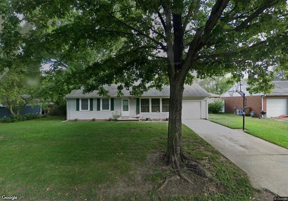
2006 Cypress Dr Champaign, IL 61821
West Haven NeighborhoodEstimated Value: $157,000 - $185,767
--
Bed
1
Bath
960
Sq Ft
$182/Sq Ft
Est. Value
About This Home
This home is located at 2006 Cypress Dr, Champaign, IL 61821 and is currently estimated at $174,692, approximately $181 per square foot. 2006 Cypress Dr is a home located in Champaign County with nearby schools including Centennial High School, St. John Lutheran School, and St. Matthew School.
Ownership History
Date
Name
Owned For
Owner Type
Purchase Details
Closed on
May 2, 2024
Sold by
Mcgill Colin D
Bought by
Cloveeaf Holdings Llc
Current Estimated Value
Purchase Details
Closed on
Jul 21, 2016
Sold by
Jictb Inc
Bought by
Mcgill Colin D
Home Financials for this Owner
Home Financials are based on the most recent Mortgage that was taken out on this home.
Original Mortgage
$99,750
Interest Rate
3.62%
Mortgage Type
New Conventional
Purchase Details
Closed on
Jan 31, 2013
Sold by
Strong Investment Properties Llc
Bought by
Janson Investment Co
Purchase Details
Closed on
Sep 10, 2004
Sold by
Carroll James R and Carroll Susan M
Bought by
Janson Investment Co
Create a Home Valuation Report for This Property
The Home Valuation Report is an in-depth analysis detailing your home's value as well as a comparison with similar homes in the area
Home Values in the Area
Average Home Value in this Area
Purchase History
| Date | Buyer | Sale Price | Title Company |
|---|---|---|---|
| Cloveeaf Holdings Llc | -- | None Listed On Document | |
| Mcgill Colin D | $105,000 | None Available | |
| Janson Investment Co | -- | None Available | |
| Janson Investment Co | $88,000 | -- |
Source: Public Records
Mortgage History
| Date | Status | Borrower | Loan Amount |
|---|---|---|---|
| Previous Owner | Mcgill Colin D | $99,750 |
Source: Public Records
Tax History Compared to Growth
Tax History
| Year | Tax Paid | Tax Assessment Tax Assessment Total Assessment is a certain percentage of the fair market value that is determined by local assessors to be the total taxable value of land and additions on the property. | Land | Improvement |
|---|---|---|---|---|
| 2024 | $3,051 | $43,730 | $12,360 | $31,370 |
| 2023 | $3,051 | $39,830 | $11,260 | $28,570 |
| 2022 | $2,828 | $36,750 | $10,390 | $26,360 |
| 2021 | $2,749 | $36,030 | $10,190 | $25,840 |
| 2020 | $2,688 | $35,320 | $9,990 | $25,330 |
| 2019 | $2,590 | $34,590 | $9,780 | $24,810 |
| 2018 | $2,524 | $34,050 | $9,630 | $24,420 |
| 2017 | $2,535 | $34,050 | $9,630 | $24,420 |
| 2016 | $2,759 | $33,350 | $9,430 | $23,920 |
| 2015 | $2,780 | $32,760 | $9,260 | $23,500 |
| 2014 | $2,251 | $32,760 | $9,260 | $23,500 |
| 2013 | -- | $32,760 | $9,260 | $23,500 |
Source: Public Records
Map
Nearby Homes
- 1801 Crescent Dr
- 1908 Barberry Cir
- 2001 S Mattis Ave Unit E
- 2003 W Kirby Ave
- 2313 Glenoak Dr
- 2203 W Kirby Ave
- 2302 Blackthorn Dr
- 1601 Carolyn Dr
- 1901 Lakeside Dr Unit B
- 1928 Blackthorn Dr Unit 1
- 2113 Sunview Dr
- 1612 W Kirby Ave
- 1410 S Mattis Ave
- 1420 S Western Ave
- 2144 Harbortown Cir Unit 2144
- 2306 Winchester Dr
- 1407 Kenwood Rd
- 1901 Branch Rd
- 2605 Trafalgar Square
- 1318 Broadmoor Dr
- 2006 Cypress Dr Unit 1
- 2004 Cypress Dr
- 2008 Cypress Dr
- 2005 Broadmoor Dr
- 2003 Broadmoor Dr
- 2007 Broadmoor Dr
- 1813 Clover Ln
- 2010 Cypress Dr
- 2003 Cypress Dr
- 1811 Clover Ln
- 2001 Cypress Dr
- 2009 Broadmoor Dr
- 1909 Cypress Dr
- 2006 Broadmoor Dr
- 2008 Broadmoor Dr
- 1814 Clover Ln
- 11 Alder Ct
- 2010 Broadmoor Dr
- 1812 Clover Ln
- 10 Alder Ct