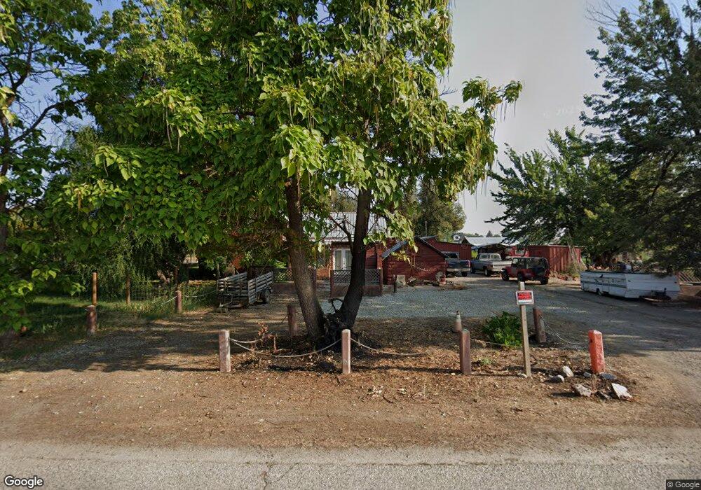
2006 E Locust St Emmett, ID 83617
Gem County NeighborhoodEstimated Value: $406,000 - $550,000
2
Beds
1
Bath
840
Sq Ft
$545/Sq Ft
Est. Value
About This Home
This home is located at 2006 E Locust St, Emmett, ID 83617 and is currently estimated at $457,606, approximately $544 per square foot. 2006 E Locust St is a home located in Gem County with nearby schools including Kenneth Carberry Intermediate School and Calvary Christian Academy.
Ownership History
Date
Name
Owned For
Owner Type
Purchase Details
Closed on
Dec 19, 2013
Sold by
Horton Ronald P
Bought by
Oleson Chad O
Current Estimated Value
Home Financials for this Owner
Home Financials are based on the most recent Mortgage that was taken out on this home.
Original Mortgage
$165,280
Outstanding Balance
$122,767
Interest Rate
4.13%
Mortgage Type
VA
Estimated Equity
$334,839
Purchase Details
Closed on
Apr 25, 2008
Sold by
Horton Ronnie P
Bought by
Horton Ronald P
Home Financials for this Owner
Home Financials are based on the most recent Mortgage that was taken out on this home.
Original Mortgage
$50,000
Interest Rate
5.81%
Mortgage Type
New Conventional
Create a Home Valuation Report for This Property
The Home Valuation Report is an in-depth analysis detailing your home's value as well as a comparison with similar homes in the area
Home Values in the Area
Average Home Value in this Area
Purchase History
| Date | Buyer | Sale Price | Title Company |
|---|---|---|---|
| Oleson Chad O | -- | Title One Boise | |
| Horton Ronald P | -- | -- |
Source: Public Records
Mortgage History
| Date | Status | Borrower | Loan Amount |
|---|---|---|---|
| Open | Oleson Chad O | $165,280 | |
| Previous Owner | Horton Ronald P | $50,000 |
Source: Public Records
Tax History
| Year | Tax Paid | Tax Assessment Tax Assessment Total Assessment is a certain percentage of the fair market value that is determined by local assessors to be the total taxable value of land and additions on the property. | Land | Improvement |
|---|---|---|---|---|
| 2025 | $904 | $395,009 | $144,759 | $250,250 |
| 2024 | $904 | $417,681 | $157,295 | $260,386 |
| 2023 | $758 | $414,848 | $179,971 | $234,877 |
| 2021 | $910 | $300,697 | $111,929 | $188,768 |
| 2020 | $899 | $230,318 | $87,577 | $142,741 |
| 2019 | $738 | $197,360 | $54,619 | $142,741 |
| 2018 | $660 | $150,755 | $43,119 | $107,636 |
| 2017 | $710 | $134,120 | $41,710 | $92,410 |
| 2016 | $702 | $123,700 | $39,360 | $84,340 |
Source: Public Records
Map
Nearby Homes
- 1732 Sandbar Rd
- 1676 Sandbar Rd
- 2185 Waterwheel Rd
- 1503 Old Maple Dr
- 1508 E Main St Unit 42
- 171 S Fuji Ave Unit Lot 28 Blo
- 2588 E Mcintosh Ct
- 1111 E Main St
- 3013 Gala Trail
- 701 Monte Vista Dr Unit 16
- TBD E Locust St
- 115 N Moffatt Ave
- 905 Gem Stone Way
- 809 Terry Dr
- 1724 Haystack R
- Lot 8 Corbett Rd
- 1716 Haystack Rd
- 1708 Haystack R
- 1709 Haystack R
- 1732 Kayak Rd
- 2006 E Locust St
- 2006 E Locust St Unit 2
- 2005 E Locust St
- 1990 E Locust St
- 498 S Sub Station Rd
- 616 N Sub Station Rd
- 616 N Substation Rd
- 0 Tbd East Locust St
- 620 N Sub Station Rd
- 620 N Substation Rd
- 380 N Sub Station Rd
- TBD Locust
- 619 N Sub Station Rd
- 608 N Sub Station Rd
- 608 N Substation Rd
- 1900 E Locust St
- 2230 E Locust St
- 1XXX N Substation Rd
- 2225 E Locust St
- 2232 E Locust St