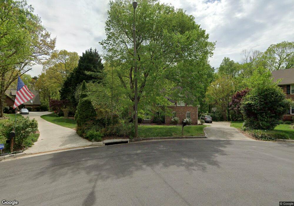
2006 La Vista Ct High Point, NC 27265
Deep River NeighborhoodEstimated Value: $432,000 - $503,111
5
Beds
3
Baths
3,453
Sq Ft
$135/Sq Ft
Est. Value
About This Home
This home is located at 2006 La Vista Ct, High Point, NC 27265 and is currently estimated at $464,778, approximately $134 per square foot. 2006 La Vista Ct is a home located in Guilford County with nearby schools including Southwest Elementary School, Welborn Academy of Science & Technology, and T.W. Andrews High School.
Ownership History
Date
Name
Owned For
Owner Type
Purchase Details
Closed on
Jan 10, 2001
Sold by
Joanne Miller C and Russell Robert Russell
Bought by
Barker Paul Curtis and Barker Kim Snow
Current Estimated Value
Home Financials for this Owner
Home Financials are based on the most recent Mortgage that was taken out on this home.
Original Mortgage
$279,000
Outstanding Balance
$103,762
Interest Rate
7.65%
Mortgage Type
Purchase Money Mortgage
Estimated Equity
$361,016
Create a Home Valuation Report for This Property
The Home Valuation Report is an in-depth analysis detailing your home's value as well as a comparison with similar homes in the area
Home Values in the Area
Average Home Value in this Area
Purchase History
| Date | Buyer | Sale Price | Title Company |
|---|---|---|---|
| Barker Paul Curtis | -- | -- |
Source: Public Records
Mortgage History
| Date | Status | Borrower | Loan Amount |
|---|---|---|---|
| Open | Barker Paul Curtis | $279,000 |
Source: Public Records
Tax History
| Year | Tax Paid | Tax Assessment Tax Assessment Total Assessment is a certain percentage of the fair market value that is determined by local assessors to be the total taxable value of land and additions on the property. | Land | Improvement |
|---|---|---|---|---|
| 2025 | $4,983 | $361,600 | $54,000 | $307,600 |
| 2024 | $4,983 | $361,600 | $54,000 | $307,600 |
| 2023 | $4,983 | $361,600 | $54,000 | $307,600 |
| 2022 | $4,874 | $361,600 | $54,000 | $307,600 |
| 2021 | $4,284 | $310,900 | $57,500 | $253,400 |
| 2020 | $4,284 | $310,900 | $57,500 | $253,400 |
| 2019 | $4,284 | $310,900 | $0 | $0 |
| 2018 | $4,263 | $310,900 | $0 | $0 |
| 2017 | $4,284 | $310,900 | $0 | $0 |
| 2016 | $4,114 | $293,300 | $0 | $0 |
| 2015 | $4,136 | $293,300 | $0 | $0 |
| 2014 | $4,206 | $293,300 | $0 | $0 |
Source: Public Records
Map
Nearby Homes
- 4109 Oak Hollow Dr
- 4103 Oak Hollow Dr
- 3908 Oak Hollow Ct
- 4306 Oak Hollow Dr
- 1955 Eastchester Dr
- 1955 Eastchester Dr Unit D
- 4218 Pelican St
- 940 Bloomington Way
- 4290 Pelican St
- 4518 Oak Hollow Dr
- 3518 Pebblestone Ln
- 4404 Essex Ct
- 3464 Basalt Ct
- 4004 Baywater Point
- 2855 Mossy Meadow Dr
- 3421 Wildwood Ave
- 2512 Burch Point
- 3905 Wynne Brook Ct
- 3650 Sunset Hollow Dr
- 3710 Spanish Peak Dr Unit 2D
- 2004 La Vista Ct
- 2008 La Vista Ct
- 2010 La Vista Ct
- 2002 La Vista Dr
- 4110 Oak Hollow Dr
- 2012 La Vista Dr
- 4108 Oak Hollow Dr
- 4112 Oak Hollow Dr
- 2014 La Vista Dr
- 4106 Oak Hollow Dr
- 4114 Oak Hollow Dr
- 2016 La Vista Dr
- 2005 La Vista Dr
- 2003 La Vista Dr
- 2007 La Vista Dr
- 2001 La Vista Dr
- 2009 La Vista Dr
- 4111 Oak Hollow Dr
- 4200 Oak Hollow Dr
- 4107 Oak Hollow Dr
Your Personal Tour Guide
Ask me questions while you tour the home.