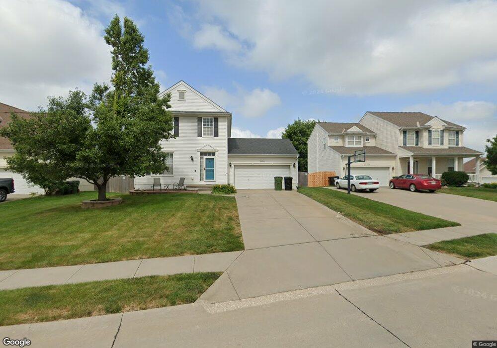
2006 Petersen Dr Papillion, NE 68046
Estimated Value: $336,359 - $365,000
3
Beds
3
Baths
1,920
Sq Ft
$182/Sq Ft
Est. Value
About This Home
This home is located at 2006 Petersen Dr, Papillion, NE 68046 and is currently estimated at $348,590, approximately $181 per square foot. 2006 Petersen Dr is a home located in Sarpy County with nearby schools including Patriot Elementary School, Liberty Middle School, and Papillion La Vista South High School.
Ownership History
Date
Name
Owned For
Owner Type
Purchase Details
Closed on
May 7, 2008
Sold by
Crutcher Randall D and Holeyfield Crutcher Ann M
Bought by
Crutcher Randall D and Holeyfield Crutcher Ann
Current Estimated Value
Home Financials for this Owner
Home Financials are based on the most recent Mortgage that was taken out on this home.
Original Mortgage
$196,448
Outstanding Balance
$124,475
Interest Rate
5.89%
Estimated Equity
$224,115
Purchase Details
Closed on
Apr 1, 2005
Sold by
Hearthstone Homes Inc
Bought by
Crutcher Randall D and Holeyfield Crutcher Ann M
Home Financials for this Owner
Home Financials are based on the most recent Mortgage that was taken out on this home.
Original Mortgage
$169,881
Interest Rate
5.75%
Create a Home Valuation Report for This Property
The Home Valuation Report is an in-depth analysis detailing your home's value as well as a comparison with similar homes in the area
Home Values in the Area
Average Home Value in this Area
Purchase History
| Date | Buyer | Sale Price | Title Company |
|---|---|---|---|
| Crutcher Randall D | -- | None Available | |
| Crutcher Randall D | $172,000 | -- |
Source: Public Records
Mortgage History
| Date | Status | Borrower | Loan Amount |
|---|---|---|---|
| Open | Crutcher Randall D | $196,448 | |
| Closed | Crutcher Randall D | $169,881 |
Source: Public Records
Tax History
| Year | Tax Paid | Tax Assessment Tax Assessment Total Assessment is a certain percentage of the fair market value that is determined by local assessors to be the total taxable value of land and additions on the property. | Land | Improvement |
|---|---|---|---|---|
| 2025 | $4,843 | $286,596 | $54,000 | $232,596 |
| 2024 | $5,353 | $279,613 | $50,000 | $229,613 |
| 2023 | $5,353 | $256,170 | $47,000 | $209,170 |
| 2022 | $5,211 | $228,653 | $42,000 | $186,653 |
| 2021 | $4,904 | $209,694 | $39,000 | $170,694 |
| 2020 | $4,706 | $201,508 | $36,000 | $165,508 |
| 2019 | $4,504 | $194,929 | $34,000 | $160,929 |
| 2018 | $4,414 | $188,755 | $32,000 | $156,755 |
| 2017 | $4,271 | $182,855 | $32,000 | $150,855 |
| 2016 | $4,109 | $174,246 | $25,000 | $149,246 |
| 2015 | $4,121 | $169,229 | $25,000 | $144,229 |
| 2014 | $4,002 | $163,821 | $25,000 | $138,821 |
| 2012 | -- | $160,934 | $25,000 | $135,934 |
Source: Public Records
Map
Nearby Homes
- 1806 Walnut Creek Dr
- 1004 Valleyview Dr
- 2231 Crystal Creek Dr
- 1018 Gold Coast Rd
- 2102 Sunburst Dr
- 501 Kent Dr
- 8904 Legacy St
- Lot 115 Ave Unit Lot 115
- 2421 Sand Hills Dr
- 8810 Legacy St
- 8811 Legacy St
- 8716 Legacy St
- 8717 Legacy St Unit Lot 71
- 8713 Legacy St Unit Lot 70
- 8704 Legacy St
- 8709 Legacy St Unit Lot 69
- 12520 S 89th Ave Unit Lot 103
- 12524 S 89th Ave Unit Lot 102
- 12512 S 89th Ave Unit Lot 105
- 12405 S 89th Ave Unit Lot 51
- 2008 Petersen Dr
- 2004 Petersen Dr
- 2010 Petersen Dr
- 2005 Diane St
- 2007 Diane St
- 2003 Diane St
- 2005 Petersen Dr
- 2003 Petersen Dr
- 2009 Diane St
- 2102 Petersen Dr
- 2007 Petersen Dr
- 1106 Port Royal Dr
- 1104 Port Royal Dr
- 1108 Port Royal Dr
- 2009 Petersen Dr
- 2101 Diane St
- 1102 Port Royal Dr
- 1110 Port Royal Dr
- 2104 Petersen Dr
- 2101 Petersen Dr
Your Personal Tour Guide
Ask me questions while you tour the home.