Estimated Value: $211,000 - $242,757
2
Beds
2
Baths
1,924
Sq Ft
$118/Sq Ft
Est. Value
About This Home
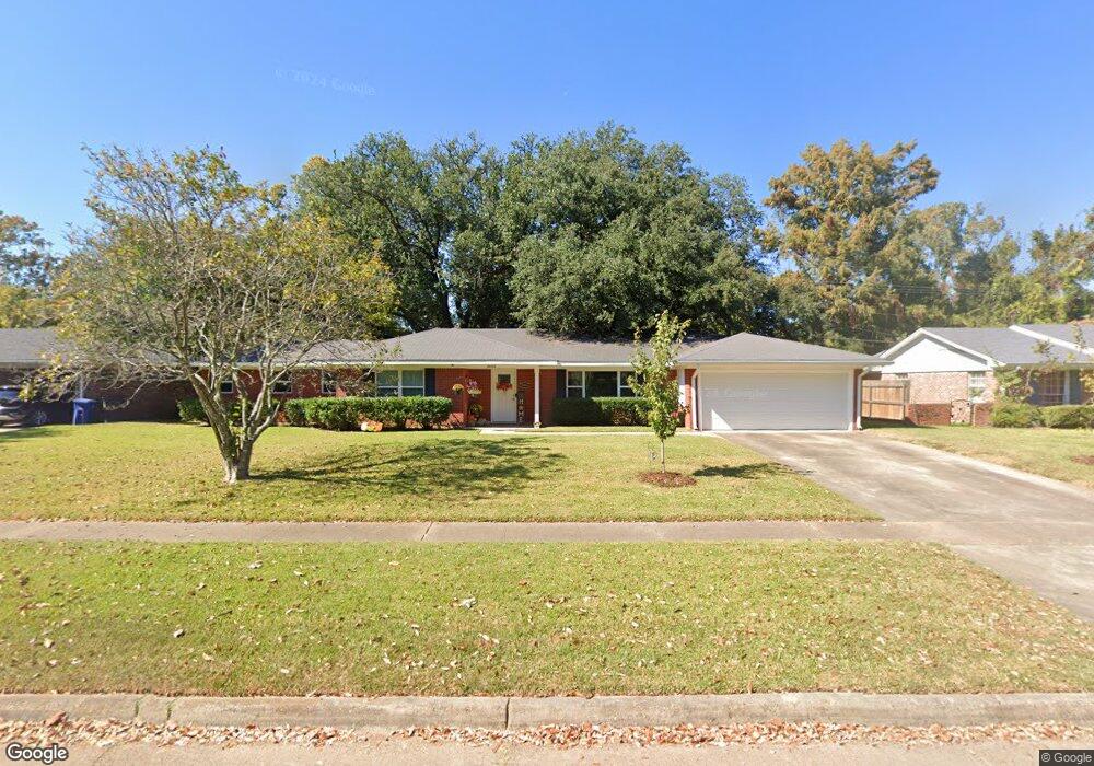
This home is located at 2006 River Rd, Shreveport, LA 71105 and is currently estimated at $226,689, approximately $117 per square foot. 2006 River Rd is a home located in Caddo Parish with nearby schools including Fairfield Magnet School, Judson Fundamental Elementary School, and Eden Gardens Fundamental Elementary School.
Ownership History
Date
Name
Owned For
Owner Type
Purchase Details
Closed on
Jan 30, 2024
Sold by
Johnson Johnny Ray and Johnson Sandra Kaye
Bought by
Dolph Thomas Earl and Freudenberger Jane L
Current Estimated Value
Home Financials for this Owner
Home Financials are based on the most recent Mortgage that was taken out on this home.
Original Mortgage
$218,500
Outstanding Balance
$214,639
Interest Rate
6.61%
Mortgage Type
New Conventional
Estimated Equity
$12,050
Purchase Details
Closed on
Apr 29, 2017
Sold by
Estate Of Johnnie Sullivan Schnuse
Bought by
Johnson Johnny and Johnson Sandra
Create a Home Valuation Report for This Property
The Home Valuation Report is an in-depth analysis detailing your home's value as well as a comparison with similar homes in the area
Home Values in the Area
Average Home Value in this Area
Purchase History
| Date | Buyer | Sale Price | Title Company |
|---|---|---|---|
| Dolph Thomas Earl | $230,000 | Bayou Title | |
| Johnson Johnny | $12,000 | None Available |
Source: Public Records
Mortgage History
| Date | Status | Borrower | Loan Amount |
|---|---|---|---|
| Open | Dolph Thomas Earl | $218,500 |
Source: Public Records
Tax History Compared to Growth
Tax History
| Year | Tax Paid | Tax Assessment Tax Assessment Total Assessment is a certain percentage of the fair market value that is determined by local assessors to be the total taxable value of land and additions on the property. | Land | Improvement |
|---|---|---|---|---|
| 2024 | $2,231 | $14,311 | $2,713 | $11,598 |
| 2023 | $2,080 | $13,051 | $2,584 | $10,467 |
| 2022 | $2,080 | $13,051 | $2,584 | $10,467 |
| 2021 | $2,048 | $13,051 | $2,584 | $10,467 |
| 2020 | $2,049 | $13,051 | $2,584 | $10,467 |
| 2019 | $2,110 | $13,048 | $2,584 | $10,464 |
| 2018 | $714 | $13,048 | $2,584 | $10,464 |
| 2017 | $2,144 | $13,048 | $2,584 | $10,464 |
| 2015 | $1,783 | $13,760 | $2,584 | $11,176 |
| 2014 | $1,754 | $13,430 | $2,580 | $10,850 |
| 2013 | -- | $13,430 | $2,580 | $10,850 |
Source: Public Records
Map
Nearby Homes
- 2013 E Kings Hwy
- 2005 E Kings Hwy
- 1919 Audubon Place
- 1906 Audubon Place
- 2049 River Rd
- 138 Justin Ave
- 150 Justin Ave
- 2045 Horton Ave
- 5702 River Rd
- 1923 Bermuda St
- 154 Southfield Rd
- 1916 Anniston Ave
- 159 Pennsylvania Ave
- 245 Stuart Ave
- 129 Carrollton Ave
- 153 Carrollton Ave
- 5822 River Rd
- 636 Pelican Place
- 230 Pennsylvania Ave
- 2043 Shadywood Ln
- 2010 River Rd
- 2014 River Rd
- 2003 River Rd
- 2007 River Rd
- 2021 E Kings Hwy
- 2011 River Rd
- 2001 E Kings Hwy
- 2017 E Kings Hwy
- 2009 E Kings Hwy
- 2025 E Kings Hwy
- 2025 E Kings Hwy
- 2018 River Rd
- 2015 River Rd
- 2019 River Rd
- 2022 River Rd
- 1909 E Kings Hwy
- 2006 Audubon Place
- 2010 Audubon Place
- 2002 Audubon Place
- 2014 Audubon Place