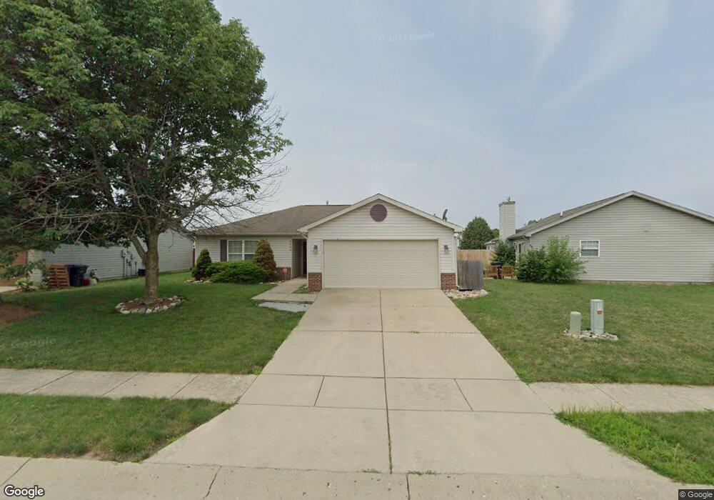
2006 Starks Cir Lafayette, IN 47909
Bridge Water NeighborhoodEstimated Value: $223,000 - $249,000
--
Bed
--
Bath
1,125
Sq Ft
$207/Sq Ft
Est. Value
About This Home
This home is located at 2006 Starks Cir, Lafayette, IN 47909 and is currently estimated at $233,179, approximately $207 per square foot. 2006 Starks Cir is a home located in Tippecanoe County with nearby schools including Amelia Earhart Elementary School, Lafayette Tecumseh Junior High School, and Sunnyside Intermediate School.
Ownership History
Date
Name
Owned For
Owner Type
Purchase Details
Closed on
Mar 17, 2017
Sold by
Little Ethel
Bought by
Munsey John
Current Estimated Value
Purchase Details
Closed on
May 8, 2014
Sold by
Munsey Christie
Bought by
Munsey John B
Purchase Details
Closed on
Jan 12, 2010
Sold by
American Properties Unlimited Llc
Bought by
Munsey John B and Munsey Christie
Home Financials for this Owner
Home Financials are based on the most recent Mortgage that was taken out on this home.
Original Mortgage
$93,279
Interest Rate
4.78%
Mortgage Type
FHA
Purchase Details
Closed on
Jan 24, 2003
Sold by
American Properties Unlimited Llc
Bought by
Potts Christopher J and Potts Anitra L
Home Financials for this Owner
Home Financials are based on the most recent Mortgage that was taken out on this home.
Original Mortgage
$780,000
Interest Rate
6.01%
Purchase Details
Closed on
Dec 30, 2002
Sold by
D & D Llc
Bought by
American Properties Unlimited Llc
Home Financials for this Owner
Home Financials are based on the most recent Mortgage that was taken out on this home.
Original Mortgage
$780,000
Interest Rate
6.01%
Create a Home Valuation Report for This Property
The Home Valuation Report is an in-depth analysis detailing your home's value as well as a comparison with similar homes in the area
Home Values in the Area
Average Home Value in this Area
Purchase History
| Date | Buyer | Sale Price | Title Company |
|---|---|---|---|
| Munsey John | -- | -- | |
| Munsey John B | -- | -- | |
| Munsey John B | -- | None Available | |
| Potts Christopher J | -- | -- | |
| American Properties Unlimited Llc | -- | -- |
Source: Public Records
Mortgage History
| Date | Status | Borrower | Loan Amount |
|---|---|---|---|
| Previous Owner | Munsey John B | $93,279 | |
| Previous Owner | American Properties Unlimited Llc | $780,000 |
Source: Public Records
Tax History Compared to Growth
Tax History
| Year | Tax Paid | Tax Assessment Tax Assessment Total Assessment is a certain percentage of the fair market value that is determined by local assessors to be the total taxable value of land and additions on the property. | Land | Improvement |
|---|---|---|---|---|
| 2024 | $1,835 | $190,400 | $43,000 | $147,400 |
| 2023 | $1,626 | $174,700 | $43,000 | $131,700 |
| 2022 | $1,226 | $126,000 | $18,000 | $108,000 |
| 2021 | $1,151 | $118,700 | $18,000 | $100,700 |
| 2020 | $976 | $109,200 | $18,000 | $91,200 |
| 2019 | $877 | $103,300 | $18,000 | $85,300 |
| 2018 | $832 | $100,100 | $18,000 | $82,100 |
| 2017 | $737 | $99,100 | $18,000 | $81,100 |
| 2016 | $711 | $98,500 | $18,000 | $80,500 |
| 2014 | $591 | $91,000 | $18,000 | $73,000 |
| 2013 | $550 | $88,700 | $18,000 | $70,700 |
Source: Public Records
Map
Nearby Homes
- 2200 Winterset Dr
- 3303 Crosspoint Ct S
- 1907 Griffon Dr
- 3320 Norwegian Dr
- 1512 Sherwood Dr
- 1801 Bengal Place
- 1609 Tabor Ct
- 3314 Pickwick Ct
- 1401 Normandy Dr
- 3244 Walton St
- 1301 Norma Jean Dr
- 120 Coldbrook Dr
- 2003 Kingfisher Dr
- 1817 Kingfisher Dr
- 936 Brookridge Ct
- 1007 Waterstone Dr
- 3905 Rushgrove Dr
- 1120 Stoneripple Cir
- 1018 Southport Dr
- 2654 Brady Ln
- 2010 Starks Cir
- 2005 Starks Cir
- 1929 Chamberlin Dr
- 1925 Chamberlin Dr
- 2001 Starks Cir
- 2014 Starks Cir
- 125 Phillips Ct
- 2015 Starks Cir
- 120 Phillips Ct
- 1921 Chamberlin Dr
- 2011 Starks Cir
- 2008 Starks Cir
- 2004 Starks Cir
- 2007 Starks Cir
- 110 Phillips Ct
- 2000 Starks Cir
- 1915 Starks Cir
- 1917 Chamberlin Dr
- 1918 Chamberlin Dr
- 1928 Starks Cir