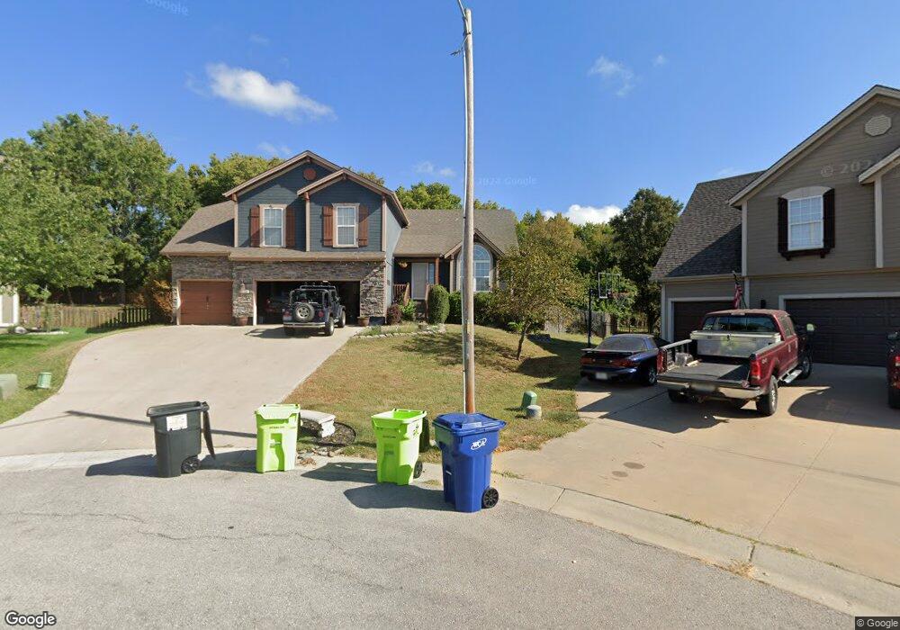
2006 SW Huntbrook Cir Lees Summit, MO 64082
Estimated Value: $439,000 - $484,264
4
Beds
3
Baths
1,971
Sq Ft
$231/Sq Ft
Est. Value
About This Home
This home is located at 2006 SW Huntbrook Cir, Lees Summit, MO 64082 and is currently estimated at $456,066, approximately $231 per square foot. 2006 SW Huntbrook Cir is a home located in Jackson County with nearby schools including Hawthorn Hill Elementary School, Summit Lakes Middle School, and Lee's Summit West High School.
Ownership History
Date
Name
Owned For
Owner Type
Purchase Details
Closed on
May 25, 2018
Sold by
Hogan Christina M
Bought by
Hogan Matthew M
Current Estimated Value
Home Financials for this Owner
Home Financials are based on the most recent Mortgage that was taken out on this home.
Original Mortgage
$240,000
Outstanding Balance
$207,122
Interest Rate
4.5%
Mortgage Type
New Conventional
Estimated Equity
$248,944
Purchase Details
Closed on
Oct 21, 2002
Sold by
Sab Construction Llc
Bought by
Hogan Matthew M and Hogan Christina M
Home Financials for this Owner
Home Financials are based on the most recent Mortgage that was taken out on this home.
Original Mortgage
$162,500
Interest Rate
6.09%
Mortgage Type
Purchase Money Mortgage
Create a Home Valuation Report for This Property
The Home Valuation Report is an in-depth analysis detailing your home's value as well as a comparison with similar homes in the area
Home Values in the Area
Average Home Value in this Area
Purchase History
| Date | Buyer | Sale Price | Title Company |
|---|---|---|---|
| Hogan Matthew M | -- | None Available | |
| Hogan Matthew M | -- | Security Land Title Company |
Source: Public Records
Mortgage History
| Date | Status | Borrower | Loan Amount |
|---|---|---|---|
| Open | Hogan Matthew M | $240,000 | |
| Closed | Hogan Matthew M | $162,500 |
Source: Public Records
Tax History Compared to Growth
Tax History
| Year | Tax Paid | Tax Assessment Tax Assessment Total Assessment is a certain percentage of the fair market value that is determined by local assessors to be the total taxable value of land and additions on the property. | Land | Improvement |
|---|---|---|---|---|
| 2025 | $5,852 | $73,120 | $10,612 | $62,508 |
| 2024 | $5,852 | $81,050 | $11,848 | $69,202 |
| 2023 | $5,810 | $81,050 | $10,549 | $70,501 |
| 2022 | $4,463 | $55,290 | $9,985 | $45,305 |
| 2021 | $4,556 | $55,290 | $9,985 | $45,305 |
| 2020 | $4,381 | $52,656 | $9,985 | $42,671 |
| 2019 | $4,262 | $52,656 | $9,985 | $42,671 |
| 2018 | $3,971 | $45,531 | $5,740 | $39,791 |
| 2017 | $3,971 | $45,531 | $5,740 | $39,791 |
| 2016 | $3,613 | $41,002 | $6,327 | $34,675 |
| 2014 | $3,649 | $40,592 | $6,331 | $34,261 |
Source: Public Records
Map
Nearby Homes
- 2040 SW Wheatfield Ct
- 2112 SW Wheatfield Ct
- 2104 SW Gooseberry Ln
- 2606 SW Farm Field Rd
- 2607 SW Firefly Ln
- 2618 SW Farm Field Rd
- 2622 SW Farm Field Rd
- 2110 SW Hook Farm Dr
- 2615 SW Tracker Ln
- 2349 SW Feather Ridge Rd
- 2630 SW Firefly Ln
- 2627 SW Tracker Ln
- 2202 SW Hook Farm Dr
- 2038 SW Harvest Moon Ln
- 2236 SW Hawk View Rd
- 1616 SW 27th St
- 1600 SW 27th St
- 2341 SW River Trail Rd
- 2809 SW Heartland Rd
- 2230 SW Crown Dr
- 2008 SW Huntbrook Cir
- 2004 SW Huntbrook Cir
- 2010 SW Huntbrook Cir
- 2002 SW Huntbrook Cir
- 2002 SW Huntbrook Cir
- 2016 SW Huntbrook Terrace
- 2013 SW Huntbrook Terrace
- 2005 SW Huntbrook Terrace
- 2000 SW Huntbrook Terrace
- 2001 SW Huntbrook Terrace
- 2017 SW Huntbrook Terrace
- 2024 SW Huntbrook Terrace
- 2021 SW Huntbrook Terrace
- 2301 SW Stone Bridge Ct
- 2028 SW Huntbrook Terrace
- 2025 SW Huntbrook Terrace
- 2300 SW Stone Bridge Ct
- 2305 SW Stone Bridge Ct
- 2032 SW Huntbrook Terrace
- 2304 SW Stone Bridge Ct