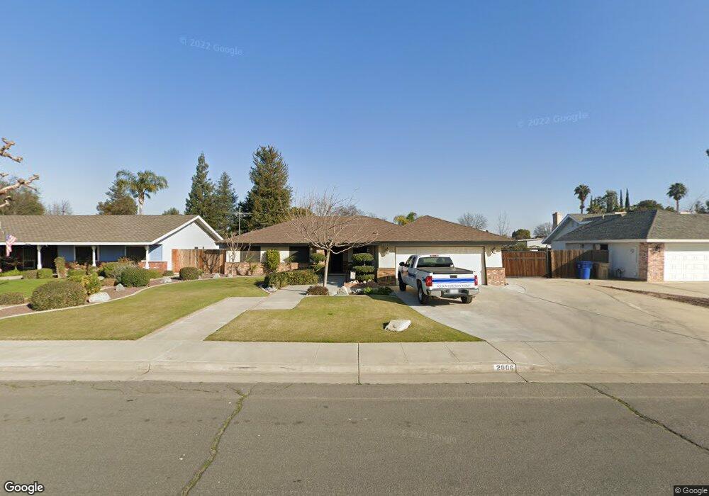
2006 Willow Brook St Bakersfield, CA 93314
Estimated Value: $501,001 - $580,000
3
Beds
--
Bath
1,750
Sq Ft
$304/Sq Ft
Est. Value
About This Home
This home is located at 2006 Willow Brook St, Bakersfield, CA 93314 and is currently estimated at $532,250, approximately $304 per square foot. 2006 Willow Brook St is a home located in Kern County with nearby schools including Centennial Elementary School, Rosedale Middle School, and Liberty High School.
Ownership History
Date
Name
Owned For
Owner Type
Purchase Details
Closed on
Feb 13, 2001
Sold by
Padilla Ruben and Padilla Marianne
Bought by
Fox Ronald L and Fox Kathy A
Current Estimated Value
Home Financials for this Owner
Home Financials are based on the most recent Mortgage that was taken out on this home.
Original Mortgage
$138,400
Interest Rate
7.09%
Create a Home Valuation Report for This Property
The Home Valuation Report is an in-depth analysis detailing your home's value as well as a comparison with similar homes in the area
Home Values in the Area
Average Home Value in this Area
Purchase History
| Date | Buyer | Sale Price | Title Company |
|---|---|---|---|
| Fox Ronald L | $173,000 | First American Title Co |
Source: Public Records
Mortgage History
| Date | Status | Borrower | Loan Amount |
|---|---|---|---|
| Previous Owner | Fox Ronald L | $138,400 |
Source: Public Records
Tax History Compared to Growth
Tax History
| Year | Tax Paid | Tax Assessment Tax Assessment Total Assessment is a certain percentage of the fair market value that is determined by local assessors to be the total taxable value of land and additions on the property. | Land | Improvement |
|---|---|---|---|---|
| 2025 | $3,456 | $260,660 | $75,330 | $185,330 |
| 2024 | $3,364 | $255,550 | $73,853 | $181,697 |
| 2023 | $3,364 | $250,540 | $72,405 | $178,135 |
| 2022 | $3,275 | $245,629 | $70,986 | $174,643 |
| 2021 | $3,159 | $240,814 | $69,595 | $171,219 |
| 2020 | $3,088 | $238,346 | $68,882 | $169,464 |
| 2019 | $3,030 | $238,346 | $68,882 | $169,464 |
| 2018 | $2,946 | $229,093 | $66,208 | $162,885 |
| 2017 | $2,890 | $224,602 | $64,910 | $159,692 |
| 2016 | $2,691 | $220,199 | $63,638 | $156,561 |
| 2015 | $2,666 | $216,893 | $62,683 | $154,210 |
| 2014 | $2,605 | $212,646 | $61,456 | $151,190 |
Source: Public Records
Map
Nearby Homes
- 13604 Providence Place
- 13603 Monarch Palm Ave
- 14035 Rosedale Hwy Unit 72
- 14035 Rosedale Hwy Unit 82
- 14035 Rosedale Hwy Unit 87
- 14035 Rosedale Hwy Unit 69
- 14035 Rosedale Hwy Unit 108
- 14035 Rosedale Hwy Unit 134
- 14035 Rosedale Hwy Unit 137
- 14035 Rosedale Hwy Unit 83
- 14035 Rosedale Hwy Unit 162
- 1838 Renfro Rd
- 13502 Coco Palm Ct
- 13417 Hinault Dr Unit 1
- 13804 Taradale Ct
- 14508 Harvest Crest Ave
- 1732 Blossom Crest St
- 1801 Blossom Crest St
- 13306 Monarch Palm Ave
- 14113 Wellington Ct
- 2000 Willow Brook St
- 2012 Willow Brook St
- 2018 Willow Brook St
- 2100 Willow Brook St
- 1912 Willow Brook St
- 2013 Deerfield St
- 2001 Deerfield St
- 2019 Deerfield St
- 1919 Deerfield St
- 2007 Willow Brook St
- 2007 Deerfield St
- 2013 Willow Brook St
- 2001 Willow Brook St
- 1906 Willow Brook St
- 2106 Willow Brook St
- 2019 Willow Brook St
- 2101 Deerfield St
- 1913 Deerfield St
- 1919 Willow Brook St
- 2101 Willow Brook St