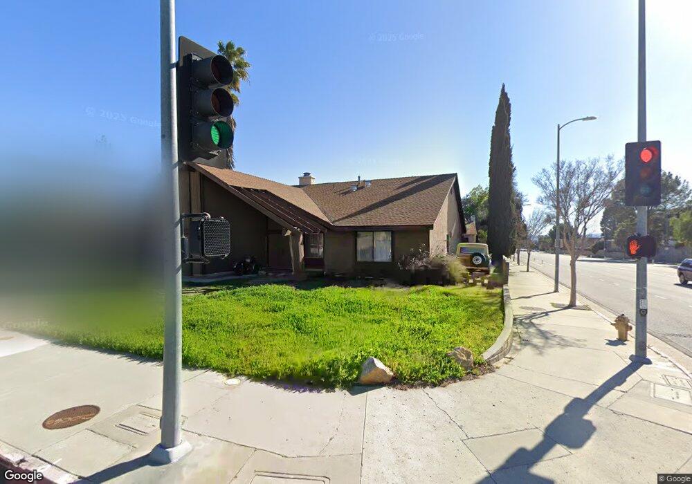
20060 Mayall St Chatsworth, CA 91311
Estimated Value: $1,156,558 - $1,349,000
4
Beds
3
Baths
2,417
Sq Ft
$503/Sq Ft
Est. Value
About This Home
This home is located at 20060 Mayall St, Chatsworth, CA 91311 and is currently estimated at $1,215,140, approximately $502 per square foot. 20060 Mayall St is a home located in Los Angeles County with nearby schools including Topeka Charter School For Advanced Studies, Our Community School, and Superior Street Elementary School.
Ownership History
Date
Name
Owned For
Owner Type
Purchase Details
Closed on
Jun 16, 1994
Sold by
First Nationwide Bank Fsb
Bought by
Farrar Raymond E and Farrar Mary
Current Estimated Value
Home Financials for this Owner
Home Financials are based on the most recent Mortgage that was taken out on this home.
Original Mortgage
$170,000
Interest Rate
8.6%
Purchase Details
Closed on
Mar 23, 1994
Sold by
Master Mtg Company
Bought by
First Nationwide Bank Fsb
Create a Home Valuation Report for This Property
The Home Valuation Report is an in-depth analysis detailing your home's value as well as a comparison with similar homes in the area
Home Values in the Area
Average Home Value in this Area
Purchase History
| Date | Buyer | Sale Price | Title Company |
|---|---|---|---|
| Farrar Raymond E | $225,000 | American Title Insurance Co | |
| First Nationwide Bank Fsb | $182,750 | Stewart Title |
Source: Public Records
Mortgage History
| Date | Status | Borrower | Loan Amount |
|---|---|---|---|
| Closed | Farrar Raymond E | $170,000 |
Source: Public Records
Tax History
| Year | Tax Paid | Tax Assessment Tax Assessment Total Assessment is a certain percentage of the fair market value that is determined by local assessors to be the total taxable value of land and additions on the property. | Land | Improvement |
|---|---|---|---|---|
| 2025 | $5,028 | $382,395 | $205,305 | $177,090 |
| 2024 | $5,028 | $374,898 | $201,280 | $173,618 |
| 2023 | $4,939 | $367,548 | $197,334 | $170,214 |
| 2022 | $4,726 | $360,342 | $193,465 | $166,877 |
| 2021 | $4,659 | $353,277 | $189,672 | $163,605 |
| 2019 | $4,529 | $342,801 | $184,048 | $158,753 |
| 2018 | $4,305 | $336,081 | $180,440 | $155,641 |
| 2016 | $4,095 | $323,033 | $173,434 | $149,599 |
| 2015 | $4,038 | $318,181 | $170,829 | $147,352 |
| 2014 | $4,059 | $311,949 | $167,483 | $144,466 |
Source: Public Records
Map
Nearby Homes
- 20118 Lassen St
- 19914 Vintage St
- 20200 Lassen St
- 10122 Jovita Ave
- 10211 Casaba Ave
- 20323 Kinzie St
- 9800 Kessler Ave
- 10020 Mason Ave
- 10345 Oso Ave
- 9710 Lubao Ave
- 10201 Mason Ave Unit 19
- 19865 Hiawatha St
- 10037 Sunnybrae Ave
- 9916 Bothwell Rd
- 9847 Bothwell Rd
- 10565 Lubao Ave
- 20604 Lemmer St
- 9527 Oso Ave
- 19510 Merridy St
- 19530 Tuba St
- 20050 Mayall St
- 20061 Merridy St
- 20055 Merridy St
- 20040 Mayall St
- 20100 Mayall St
- 20059 Mayall St
- 20043 Merridy St
- 20047 Mayall St
- 20108 Mayall St
- 20111 Stare St
- 20109 Stare St
- 20030 Mayall St
- 20101 Mayall St
- 20035 Mayall St
- 20029 Merridy St
- 20114 Mayall St
- 20058 Romar St
- 20062 Merridy St
- 20048 Romar St
- 20115 Stare St
Your Personal Tour Guide
Ask me questions while you tour the home.