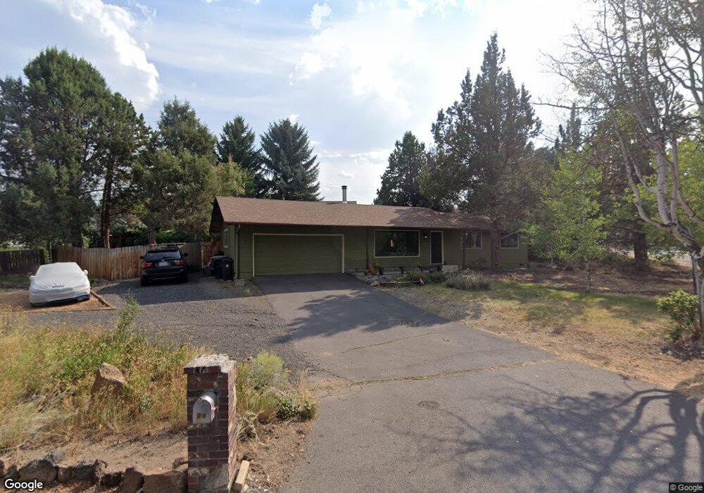
20061 Thomas Dr Bend, OR 97702
Larkspur NeighborhoodEstimated Value: $593,000 - $630,000
About This Home
This home is located at 20061 Thomas Dr, Bend, OR 97702 and is currently estimated at $616,796, approximately $504 per square foot. 20061 Thomas Dr is a home located in Deschutes County with nearby schools including Bear Creek Elementary School, Pilot Butte Middle School, and Bend Senior High School.
Ownership History
We collect this data history from publicly available records. To have your information removed, we recommend requesting removal directly through your county’s website.
Purchase Details
Home Financials for this Owner
Home Financials are based on the most recent Mortgage that was taken out on this home.Home Values in the Area
Average Home Value in this Area
Purchase History
We collect this data history from publicly available records. To have your information removed, we recommend requesting removal directly through your county’s website.
| Date | Buyer | Sale Price | Title Company |
|---|---|---|---|
| -- | Western Title & Escrow |
Mortgage History
We collect this data history from publicly available records. To have your information removed, we recommend requesting removal directly through your county’s website.
| Date | Status | Borrower | Loan Amount |
|---|---|---|---|
| Closed | $300,000 | ||
| Closed | $184,000 |
Tax History
We collect this data history from publicly available records. To have your information removed, we recommend requesting removal directly through your county’s website.
| Year | Tax Paid | Tax Assessment Tax Assessment Total Assessment is a certain percentage of the fair market value that is determined by local assessors to be the total taxable value of land and additions on the property. | Land | Improvement |
|---|---|---|---|---|
| 2025 | $3,476 | $205,730 | ||
| 2024 | $3,344 | $199,740 | ||
| 2023 | $3,100 | $193,930 | $0 | $0 |
| 2022 | $2,893 | $182,810 | $0 | $0 |
| 2021 | $2,897 | $177,490 | $0 | $0 |
| 2020 | $2,748 | $177,490 | $0 | $0 |
| 2019 | $2,672 | $172,330 | $0 | $0 |
| 2018 | $2,453 | $158,070 | $0 | $0 |
| 2017 | $2,278 | $146,830 | $0 | $0 |
| 2016 | $2,173 | $142,560 | $0 | $0 |
| 2015 | $2,113 | $138,410 | $0 | $0 |
| 2014 | $2,050 | $134,380 | $0 | $0 |
Map
- 21023 Thomas Dr
- 796 SE Briarwood Ct
- 194 SE Cessna Dr
- 21035 Clairaway Ave
- 1044 SE Baywood Ct
- 1630 SE Tempest Dr Unit 10
- 21025 Denning Dr
- 253 SE Soft Tail Dr
- 1624 SE Bronzewood Ave
- 1953 SE Elkwood Ct
- 69 SE Piper Dr
- 2241 SE Pilatus Ln
- 1105 SE Palmwood Ct
- 21154 Darnel Ave
- 23 SE Benaiah Cir
- 217 SE Soft Tail Dr
- 21163 Clairaway Ave
- 21172 Clairaway Ave
- 21184 Darnel Ave
- 21190 Darnel Ave
- 1932 SE Fairwood Dr
- 1944 SE Fairwood Dr
- 1920 SE Fairwood Dr
- 20071 Thomas Dr
- 1950 SE Fairwood Dr
- 20068 Thomas Dr
- 545 SE Airpark Dr
- 1962 SE Fairwood Dr
- 565 SE Airpark Dr
- 20083 Thomas Dr
- 615 SE Airpark Dr
- 688 SE Shadowood Dr
- 593 SE Airpark Dr
- 1927 SE Fairwood Dr
- 1974 SE Fairwood Dr
- 650 SE Airpark Dr
- 505 SE Airpark Dr
- 1953 SE Fairwood Dr
- 480 SE Airpark Dr
- 641 SE Airpark Dr
Ask me questions while you tour the home.